• ARCGIS

    ArcGIS Overview
    Esri's enterprise geospatial platform
    ArcGIS Online
    Complete SaaS mapping platform
    ArcGIS Pro
    The world's leading GIS software
    ArcGIS Enterprise
    Foundational system for GIS & mapping
    Developer Technology
    Build mapping & spatial analysis applications
    All products

    CAPABILITIES

    Mapping
    See & understand data spatially
    Analytics
    Bring location to analytics
    Data Management
    Manage, enhance & share your GIS data
    All capabilities

    BUY ARCGIS

    User Types
    Role-based access to ArcGIS
    Esri Store
    ArcGIS products from Esri
    How to Buy
    Esri products, partner products & developer subscriptions

    FEATURED SOLUTIONS

    A contour map of a mountain region in shades of green with a red map point connected to a square by a dotted line, indicating how far apart the two are
    ArcGIS for operational intelligence
    ArcGIS for operational intelligence is geospatial software that helps analysts move from strategic to tactical, transforming operations and intelligence data into actionable, real-time insight.
    Explore ArcGIS for operational intelligence
  • INDUSTRIES

    Architecture, Engineering & Construction
    Business
    Conservation
    Education
    Energy Utilities
    Facilities Management
    Health & Human Services
    National Government
    Natural Resources
    Nonprofit
    Public Safety
    Science
    State & Local Government
    Sustainable Development
    Telecommunications
    Transportation
    Water
    All industries

    FEATURED EVENT

    Person wearing a yellow shirt smiling and speaking at an onstage podium in a conference auditorium
    Esri Education Summit
    Registration is now open for the Esri Education Summit in San Diego, California, on July 12–15, 2025. Join a collaborative user community of educators and administrators sharing innovative geospatially-focused learning strategies and best practices.
    Explore the event page
  • Support & Services

    Services Overview
    Technical Support
    Premium Support
    Training
    Consulting Services
    Managed Cloud Services
    Advantage Program

    SELF-SERVICE

    Path to Geospatial Excellence
    Esri Community
    ArcGIS Blog
    Documentation
    My Esri

    CONTACT US

    Contact Support

    Featured training

    A top-down view of a building model overlaid with an indoor map showing rooms, hallways, and exits surrounded by landscaping
    New Course | Introduction to Indoor Mapping Using ArcGIS Indoors
    Learn how to create and maintain a complete system for indoor mapping and data management.
    Learn more about the course
  • ESRI STORIES

    WhereNext Magazine
    Executive-level news and insights
    Esri Blog
    Real-world, global GIS innovation
    Esri & The Science of Where Podcast
    Voices of business and technology leaders
    ArcUser
    Practical, technical resource for ArcGIS users
    ArcNews
    Industry news and ArcGIS updates
    ArcWatch
    Geospatial news, views, and trends
    All stories

    FEATURED STORY

    Three rows of students both seated and standing smiling and posing for a photo in a University common area
    The Bullard Center’s pioneering environmental justice internship
    Students at Texas Southern University gain essential knowledge and skills in GIS software to address pollution and climate change.
    Read the story
  • About Esri

    About Esri
    Esri Programs & Initiatives
    Events
    Partners
    Careers
    Media & Analyst Relations
    Contact us

    About GIS

    What is GIS?
    Geographic Approach

    Commitment to Innovation

    Artificial Intelligence
    Location Intelligence
    Digital Transformation
    Digital Twin

    FEATURED EVENT

    Colorful background of geometric shapes in purple, orange, pink, and blue with UC25 in bold muticolored letters
    Esri User Conference detailed agenda

    July 14–18, 2025

    The detailed agenda for the Esri User Conference is now live. Explore session and speaker details, then save your favorites to create your personal schedule.
    Review the agenda
Esri and Autodesk
  • Overview
  • Get Started
Get Started

Esri and Autodesk

Strategic Alliance

Unifying GIS and BIM to transform workflows and build a better future

NEW

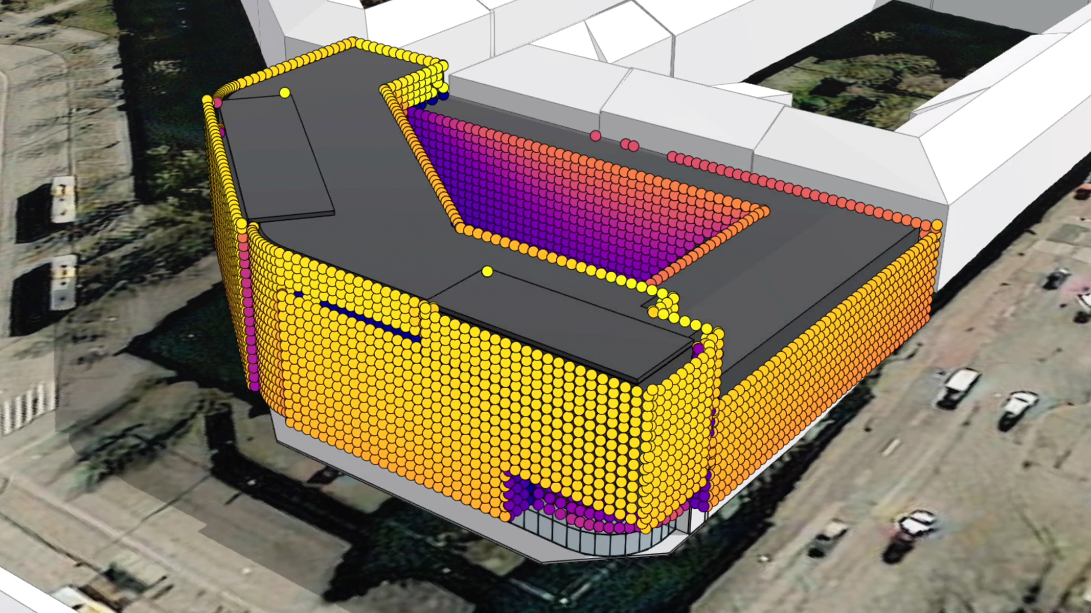
ArcGIS for Autodesk Forma

Integrating location for inspired designs

Elevate your Autodesk Forma designs with Esri’s ArcGIS data. Integrate it into your pre-design, design, and urban planning work directly within Autodesk Forma to:

  • Bring spatial context into your designs from the very beginning of your project
  • Enrich designs with contextual geographic data for buildings, zoning, roads, property boundaries, imagery, and more
  • Extend ArcGIS enhanced designs across Autodesk’s software library, including Autodesk Revit, to eliminate fragmented workflows
Explore ArcGIS for Autodesk Forma

Enrich design and build projects with real-world context

GIS and BIM integration

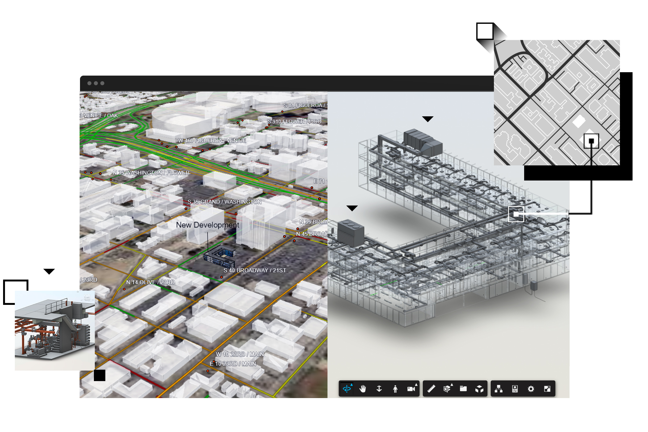
Esri has partnered with Autodesk, a global leader in design and engineering software, to unite two powerful technologies: geographic information system (GIS) technology and BIM.

Esri’s leading GIS platform, ArcGIS, puts BIM assets in the context of geography, transforming project design, delivery, and management across the AEC, water, transportation, and utility industries. 

Bring spatial data into your designs

Connect natural and built environments and add demographics to create a holistic and dynamic view of your project.

Evaluate outcomes before breaking ground

Test and model designs to understand impacts on people and places without real-world risk.

Increase project resiliency and sustainability

Track and manage assets, resources, and materials to reduce waste, cost, and environmental impact.

Get started with BIM and CAD in ArcGIS

Rich visualizations enhance understanding

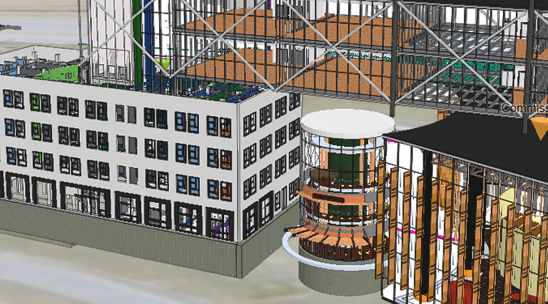
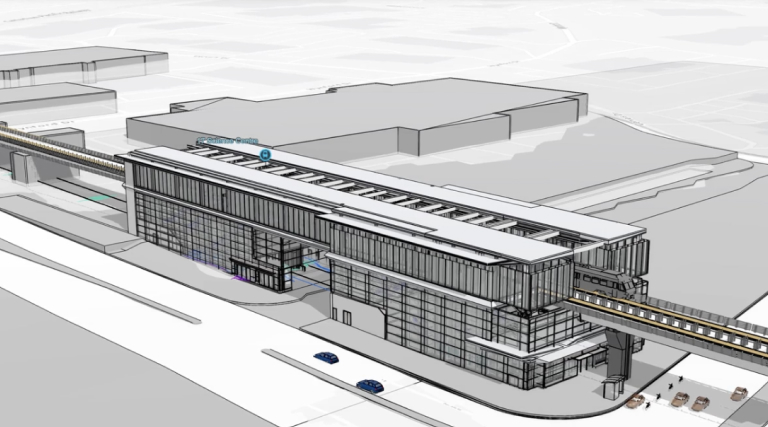
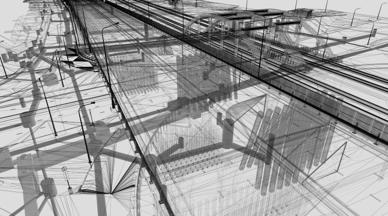
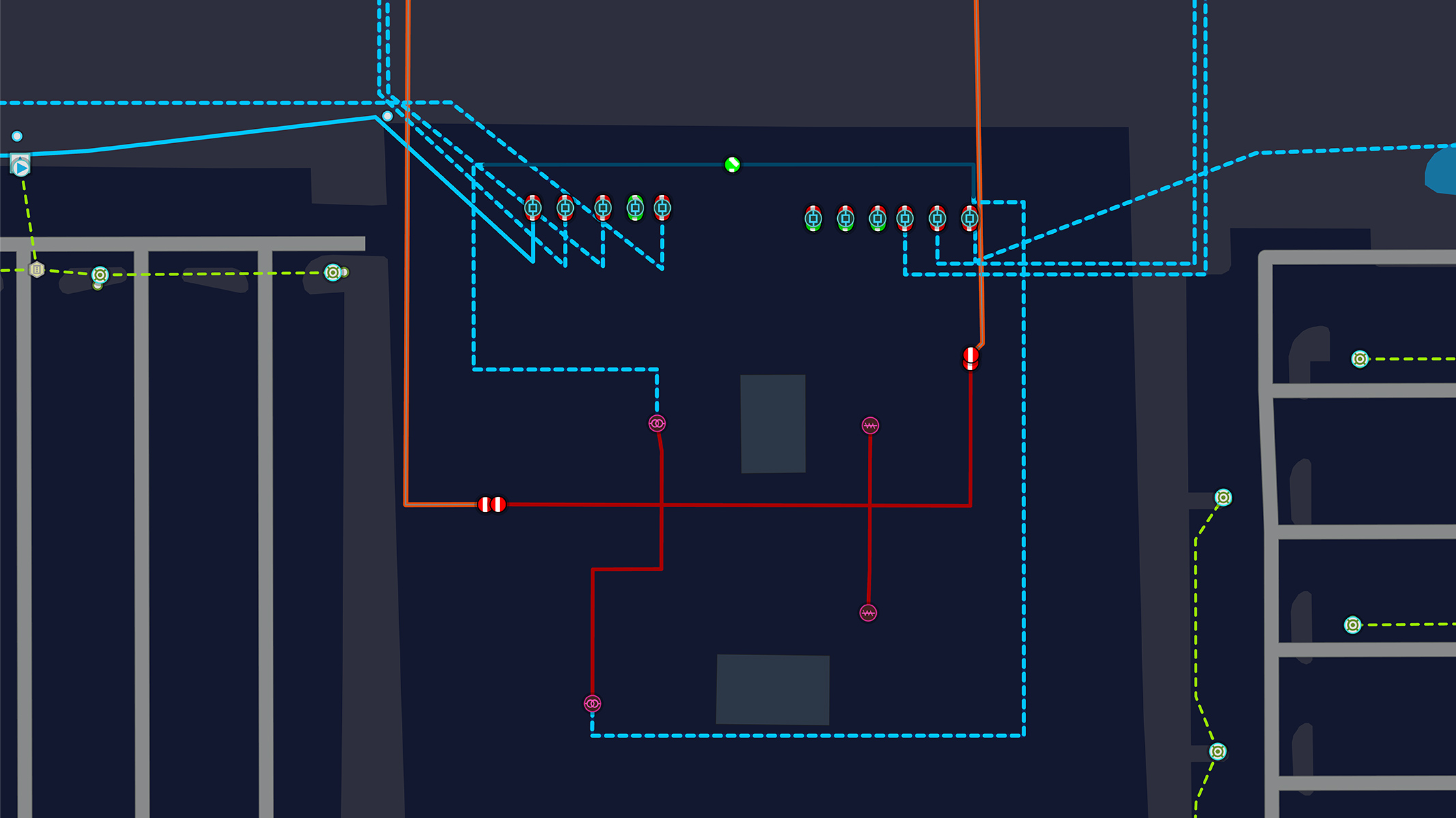
Exploring above and belowground infrastructure with smart maps and digital models provides an intuitive way to understand projects, such as the Grand Paris Express, throughout its life cycle.

Building a more resilient future, together

Find out how Esri and Autodesk are pioneering progress across infrastructure projects.

Featured

Autodesk and Esri alliance

Plan, design, build, and operate better.

ArcGIS GeoBIM

ArcGIS GeoBIM connects the Esri and Autodesk cloud platforms in a single web app, reducing complex data handling and file conversion.

HDR: Thinking “3D First”

At HDR, visualizing complex 3D BIM data in GIS maps increases engagement with stakeholders and speeds up decision-making.

VolkerWessels: Innovating with GIS and BIM

VolkerWessels integrates BIM and GIS to exchange data, collaborate with stakeholders, and improve efficiency.

Arcadis: Using GIS and BIM to connect teams

Arcadis advances digital engineering for large-scale projects with BIM and GIS.

Previous
Next

What firms are saying about Esri and Autodesk

  1. HDR
  2. HNTB
It's an exciting time for the AEC industry as Esri and Autodesk's partnership deepens the integration of GIS and BIM. This alliance breaks traditional barriers, offering first-of-its-kind integration of Esri's global spatial analytics and Autodesk's infrastructure design tools. Together, they are revealing unparalleled possibilities, helping to redefine what is possible and enhancing the digital future of the AEC industry.
Cameron Schaefer
Transportation Digital Delivery and Data Acquisition Director
The Esri and Autodesk partnership equips designers of tomorrow's communities with capabilities that focus on integrating authoritative data critically important to our industry’s digital transformation. Project foundations built with GIS and BIM accelerate collaboration, streamline quality, and reduce design revisions. Integration without translation is here, and we’re embracing it fully.
Darin Welch
Associate VP and HNTB Associate Fellow, Digital Transformation Solutions Director

GIS & BIM Integration for Sustainable AEC Industry Practices

An Esri and Autodesk ebook

Learn how projects at Los Angeles International Airport, Norwegian Railway, Milwaukee Metropolitan Sewerage District, and more integrated GIS and BIM across project life cycles to:

  • Improve data accuracy and collaboration
  • Speed up plan approvals and permitting
  • Reduce material usage and construction costs

Download the ebook

Explore the geography-driven power of ArcGIS

ArcGIS equips design and build professionals with world-leading tools for creating, managing, analyzing, mapping, and sharing data. Discover a few ways it can transform your workflows.

  • 3D GIS

    Gain greater insights and understanding with realistic visualizations, advanced analytics, and immersive experiences of built and natural environments.

    Learn about 3D GIS
  • Imagery and remote sensing

    Turn drone, aerial, and satellite imagery into geospatially-accurate BIM models. Get fast, precise insights for shared operational awareness and smart project delivery.

    Learn about imagery and remote sensing
  • Field operations

    Improve coordination, efficiency, and accuracy in the field. Ensure consistent data between on-site and office teams, reduce errors, and boost productivity using specialized mobile apps and tools.

    Learn about field operations
  • Digital twins

    Understand complex systems and make informed decisions with geospatial digital twins. Visualize and manage construction projects in 5D with time and cost dimensions.

    Learn about digital twins
Previous
Next

Contact sales

Speak with a representative.

1-800-447-9778

7:00 a.m.–5:00 p.m., Monday through Friday (PT)

Outside the US

Chat now

Start a conversation online.

Send a message

Get an email response.

Get help and technical support

Customer service

Technical support

Training

opens in new window
An error has occurred, please reload the page and try again.