Make sense of your unstructured big data
- Rapid entity extraction
- Automate workflows
- Map extracted entities

Rapid entity extraction from anywhere
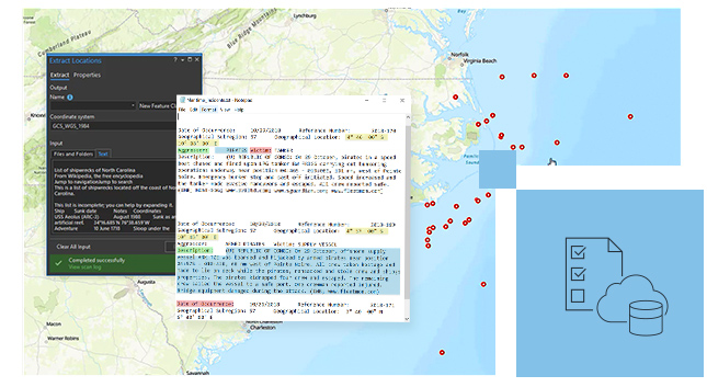
Extract location data from intelligence reports, social media, and more. Discover and reveal geocoordinates, place-names, image geotags, dates, and other critical information from unstructured data. Identify and extract thousands of variations of geocoordinate formats. Publish in ArcGIS and use in ArcGIS apps to analyze relationships.

Automate entity extraction workflows
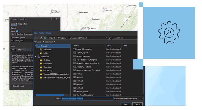
Reduce the amount of time it takes to generate and disseminate maps, apps, and reports. Automatically extract data to feature classes, feature services, shapefiles, KML files, and geodatabases. Create custom extracted attributes by configuring keyword search and extraction controls. Store past attributes to remind the user for future workflows.
Map entities extracted from source content
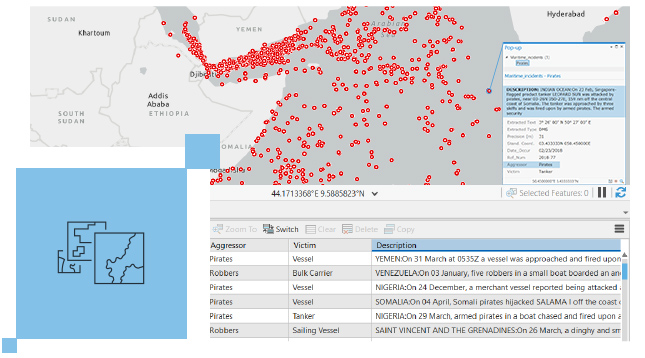
Interact with and view entity and location data on a map with source content. Discover, sort, and map extracted locations. Interact with points to reveal pre-text and post-text from source content. Simplify and accelerate geocoding of text-based assets for situational understanding.
How it works
Select data
Select unstructured data for analysis from an array of messages, reports, briefings, and social media posts.
Extract entities
Uncover location names, coordinates, and more, from your unstructured reports, social media posts, and other sources.
Map data
Plot location information extracted from your data with source content for actionable intelligence.
Automate workflows
Store past attributes and configure parameters to automate future entity extraction workflows.

Get the most from ArcGIS
Extend the value of existing IT investments. Install ArcGIS LocateXT and easily get started, knowing it fully integrates with your existing ArcGIS implementation. Jump-start future projects while saving time and reducing operating costs by leveraging existing workflows and systems.
ArcGIS Pro
ArcGIS Pro
Take advantage of data visualization, advanced analysis, and much more, with ArcGIS Pro, a next generation desktop GIS.
ArcGIS Enterprise
ArcGIS Enterprise
Get started with ArcGIS Enterprise, the industry-leading geospatial technology.
Documentation
Find answers and information so you can complete your projects.
Vorige
Weiter