GIS Hero
He describes GIS not as a tool but as a philosophy, a way of life.
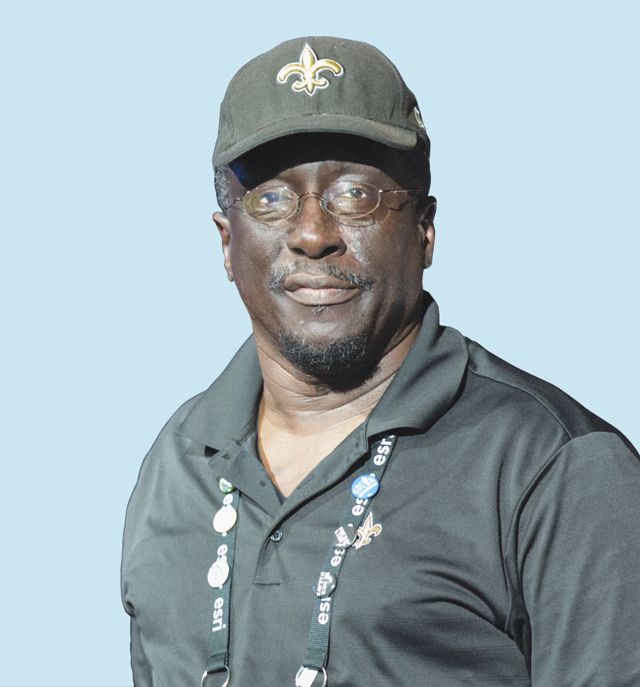
“I can’t tell you exactly what it is, but it’s not a software anymore,” said Forrest Lamb, a general engineer for the facilities branch of the Marine Forces Reserve and a true GIS evangelist. “I can’t see the world without GIS.”
As someone whose life, as he put it, keeps drifting along to GIS, Lamb has run the gamut of experiences with the technology—from using it in the US Air Force and for facilities management to educating both kids and teachers about how it works.

At some point, he said, he realized that promulgating the virtues of GIS was his place of significance in the world.
“I’m going to immerse myself in this and give my life over to it,” he recalled thinking when he had his epiphany about GIS being his life’s work. “It’s fun for me, so I can’t see me not having GIS.”
GIS—Right Up His Alley
Lamb first encountered GIS in the 1980s when he was a civil engineer in the US Air Force at what was then Norton Air Force Base in San Bernardino, California. He and his colleagues were tasked with using Esri’s ARC/INFO for national defense planning—looking for locations where they could base strategic missiles and big weapons systems.
“For a young captain, that was an amazing project!” he recalled.
And the technology was right up his alley.
“GIS is visual, and I’m a visual person,” he said.
Visualizing information on a landscape, as GIS let Lamb do, is akin to viewing the earth’s terrain from the air. So it’s no surprise that, as a child in Little Rock, Arkansas, he wanted to be a pilot when he grew up.
Upon graduating from high school, he received a prestigious appointment to the US Air Force Academy—though he ended up transferring to Tuskegee University in Alabama, where his father and uncles had gone and his soon-to-be wife went as well. Lamb considered studying aeronautical engineering, but after noticing dwindling career opportunities in the field, he settled on mechanical engineering.
Once he received his bachelor’s degree, Lamb was commissioned for active duty in the air force—not as a pilot, however (because of astigmatism), but rather as a mechanical engineer.
He was stationed first at Little Rock Air Force Base and then spent a year in South Korea before being transferred to Southern California, where he spent seven years.
Lamb started picking up GIS toward the end of his stint at Norton. From there, he went to Barksdale Air Force Base in Louisiana, where—after completing a master’s degree in aerospace science at Embry-Riddle Aeronautical University—he got progressively more involved with GIS.
When Lamb’s job in the air force was closed, he took a civilian position with the government as a community planner for the 2nd Civil Engineer Squadron (also at Barksdale) and joined the US Air Force Reserve. He continued working with GIS.
By 1995, Lamb was base civil engineer for the 926th Mission Support Group at the Naval Air Station Joint Reserve Base in New Orleans, Louisiana, where he directed all aspects of facility management. It was here that he got his first GIS.
“That’s when I got my hand on the steering wheel,” he said.
He and his colleagues used GIS to conduct battle studies and do land-use analyses for various bases. He eventually found himself doing less engineering and more planning. So he decided to shift his focus to GIS.
“This is a no-brainer,” he recalled thinking.
Lamb transferred to the Marine Forces Reserve in 2006, where he introduced GIS. Currently, he and his team build GIS databases for reserve centers to help with facility planning.
Lamb is credited with setting up 180 GIS sites around the United States. And he shows no signs of slowing down.
A GeoMentor in Every Respect
“I want GIS to become a household word,” said Lamb.
Since shifting his focus to GIS, Lamb has become quite a force in the GIS education world—especially as a GeoMentor.
“GIS cuts across so many different areas,” he said. “It’s a life skill.”
Inspired by his mother, who invested a lot in education, Lamb focuses much of his indefatigable energy on teaching kids—and their teachers—about the technology.
“If it can be a game changer for me just in this local setting, it could be a global game changer,” he exclaimed.
Because GIS is so visceral and has so many moving parts, Lamb believes that it really resonates with kids. He thinks that if they could get their hands on the technology, they would be so interested in it and enthralled by what it can do that they wouldn’t have time to get into trouble.
He has shared Esri’s Tapestry lifestyle data—which categorizes US neighborhoods based on demographic and socioeconomic attributes—with kids to exhibit how retailers, for example, can use GIS to influence what people buy. And the kids show lots of interest, he said.
But the mentoring doesn’t stop with GIS.
“He has a real passion for students who don’t think that they actually have a future—not even in GIS, but just a future,” reflected Joseph Kerski, an education manager at Esri who has worked with Lamb in various education and GeoMentoring capacities over the years.
Lamb prides himself on opening kids’ eyes to what exists in the world outside their bubble—which he said is especially important in post-Hurricane Katrina New Orleans, where Lamb noticed lots of kids who didn’t have any vision for the future. He tells a story about a time when he asked a little girl—who showed up unexpectedly at Lamb’s church one night after Katrina—what she could do with her life if money and time and responsibilities didn’t matter. The girl, named Destiny, told him she liked to shop. He responded that those people are called buyers. She beamed.
“My work is cut out for me, and I’ve got it right here,” said Lamb.
Aside from one-on-one mentoring, Lamb has helped scores of kids in Louisiana’s schools learn GIS by hosting GIS days; setting up GIS workstations at his daughter’s school; being on the steering committee for the Louisiana Geographic Education Alliance; and being on the board of Communities in Schools of Greater New Orleans, which brings community resources into public schools to try to keep students enrolled. He has also instructed teachers in GIS through Esri’s Teachers Teaching Teachers GIS (T3G) Institute.
“There are some people who understand why GIS in education matters,” said Kerski. “But Forrest, he’s a GIS analyst. He knows what he’s talking about on a technical level too.”
And Lamb wants as many people as possible to know and understand GIS.
“He is always wanting to make this whole idea—of getting people to make smarter decisions with GIS—bigger, more impactful,” said Kerski. “He’s definitely never content with the status quo for GIS.”
“He just thinks that if we can get people to engage GIS, then vast numbers of problems will simply melt away as people understand how to look at and think about and cope with complex issues,” said Charlie Fitzpatrick, schools program manager at Esri. “For Forrest, GIS is quite simply the way to organize information.”
Continuing to Inspire
Lamb, who retired from the Air Force Reserve as a Lieutenant Colonel, still works for the Marine Forces Reserve. But he has myriad plans for when he fully retires.
Continuing to employ his infectious excitement, Lamb intends to go on speaking publicly about the benefits of GIS and wants to start doing GIS workshops.
“I would also like to have a mobile GIS trailer,” he said, so he can “take it to places where they’ve never seen GIS, where they don’t even have the Internet.”
Lamb wants to fly as well. He got his private pilot’s license in 1990 and has gotten to fly with the Civil Air Patrol. But what he really wants to do is take kids flying.
“I let them hold the controls, I put the headsets on them, I tell them what to do, and then I let go of the controls,” he said. “Their eyes light up.”
Read other articles in the “GIS Heroes” series.

