Tech Time
Get incredible new apps such as Drone2Map for ArcGIS and awesome visualization capabilities like vector tiles in the new ArcGIS 10.4 release. Read the blog. Learn more.
-
Esri’s David Cardella answers 10 questions from GIS users about developing apps with the ArcGIS platform. He shares some great advice with app builders. Watch the video.
-
Use ArcGIS Full Motion Video to analyze video data collected by drones, unmanned aerial vehicles, unmanned aircraft systems, and video cameras. Read the blog. Learn more.
-
Eliminate error-prone paper workflows! Esri will host the live training seminar, Modernize Your Field Workflows Using Collector for ArcGIS, on March 31, 2016. Take the seminar.
Maps & More

-
What is a location strategy for real estate (or any other industry for that matter), and why do you need one? Read the article.
-
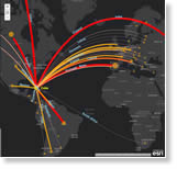
President Obama’s scheduled visit to Cuba this month puts a focus on Cuban trade, the topic of this story map that Esri created with partner Datamyne. Read the blog. View the story map.
-
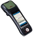
ZenoCollector is an all-in-one data collection solution that combines Esri’s Collector for ArcGIS app with Leica’s Zeno 20 device. Order today.
The Last Word
-
The Esri Story Map Cascade app, which will be released later this year, was used to create this riveting story about the Syrian civil war and the plight of Syrian refugees fleeing that country. View the story map.
-
Esri Story Map apps are commonly used to create tours of places or communicate information about major local, national, or global issues. However, story maps also can be used to deliver annual reports, develop interactive resumes, and much more. Read the blog.