They came hungry.
They had an appetite for ArcGIS API for JavaScript, ArcGIS Runtime SDKs, Python, Ruby on Rails, ArcGIS WebApp Builder, ArcGIS Pro .NET SDK, Esri Geotrigger Service, and anything else available to build and power their geospatial apps.
When they left the Esri International Developer Summit (DevSummit), held March 10–13, 2014, in Palm Springs, California, the 1,800 developers and GIS professionals were well fed, stuffed with knowledge from more than 200 technical sessions hosted by Esri.
Boris Lutskovsky of Portland, Oregon, uses ArcGIS API for JavaScript and ArcGIS for Desktop in his work at EarthSoft, which makes environmental data management software. But he branched out at the DevSummit, getting a taste of Python and Node.js. He raved about a technical session called Accessing and Visualizing Esri GeoServices with ArcGIS API for JavaScript, D3, and Node.js, which focused on how to make compelling maps and visualizations from a multitude of services.
“It perfectly matches an issue I’m working on right now,” said Lutskovsky, who likes the DevSummit’s educational aspects. “It was really good to get one-on-one time with Esri developers and learn some new skills with new technology.”

Esri hosts the DevSummit annually to familiarize developers with the ArcGIS platform and to offer training and technical workshops that will help them build apps with geospatial functionality. In welcoming attendees, Esri president Jack Dangermond told them that the company is upping its commitment to supporting developers.
“We’ve been lifting up the hood of the platform and making it a strong platform for developers,” Dangermond said. “This has meant opening up a lot of things—opening up some of our software to open source with GitHub; opening up our data models with open data programs and applications; and also opening it up for easy configuration and development with lots and lots of resources for developers.”
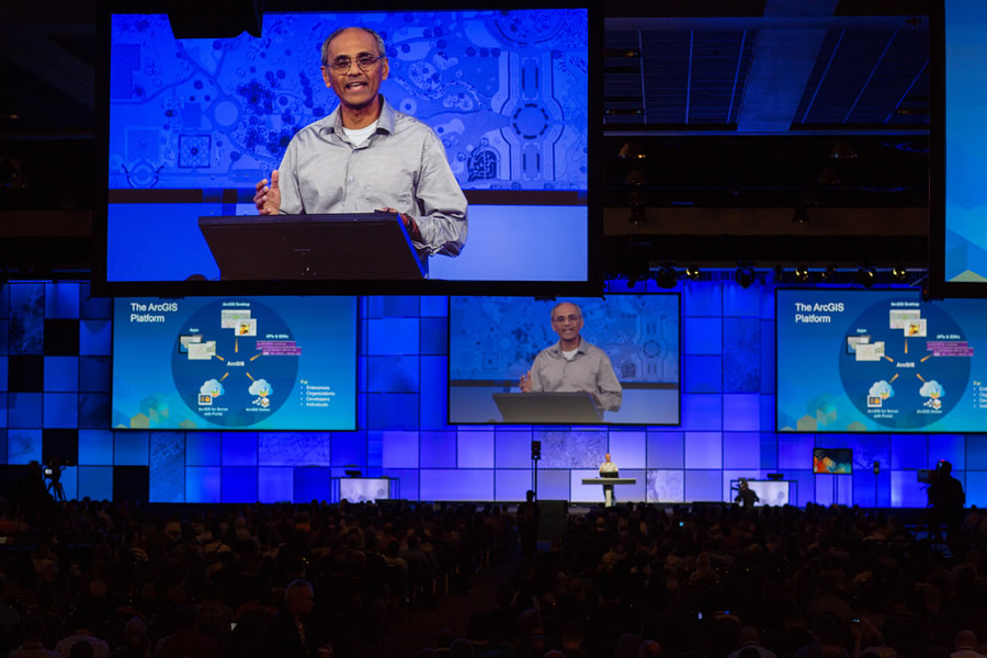
Esri director of software development Sud Menon spoke about what the ArcGIS platform does for developers, including creating maps and authoring apps to share with users.
That’s what Jessica Altamira plans to do with ArcGIS. She attended DevSummit to get training and tips on how to develop a web application for a resort owner on Long Caye in Belize. Altamira is a student in the master of science GIS program at the University of Redlands in California. For a school project, she will develop an online app that will help the resort publicize the island’s ecologically valuable areas to potential visitors.
The features she will map include mangroves, coral reefs, and lagoons. “I would like users to be able to zoom in to their area of interest and view the vegetation layers with pop-up windows containing pictures of the area,” Altamira said.

To learn about creating apps for the web, Altamira attended the session Introduction to the ArcGIS WebApp Builder: JavaScript Apps Made Easy. (In the summit agenda, the new ArcGIS WebApp Builder is described as a pure HTML5/JavaScript-based application that lets developers create intuitive, fast, and beautiful web apps without writing a single line of code.)
“A basic knowledge of widgets and web design are a must for my project,” Altamira said.
She also attended Publishing and Using Map Services with ArcGIS for Server and Introduction to ArcGIS API for JavaScript sessions, where she said she got some “good tips and tricks.”
Altamira said she also may use ArcGIS Online to create story maps for Long Caye, which is near the famous diving site, the Great Blue Hole. “User-friendly maps are always a good promotion technique for vacationers seeking a tropical island getaway,” Altamira said.

Nicolas Roldos, another student in the master of GIS program at the University of Redlands, went to the DevSummit to learn about the new Esri Geotrigger Service. The Geotrigger Service gives developers the technology and tools to configure apps for Android and iOS devices that send users location-based alerts while keeping battery drain to a minimum.
Roldos is using the Geotrigger software development kit (SDK) to develop a location-based service to advertise concerts and sales at record stores in and around Los Angeles, California. “I have set up a framework for an iPhone application targeting small record stores and live music venues in the LA basin,” Roldos said.
Here’s his idea: With the app on their smartphones, users would receive an alert that notified them about a concert at a music venue or a sale at a record store when they entered a specified geographic area or “trigger zone” near the venue or store. “For example, a record store in Long Beach may have a 40 percent markdown on vinyl records on [a certain] day,” Roldos said. “A trigger can be set up around the store and its vicinity to alert passersby of this sale without using flashy signage, e-mail blasts, paper flyers, or other forms of marketing.”
Roldos thinks the Geotrigger Service embodies the power of where.
“With my app, the concertgoer or record buyer is empowered by his or her location and proximity to participating stores and rewarded with a coupon or markdown on ticket price,” he said. “The power of where supersedes the power of, say, a large customer e-mail database or flashy signage. With so many people using smartphones to make decisions on entertainment and shopping, an application using the Geotrigger SDK hits the nail on its head in terms of providing a customer or concertgoer with an experience that is relevant and redeeming.”

Roldos said he left Palm Springs armed with the information he needed to build the location service. “DevSummit was a lifesaver in terms of getting me where I need to be in my understanding of [the Geotrigger Service] to integrate the SDK into my app,” Roldos said. “The summit overall was very helpful for my project, my knowledge of what Esri makes available, and the amazing growth Esri is having in its developer platforms. It was clear that Esri is taking the lead in developing GIS for the next generation.”
Web application developer Alex Bostic from URS Corporation, an engineering, design, and construction firm, was at his fifth DevSummit. Bostic lives in West Virginia but develops web applications for the Tampa Bay Partnership, an organization that promotes economic development in the Tampa Bay area of Florida.
Bostic plans to use Esri Business Analyst Online and story maps, along with ArcGIS Online, to give businesses interested in relocating to the Tampa Bay region the means to analyze educational information about the potential work force in the area.

He said the businesses, often high-end medical device and financial services companies, want to see where universities are located on a map and find out information about the graduates. (Read more about the Tampa Bay Partnership project in this ArcNews article.)
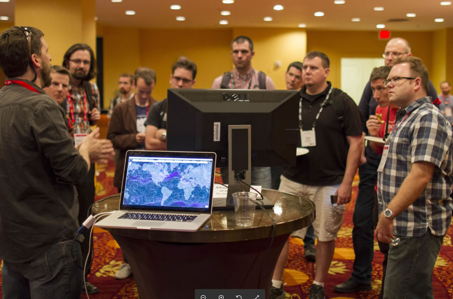
For him, the DevSummit is a must-attend event. “Being able to make connections with Esri developers and others creates a support network that would not be established otherwise,” said Bostic. “The keynote, Chris [Wanstrath of GitHub], was a huge part of me liking the experience this year. His presentation style and talking points appealed to me. Also, the Innovation Lab is a good experience because you get to see cutting-edge stuff that makes light bulbs go off.”
For developers interested in geospatial technology, Altamira said DevSummit is like no other conference.
“I was ecstatic to be surrounded by GIS nerds,” she said. “No sarcasm there. I’m glad this field is really moving forward. Networking was quite easy and enjoyable. Although I’m only 22, I realize gaining this type of exposure at a young age is great!”
Read about the keynote by GitHub cofounder and CEO Chris Wanstrath, who talked about his company’s mission and social coding in the story Collaboration and the Future of Software.
Read about the winning applications in the 100 lines or less of ArcGIS JavaScript contest in this blog post from Allan Laframboise. And find out who won the Hackathon in this blog post by John Yaist.
Access all the DevSummit Plenary Session videos.

