Tech Time
A new aspect-slope raster function, which you can download from Esri's GitHub repository, makes it easier and faster to create an aspect-slope map from raster elevation data. Learn more.
-
Since Esri Story Maps apps are open source, you can go to GitHub and download the code for any app and host the app on your organization's own server. Read the how-to article.
-
Esri is hosting a series of webinars on Military Tools for ArcGIS. Topics covered include coordinate conversion and linear and radial line-of-sight analysis. Watch the webinars.
-
Based on conversations and feedback at the Esri Developer Summit, here are the answers to 10 questions about building apps using AppStudio for ArcGIS. Read the blog.
Maps & More
-
Businesses can find hidden intelligence in data. To learn how, use Esri's Discover Local Insights app to search by ZIP code and get a snapshot of 10 different income, consumer spending, demographic, and lifestyle trends. Try the Discover Local Insights app. Learn about Location Strategy for Business.
-
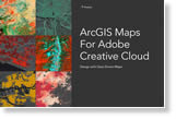
Get creative with maps using ArcGIS Maps for Adobe Creative Cloud, now in beta. You can choose from thousands of maps via Adobe Illustrator and Photoshop and then add your own design touches. Learn more and get the beta version.

-
Esri offers US customers the ArcGIS Desktop Virtualization Dell Appliance, a virtualization solution optimized for ArcGIS Pro.
Order today.
The Last Word
-
Esri staff will teach you how to create 3D point clouds, 3D texture meshes, and 3D PDFs with Drone2Map for ArcGIS. The Drone2Map for ArcGIS app turns raw still imagery captured by drones into professional 2D and 3D imagery products. Sign up for the web course.
-
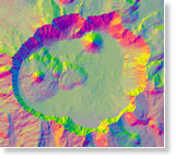
Esri is continuing to help planetary scientists study planets and moons, including Mars, Mercury, Venus, Deimos, Phobos, and Europa. New capabilities are being added to the ArcGIS platform, including ArcGIS Online and ArcGIS Pro, to help investigate what's out in space. Read the blog.