Tech Time
Won’t be able to catch that total solar eclipse of the sun in 2187? Missed the annular solar eclipse of 1621? No problem. Solar Eclipse Finder is a JavaScript-based web app that displays the path of past and future solar eclipses that pass through the location you define. Source data is published as a hosted service on ArcGIS Online. Try the Solar Eclipse Finder. Read the blog.
-
Download the 2014 US Esri Data update for Esri Business Analyst Desktop and Esri Business Analyst for Server at my.esri.com. Updates include block level demographic changes following the 2013 tornado in Moore, Oklahoma. Read the blog.
-
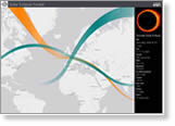
How will integrating ArcGIS with SciPy, a software library for custom scientific and technical computing, help scientists and other professionals? Esri’s Kevin Butler answers this question. Read the blog.
-
Along with ArcGIS Pro’s 3D capabilities, the new ArcGIS 10.3 release will include some great new ArcMap tools for analysis, automation, and managing your data more efficiently. Read the blog →
Maps & More
-
Your data will shine more brightly when you use the new dark gray canvas basemap from Esri. The basemap will soon be added to the ArcGIS Online basemap gallery. Read the blog.
-
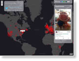
Talk about GIS crowdsourcing! Tweeted selfies poured in for GIS Day, populating the GISDaySelfie Story Map with selfies stretching from Accra, Ghana, to Zoetermeer, the Netherlands. See the GISDaySelfie Story Map.

-
Complement or upgrade your existing GIS infrastructure. Get Esri ArcGIS for Desktop software with a Dell Precision Workstation or Notebook. Order today.
The Last Word
-
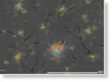
The buzz about bees: They come in all colors, shapes, and sizes depending on where they live. Meet the Polysocial Hairy-tongued Bee from France, the Sawtooth Sputnik Bee from Kenya, and more, in Geography Bee: A Global Gallery of Pollinators, an Esri Story Map Tour. View the map without getting stung.
-
Matt Carmichael, editor of Livability.com, counts on Esri data in researching the best places to live, work, and play in the United States. Listen to the podcast.