Real-time understanding
GIS supports more than the planning and design phases of the upstream business. It is critical in allowing real-time analysis, visualization, and integration of massive volumes of data.

Unify upstream workflows with GIS
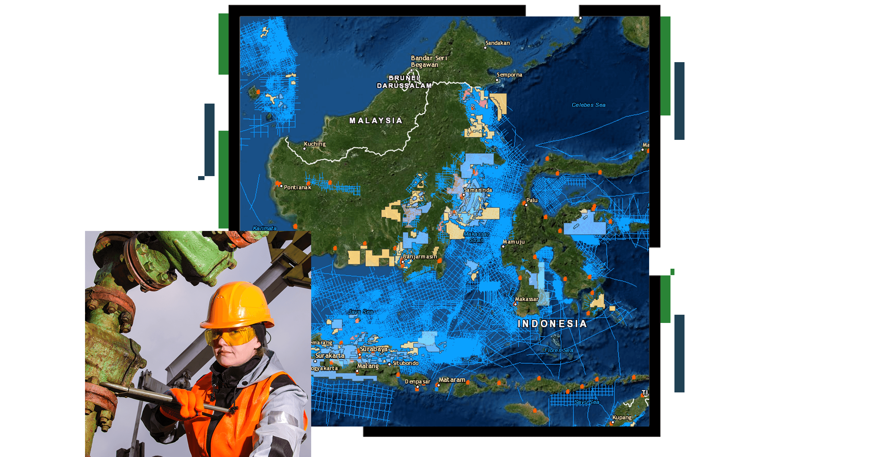
GIS provides an efficient and effective platform for analyzing, visualizing, and integrating massive volumes of exploration data—from basin, play, prospect, and reservoir studies to block and lease analysis and scenario planning. GIS unifies diverse data and enables you to perform quantitative and repeatable analysis for consistent investment decisions.

GIS provides one place to discover and access your land asset data at the project, region, and corporate levels. Leverage web and map services to allow direct use and analysis in the office or in the field. GIS helps you maximize your land value across exploration, operations, renewables, or carbon markets.
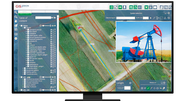
Manage and monitor complex production operations from the office or the convenience of your mobile device. GIS helps bring your real-time feeds together with accurate representations of your physical assets to generate a digital twin of your production processes. The digital twin allows you to comprehensively understand operations, model alternative designs, and implement the most effective options.

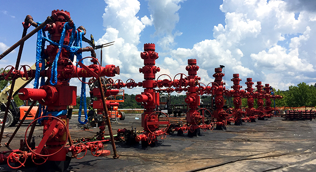
GIS helps you better manage complex operations that include wells, pipelines, power and communications, field roads, fences, facilities, people, vehicles, and equipment. Unite real-time data feeds with physical operations to generate a digital twin of your business processes. Ensure safe and efficient operations that reduce downtime and maximize operational revenues.

Maximize your development opportunities. Use GIS to design and optimize unconventional infrastructure, roads, pads, and well placement. Ensure safe and compliant operations with real-time asset tracking and workforce coordination. Integrate asset information with real-time data feeds to enable a digital twin of operations.

Determine the most effective locations to introduce large-scale carbon capture and sequestration projects. Use GIS to understand CO2 and methane sources, subsurface storage capacity, and available transport infrastructure. Evaluate potential technical projects together with economics; regulations; political and social variables; and health, safety, and environment (HSE) impacts.

Geographic data and analytics are often common across industries. Explore how other industries and initiatives are applying Esri technology to solve complex problems. Leverage their innovation and ideas to help drive new solutions in support of the upstream segment.

ArcGIS is a comprehensive GIS for energy utilities. It provides all the elements needed to meet utility challenges and maintain key information for energy distribution mapping and analysis.
Use maps and analysis of spatial data to visualize, understand, plan, and act when coordinating natural resource management programs. Optimize workflows and mitigate risk while improving regenerative practices and ensuring social equity.
Apply location intelligence to energy sustainability projects and missions to understand need, map your work, measure impact, analyze performance, and engage stakeholders.
In a constantly changing world, GIS technology provides greater business intelligence for more successful, resilient organizations that can withstand the most severe disruptions and thrive to better serve their stakeholders.