ArcUser Online
GIS Bookshelf
This article as a PDF.
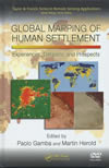
Global Mapping of Human Settlement Experiences, Datasaets, and Prospects
Edited by Paolo Gamba and Martin Herold
 One in a series of books from this publisher on recent developments in remote sensing, Global Mapping of Human Settlement focuses on the use of remote sensing for assessing the impact of urban areas on the environment. Urbanization is changing the face of the earth more rapidly now than in any other time period. Recent improvements in the spectral resolution of this data, coupled with more rapid processing by commercial suppliers, have made it far more useful in studying urban areas—a pressing concern, as more than 60 percent of the world's population may be living in urban areas by 2030. This text reviews the methodologies, datasets, and approaches associated with the use of remotely sensed data when analyzing city landscapes, particularly as related to the challenges of delineating and classifying urban areas. CRC Press, 2009, 374 pp., ISBN-13: 9781420083392
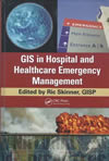
GIS in Hospital and Healthcare Emergency Management
 Edited by Ric Skinner, GISP
Although many books are available on the use of GIS in health care or emergency management, this book contains practical information on its use in both. In this book, Skinner brings together leaders in this area who provide insights that should improve both planning and response to health care emergencies. Conceptual Approach, the first of the book's three sections, discusses the role and value of GIS. The Applications section addresses specific tasks associated with health care emergencies that improved with the use of GIS—evacuation and sheltering, situational awareness, and optimal siting for alternative care and trauma centers. The Case Studies section draws from examples on many scales, from preparing hospital disaster plans to deal with pandemics to regional planning for mass casualties. CRC Press, 2010, 279 pp., ISBN-13: 9781439821299
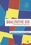
Qualitative GIS: A Mixed Methods Approach
 Edited by Meghan Cope and Sarah Elwood
Historically, GIS has been based on quantitative methods. This scholarly collection of articles explores the adoption of qualitative GIS, incorporating noncartographic data and analyses that provide interpretation of both situations and processes. The text is structured around three themes: representations, analysis, and theory. Readers learn how to frame questions, collect data, analyze results, and represent findings in a truly integrated way. SAGE Publications Ltd, 2009, 192 pp., ISBN-13: 9781412945660
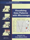
Visualizing Data Patterns with Micromaps
By Daniel B. Carr and Linda Williams Pickle
 Micromaps link statistical information to an organized set of small maps that reveal the statistical and geographic patterns in the data. The design of these maps incorporates research in cognitive psychology, statistical graphics, computer science, and cartography. After the introduction of the three kinds of micromaps—linked, conditioned, and comparative—in the first chapter, the following chapters explain the research behind micromaps and how this research was applied in designing these maps, then apply all three techniques to the same data to illustrate the purpose of each type, its strengths, and its limitations. This book is part of the Chapman & Hall/CRC Interdisciplinary Statistics Series and has an accompanying Web site that supplies datasets and examples. The authors are leaders in this field. Carr, a professor of statistics at George Mason University in Fairfax, Virginia, has been developing graphic and computational methods for exploratory visualization for more than 30 years. Pickle is principal and chief statistician at StatNet Consulting LLC. CRC Press, 2010, 182 pp., ISBN-13: 9781420075731