ArcUser Online
Spring 2011 Edition
City Benefits Greatly from ELA
Cutting costs, capturing revenue, and improving processes
By Emily Norton, City of Woodstock, Georgia, and Timothy Poe, Barstow County, Georgia
This article as a PDF.
Since the City of Woodstock, Georgia, purchased an Esri Small Municipal and County Government enterprise license agreement (ELA), the city's GIS division and other departments have been able to accomplish more tasks with less resources while improving the overall quality of the city's spatial data.


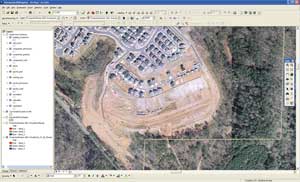
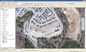
The storm water billing process project identified 348 parcels that were not being assessed city property taxes. Imagery from 2008 and 2009 show new construction in this rapidly growing area of Georgia.
At the beginning of the 2008–2009 fiscal year, the city of approximately 23,000 purchased an ELA that allows small jurisdictions to pay an annual fixed price in exchange for unlimited amounts of ArcGIS software throughout the organization as well as maintenance, services, and training. The program overcomes financial and administrative barriers so local governments can quickly achieve an enterprise-wide GIS that improves government operations and service to citizens.
Woodstock's ELA has been critical in two projects that improved the accuracy of the city's storm water utility billing process and updated the mapping of the storm water and sanitary sewer systems. Rather than employ consultants to complete the work, Woodstock decided to take advantage of its newly purchased ELA and the GIS division's close relationship with Kennesaw State University's geographic information science degree program. The city hired five highly motivated and skilled interns from Kennesaw State University and Gainesville State College to complete the projects.
In the first project, interns reviewed the storm water billing process and corrected errors in impervious surface measurements and parcel classification. During this process, they found 348 parcels in the city that were not being assessed city property taxes. As a result, the team discovered more than $700,000 in missed tax revenue for fiscal year 2008 and approximately $1 million in additional annual revenue for subsequent years. The entire project was accomplished in less than three months at a total cost of less than $25,000.
In the second project, interns updated the storm water and sanitary sewer systems infrastructure. ArcGIS Desktop was deployed on an Xplore tablet coupled with Leica's MobileMatriX and GPS gear so intern teams could collect survey-quality data for the future development of a flow network model.
Overall, both the utility billing project and infrastructure project were highly successful. Both projects represented not only a cost savings but, in the case of the utility billing project, revenue generation for the city. The projects also provided excellent educational experience for the interns.
The ELA has also enabled the city to cut costs significantly by deploying ArcGIS Server software-based web mapping applications to internal customers. For example, when a police crime mapping application malfunctioned, the GIS division deployed a fully functional web editing application within five hours. Over the next week, the police crime analyst made several requests that the GIS division implemented that enhanced the police department's mapping capabilities. The ability to edit versioned data through web applications has met the data integrity and security needs of the GIS division as well as the practical usability needs of the police department's crime analyst. Also, zone commanders and other police management have ongoing access to up-to-date crime maps.
Similar web mapping applications have been deployed to further enhance public safety and deliver additional cost savings to city departments. For instance, the GIS division has developed a web mapping application that aids the fire department in tracking hydrant locations and maintenance records so the department can maintain its excellent Insurance Services Office (ISO) Public Protection Classification (PPC) rating. This results in cheaper insurance rates for Woodstock's residents and business owners.
In addition, a multidepartment task force has been able to remotely edit and track vacant buildings to aid in city planning, development, firefighting, policing, and code enforcement. The ability to remotely edit a single versioned data source has eliminated the extensive data duplication and associated systemic bottlenecks to data acquisition and distribution common under the old paper-based systems.
The ELA has helped the City of Woodstock produce and maintain high-quality data while minimizing both labor and capital costs. The ELA helped the GIS division improve work processes and lower overhead costs. The web mapping capabilities it supports have significantly increased data access and usability and simplified processes for nearly every department in the city. For more information, visit esri.com/ela or contact Emily Norton at enorton@woodstockga.gov.
About the Authors
Emily Norton is the GIS manager for the City of Woodstock, Georgia. She received a bachelor's degree in geographic information science from Kennesaw State University.
Timothy Poe, GISP, is the GIS coordinator for Barstow County, Georgia, and former GIS manager for the City of Woodstock, Georgia.