Improving the Quality of Spatial Data
By Mike Weir, Esri Survey Industry Manager
 |
| The ArcGIS Survey Analyst extension allows surveyors and GIS technicians to work in a truly collaborative manner in a unified environment. |
ArcGIS Survey Analyst brings survey quality data into the GIS environment. Developed jointly by Esri and Leica Geosystems, this new extension to ArcGIS allows surveyors and GIS technicians to work in a truly collaborative manner in a unified environment. Users can manage survey measurements in ArcCatalog as a survey dataset. Projects, the common work unit for surveyors, are used for organizing survey data.
Project folders contain survey points, measurements, and computations. Computations resolve and adjust survey measurements into a completed survey with coordinates computed for the survey points. Any survey point that has a corresponding identifiable GIS feature in a GIS layer can be used to edit a GIS feature. For example, a project folder might contain a traverse survey with offset computations that can more precisely locate hydrants, bus stops, manhole covers, and utility poles. ArcGIS Survey Analyst uses industry-standard computations and adjustment procedures to resolve the locations of features.
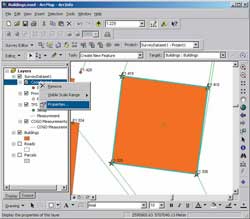
Although GIS coordinates for survey points are stored and managed by ArcCatalog within project folders, they are maintained separately from GIS layers. GIS layers can be made survey aware so that features within a survey aware layer can be edited using survey data. Features are linked to survey points and displayed together in ArcMap. Because the link information is stored within the GIS layer-not the survey layer-the GIS feature knows which survey point it is linked to. Features linked to survey points can be snapped to move them in coordinate space so that they are spatially coincident with survey points. This process improves spatial quality and also allows for heads-up digitizing by selecting survey points that define the location, size, and shape of new GIS features interactively from the screen.
 |
| Computations resolve and adjust survey measurements into a completed survey with coordinates computed for the survey points. Any survey point that has a corresponding identifiable GIS feature in a GIS layer can be used to edit a GIS feature. |
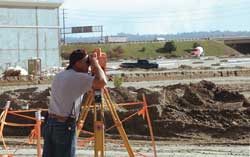
In ArcGIS Survey Analyst, new surveys can be added and new computations performed on existing survey points. The coordinates of survey points can change as new data is added or new procedures and equipment are used to better define survey point locations. This data can come from multiple sources such as digital data files from survey collectors such as Total Stations; notes and measurements contained in a survey field book; or measurements from map manuscripts, legal documents, and maps.
With ArcGIS Survey Analyst, a new data type-survey data-allows surveyors and engineers to build a survey information system within ArcGIS. This provides opportunities to build multiuse survey datasets within the measurement database, adding value to the volumes of survey data collected, managed, and maintained by surveying and engineering firms. This system is also ideally suited for providing the GIS data layers and maps that are often required as a deliverable on survey contracts. The bottom line-GIS technicians, practitioners, and managers have a tool for improving the quality of GIS data.
|