Better Data Use, Workflows, and Communication
Large organizations benefit from the geographic approach
 |
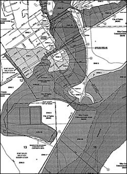
| The Federal Emergency Management Agency (FEMA) has moved from paper maps. |
The world's largest corporation, Saudi Aramco, realized that virtually every aspect of its work is related to geography. It developed GIS applications that support its core activities in emergency response and safety, land management, pipelines and utilities asset management, planning and engineering, environmental protection, transportation and logistics, and community services. For example, GIS is being dynamically integrated with real-time plant monitoring systems, facility surveillance camera streams, and enterprise information systems to simplify business processes and improve decision making.
How can one technology—GIS—address the needs across a huge organizations? Because GIS applies geography to complex problems, it's a framework for understanding the relationships and interdependencies of events and conditions. The geographic approach avoids a narrow focus that often characterizes current approaches to solving problems. Though geography has been largely misunderstood and underappreciated in the United States for many decades, it is the science for understanding both the physical and cultural patterns of the world.
| Large organizations were among the first GIS users who realized the advantages of adopting an enterprise approach and using geography as a framework for optimizing business processes. |
A geographic approach is more vitally needed than ever in a world facing many challenges. Handling the problems caused by population growth, global warming, resource scarcity, social conflicts, and loss of biodiversity will require more knowledge and situational awareness. Whether these issues are global in scale, such as determining the causes of climate change, or more localized, such as resolving competing land uses, the best decisions are made when problems are treated in context. The unique spatial perspective afforded by geography helps identify patterns in data that may not be immediately apparent.
Applying a geographic approach through the use of GIS enhances collaboration across organizations by improving data sharing, workflows, and communication. Managing data effectively means avoiding duplication, maintaining currency, and providing timely and appropriate access to data. Early GIS users struggled with the relative scarcity and expense of data. The availability of geospatial data, in terms of quantity, quality, and variety, has grown exponentially. Consequently, the benefits of centrally managing this data are greater than ever.
However, if data is to be widely shared throughout an organization, it must be well-documented. Metadata facilitates data discovery, supplies information on data currency and any restrictions in its use, and aids in coordinating data acquisitions. Automating metadata creation as much as possible ensures consistent and comprehensive information on an organization's data holdings.
The United States Environmental Protection Agency (EPA) has created a geoportal to make its data easier to discover and access. The agency recognized that the success of the portal related directly to the quality of the site's metadata. Developing a metadata editor that respected EPA standards for positional accuracy and use, adhered to regulatory agency standards, and worked with Esri software specifications has ensured that metadata is consistently created that comprehensively addresses the agency's needs. The resulting reduction in the staff time needed to maintain metadata is expected to save the EPA $200,000 per year. "The EPA Metadata Editor—A simple framework for consistent metadata production agencywide" describes how EPA developed its custom metadata editor.
Making geospatial data more available depends not only on creating proper metadata but also on handling access to geospatial data that is now supplied in many formats. Imagery has become a core data type because it allows the gathering of data from vast or largely inaccessible areas economically. Recently, improvements in computational power, bandwidth, and support for IT standards, combined with more powerful GIS software, have substantially increased performance when processing, displaying, managing, and serving large imagery files, both locally and across networks.
 |
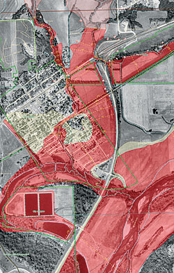
| FEMA now uses GIS for compiling, creating, delivering, and viewing its digital floodplain maps. |
The scope of its mission—to manage and learn more about the 193 million acres of public lands in forests and grasslands in its stewardship—makes remotely sensed imagery a critical data source for the U.S. Forest Service's 10,000 GIS users. These users in regional, forest, and field offices require quick access to high-quality, current imagery. The recent adoption of ArcGIS Image Server eliminated long preprocessing and loading times while providing fast access to imagery and its metadata by multiple users and maintaining data security and access logging. Articles in this issue explain in detail why the Forest Service chose this solution and how it was implemented enterprise-wide.
The subject of the final article in the Focus section tells how GIS helps the Federal Emergency Management Agency (FEMA) through enhanced data integration and improved collaboration for the agency, its mapping partners, and the consumers of its products.
FEMA is tasked with reducing the loss of life and property caused by flooding. Its Map Modernization program is moving from a system based on paper maps and an earlier digital format to a more reliable and complete approach based on the digital Flood Insurance Map (dFIRM) format. GIS has improved the workflow associated with the creation and maintenance of flood maps. FEMA can more easily collaborate with the National Flood Insurance Program member communities and state and regional agencies that contribute dFIRM basemap data by using GIS as a common framework.
Within the agency, ArcGIS Production Line Tool Set (PLTS) and Job Tracking for ArcGIS (JTX) help FEMA more efficiently and rapidly compile and update maps and maintain a high degree of accuracy. Esri developed JTX, a workflow management application, to support large-scale implementations and help large organizations manage GIS in a multiuser environment. With JTX, managers can define the individual tasks that make up a project, monitor the progress of the individual jobs that make up a multiuser GIS project, automate tasks, and better allocate staffing resources. JTX is available as an extension for ArcGIS Desktop and ArcGIS Server.
Flood map data supplied as dFIRMs is more easily consumed by government and business organizations that rely on flood information. These organizations can easily and quickly incorporate this format into existing GIS systems for flood hazard analysis and visualization. Maps generated can be distributed digitally, printed, or shared online using ArcIMS or ArcGIS Server.
Large organizations were among the first GIS users who realized the advantages of adopting an enterprise approach and using geography as a framework for optimizing business processes. The role of GIS and the GIS professional in these organizations has qualitatively changed with the move from departmental to enterprise-wide GIS implementations and the development of more powerful tools for authoring, integrating, and serving geospatial data. GIS is now an integral part of these organizations' information infrastructure and business processes.
|