Startup Tips Offered on How to Create GIS Services with ArcGIS Server 9.2
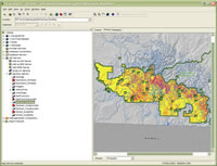
 ArcCatalog can be used to publish GIS Services. |
The Creating and Using GIS Services workshop at the Esri International User Conference in June demonstrated Esri's out-of-the-box functionality that allows you to share maps, geoprocessing tasks, and geodatabases as GIS services. This ability to create GIS services without programming is a new enhancement of ArcGIS Server 9.2.
Presenters Sud Menon and Julio Andrade from Esri's software development division showed the audience how to take a GIS resource located on a server and make it easily available to others. First, an ArcGIS Desktop application such as ArcMap, ArcCatalog, or ArcGlobe is used to "author" or create the GIS resource. Then, ArcGIS Server Manager has a wizard for "serving" it to the GIS server for sharing with clients on the Web. Clients can "use" it for things like looking at data on a map, inputting and analyzing custom information, or using and updating a master database, to name a few.
For example, the Globe service is targeted at 3D clients using ArcGlobe, ArcReader, or ArcGIS Explorer to visualize data. Menon demonstrated one feature that publishes vector data as raster data and drapes it on the surface of a globe. The result: You can open up the easy-to-use ArcGIS Explorer and see your data displayed in map form on a beautiful globe of the Earth. You can also publish data in KML format for publishing to Google Earth in a single layer or as multiple layers that you can turn on and off.
The Geoprocessing service allows you to build data processing with ModelBuilder, centralize the processing on a server in your organization, and then provide the processing service to others. For example, you can create a data processing model that finds the optimum sites for locating campsites in a campground by using weighted overlay criteria, such as distance from a road, distance from water, and hours of sunlight exposure. Visitors can then go on to your Web page to see the criteria, choose their own weights for each criterion, and then run their own data through the process. They can print the results in an attractive map format that you designed.
The Geodata service works well for large organizations that use enterprise systems and master databases. It allows you to share data across the organization or out to others over the Web by using database replication. You can give others permission to add and edit data and then synchronize those changes back to the geodatabase server. Head offices could then share information with their branches. Menon noted that opening these channels to share information does raise security questions, and he described ArcGIS Server security options for restricting access permissions and adding data encryption.
You can learn more about creating GIS Services with ArcGIS Server 9.2 by listening to a podcast titled Introduction to ArcGIS Server or viewing the free live training seminar, What's New in ArcGIS Server at 9.2.
Recordings of the technical workshops at the 2007 Esri International User Conference are available on DVD-ROM. The UC Proceedings CD, which contains the user presentations, will be mailed to all attendees at no cost.