The Geneva International Centre for Humanitarian Demining (GICHD) and Esri have joined forces to modernize the software that plays a central role in clearing land mines and unexploded ordnance (UXO) in more than 40 countries around the world.
Esri is working with GICHD to develop new mobile data collection apps and spatial analysis and reporting tools for the Centre’s Information Management System for Mine Action (IMSMA), the software that makes mine action (the broad efforts to remove land mines and UXO) safer and more efficient.
“Mine action is inherently geographic,” said GICHD ambassador and director Stefano Toscano. “It relies on identifying the location and spatial extent of explosive hazards and analyzing their proximity to vulnerable communities and assets. GIS is ideally suited to support this work.”
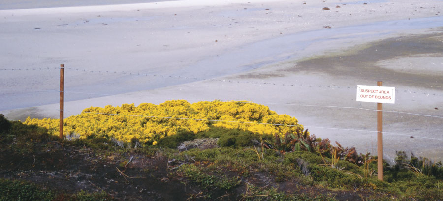
GICHD is an international organization dedicated to helping nations find and dispose of land mines, cluster munitions, and other explosives. Although casualty numbers are decreasing, more than 3,600 people were killed or maimed by land mines and other UXO in 2014, according to Landmine Monitor 2015, a publication from the International Campaign to Ban Landmines. These hidden hazards affect the daily lives and socioeconomic development of communities long after armed conflicts have ended. GICHD provides expert guidance to government and nongovernmental agencies in the mine action sector to observe standards, apply effective and cost-efficient tools, and improve survey and clearance methods.
GICHD and Esri signed a memorandum of understanding in October to strengthen their 17-year partnership to rid the world of land mines and other explosive remnants of war. In 1998, GICHD enlisted the help of Esri and a team of GIS programmers to create IMSMA, a single database application for all mine action projects that could be tailored to each country’s cleanup efforts.
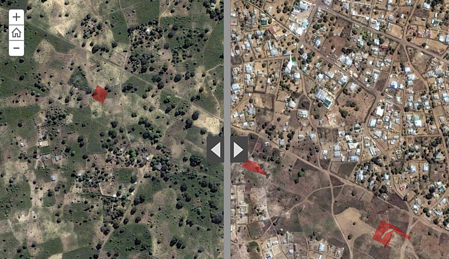
Free access to IMSMA helps mine action officials in each country identify, develop, and improve demining activities. National authorities, mine action centers, and partner organizations use IMSMA to securely collect, aggregate, and share data via interactive maps.
With Esri’s ArcGIS technology, IMSMA grew to serve a critical purpose in the mine action process: understanding exactly where mines are located prior to conducting clearance. And the system has since evolved. What began as a tool for mine action partners to organize, qualify, and share data has developed into a system of tools that delivers actionable intelligence.
“IMSMA has grown to become arguably the most advanced and widespread information management tool in the humanitarian sector,” Toscano said.

When IMSMA was first deployed in 1999 in Kosovo after the conflict there, the Mine Action Coordination Center (MACC) processed vast amounts of raw data about suspected land minds for inclusion in the database. The information was then distributed to fieldworkers in near real time, helping personnel verify true minefields over rumored ones. GICHD then amplified IMSMA with other tools, including its Mine Action Intelligence Tool (MINT). Today, MACC and organizations around the world use MINT to create and schedule reports, analyze demining data stored in IMSMA and other systems, track indicators, and design dashboards. Available on mobile devices, MINT helps demining personnel get the most out of their data so they can make evidence-based decisions.
GICHD’s next version of IMSMA will further harness Esri’s latest GIS software and deliver a set of increasingly interconnected tools and processes that can be configured for each country’s needs. With the current version of IMSMA offering limited GIS analysis capabilities, GICHD will work with Esri to develop future IMSMA components that enhance existing information management offerings. The organization plans to integrate existing Esri solutions into IMSMA to offer the mine action community the latest GIS technology for mobile data collection, spatial analysis, and reporting.
Several of these components are already in progress, with functions available in beta to the mine action community.
For example, GICHD’s multicriteria prioritization tool (PriSMA), powered by Esri technology, will let decision makers use spatial data to determine where to dispatch resources. Built on an interface that requires minimal training, stakeholders will be able to interact with data and weigh various factors to identify the hazards and areas that are most important. Users will be able to gauge which hazards pose the highest risk to regions based on population, access to hospitals, proximity to schools and roads, and more. By scaling these indicators according to their level of importance, the tool will run a priority analysis and produce a map that shows the areas that are most impacted and the hazards that are the most dangerous.
GICHD’s objective is to work with Esri and other partners to enable the use of GIS throughout the mine action community within the next three years.
“The Centre’s work is profoundly important and deeply geographically oriented,” said Esri president Jack Dangermond. “Saving and enhancing people’s lives across the world depends on GICHD’s success, and the Centre’s success depends on accurate, up-to-date GIS solutions and information. We at Esri are proud to provide our technology and expertise to help drive GICHD’s mission.”
For more information, visit GICHD’s website.

