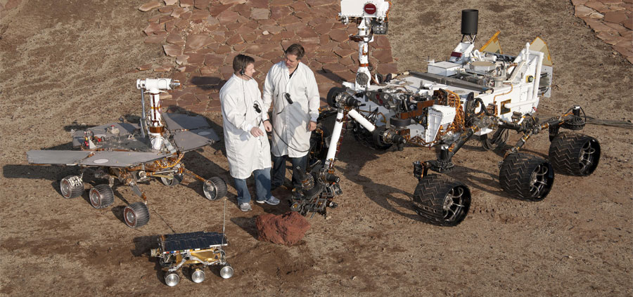
In anticipation of future missions to Mars, GIS techniques are now being applied to previously collected elevation data from Mars to model the terrain to aid rovers and—eventually—humans.
The possibility of humans exploring Mars in the relatively near future has increased significantly as evidence from several missions has accumulated showing that water was—and perhaps still is—flowing on the planet.
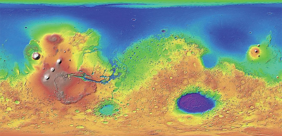
Missions to study Mars have stimulated the public’s collective imagination about interplanetary travel while providing a wealth of information about one of Earth’s nearest neighbors. Detailed information about the surface of the planet has been regularly collected for the past 20 years. The National Aeronautics and Space Administration (NASA) created digital elevation models (DEMs) from data provided by the Mars Orbiter Laser Altimeter (MOLA), an instrument on its Mars Global Surveyor spacecraft (1997 to 2001). Digital terrain models (DTMs) have been produced from the High Resolution Imaging Science Experiment (HiRISE) camera on board the Mars Reconnaissance Orbiter that has been collecting data since 2006.
However, sending manned missions presents many challenges that must be overcome and critical technologies that must be developed. While the MOLA and HiRISE data are valuable in themselves, they also provide the opportunity to extract significantly more information from them.
Developing High-Resolution Terrain Models
A few years ago, François Smith, geospatial data scientist at MDA Information Systems LLC in Gaithersburg, Maryland, began exploring the application of Earth-based terrain analysis methods to the existing DEMs and DTMs of the Martian surface. He was particularly interested in developing high-resolution geomorphological data layers for use in a vehicle mobility model that would determine the safest routes for rovers—and eventually, humans—to travel across the Martian landscape.
“We are using ModelBuilder and other tools to apply MDA’s Terrain Network Tools [TNT] to the surface data NASA has collected for Mars,” said Smith. “The results feed our Vehicle Mobility model. Determining the best path for the Mars rovers to collect data as they move around the planet is one use of high-resolution terrain data. However, there are many other uses for this technology as we prepare for a comprehensive exploration of the planet. For example, where are the safest places to land? Where are the most interesting scientific locations? Where can liquid water most likely be found? More significantly, all of this information can be used to help determine where human settlement should occur.”
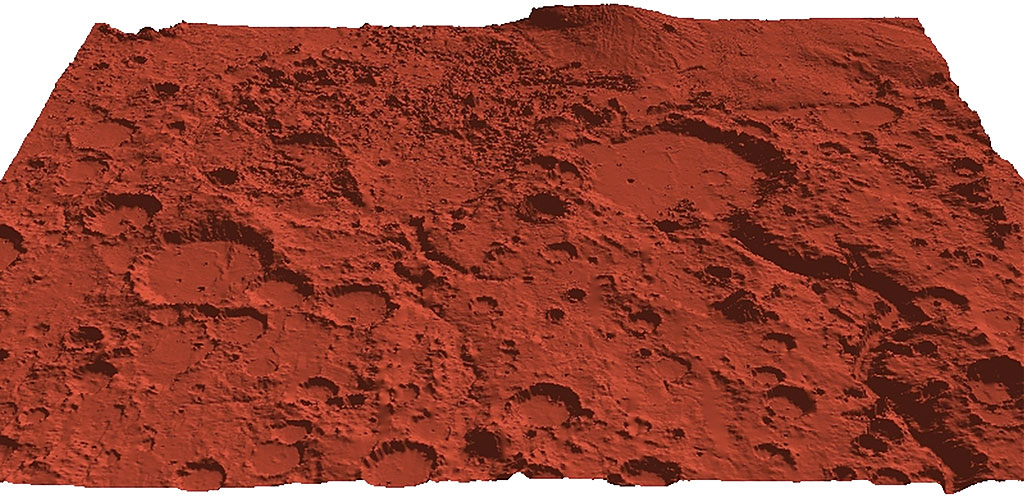
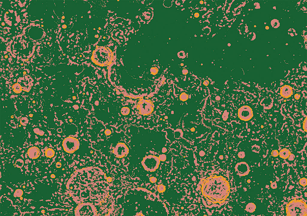
MDA Information Systems has developed the tools to create complex terrain maps of the entire planet at 1-meter resolution. This technology has been tested in different areas and environments on Mars that range from an ancient ocean to mountainous regions and craters. These tools are being used on data from areas where the rovers are currently collecting data.
Deriving Many Products from DEMs
“While we develop our own custom algorithms, we use operators found in the Esri environment,” said Smith. “We use ArcGIS Pro and the Image Analysis Window in ArcMap quite a lot. We also use ArcPy, which is a set of geospatial libraries that we include in our workflows. We systematically use advanced image classification tools that Esri has recently released such as the Segment Mean Shift, which is a segmentation algorithm that we use almost exclusively. We also often use Esri’s advanced classifiers such as SVM [Support Vector Machine] and Random Forests. Random Forests uses decision tree classifiers on subsamples of large datasets. It employs averaging techniques to improve predictive analysis.”
Esri’s advanced classification tools are founded on Object-Based Image Analysis (OBIA) concepts. The image is segmented into objects from groups of pixels derived from color, shape, and size characteristics. These objects more accurately delineate and represent the contiguous real-world features in high-resolution imagery than a pixel-based classification does, resulting in better feature recognition and extraction.
Jeff Liedtke, a product engineer with Esri’s raster team, worked with Smith to validate the accuracy of the segmentation and classification tools. “Feature classification accuracy is greatly increased when spatial characteristics such as object shape and size are considered along with the multispectral information and analyzed together using advanced non-parametric classifiers such as Random Forest and SVM,” said Liedtke. Because he has unique feature classification experience and domain knowledge in operational remote-sensing environments, Liedtke said that working with MDA to validate the accuracy and utility of these tools and workflows was valuable for users engaged in practical feature classification.
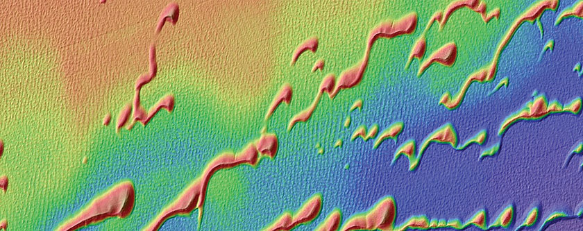
MDA developed TNT to produce DEM derivatives that include relative elevation, terrain complexity, terrain characterization, slope diversity, aspect diversity, and elevation range products. These layers are used in different combinations to model specific applications.
“TNT is a set of tools used in the ModelBuilder environment that enables us to utilize the DEM of any region to develop a variety of products that provide detailed information about the topography of that region,” said Smith. “TNT allows the user to create an array of datasets including terrain complexity, relative elevation, and terrain characterization, which are used to model specific geomorphological characteristics of the landscape, which can in turn be used to classify suitable environments for various activities. This is particularly valuable for future missions to Mars.”
MDA used ModelBuilder in a hierarchical model structure with its TNT toolset to develop a vehicle mobility model in separate modules. A series of models were created to make a modular workflow. The outputs of each of those models was integrated into subsequent models.
Dynamic Use of Big Data
Smith observed that big data lets MDA make products more accurate and efficient and generate solutions for more applications and include temporal components into analyses to show how the data changes over time. “This dynamic aspect of the data provides a key signature for deeper analysis, and with access to more data, [that] allows us to make greater use of its temporal aspect. Not only do we use the data for time series analysis and time signatures, but we also use it to corroborate the other datasets. Having multiple sources of data is very beneficial in terms of making our process multidimensional, more efficient, and more accurate,” said Smith.
“In addition, by connecting to data from different sources and integrating the resulting data into our geodatabases, big data provides us with more geospatial information in real time to increase our responsiveness,” said Smith. “For some of the projects, the datasets are so large and processes so complex that we require cloud-based computing strategies to implement our solutions.”
The Future of Interplanetary GIS
As more geospatial datasets are collected on Mars and other planets, MDA will be able to develop more accurate, sophisticated products and services. Learning more about the planets will let MDA tailor the design of its sensors and processes to more specifically address planetary applications.
“Our understanding of the planets in our solar system, as well as exoplanets, will begin to increase exponentially. At the same time, we will continue to apply the remote-sensing/GIS processes that we develop for Earth to planetary environments where applicable,” said Smith. “Especially for a planet like Mars, where it is likely humans will be taking field measurements within the next 15–20 years, a unique opportunity for planetary image data verification will develop. It will allow us to better interpret the imagery we collect and improve the geospatial models we create for interplanetary study, and I think that’s very exciting.”
