

November 1, 2022 | Multiple Authors |
November 15, 2022
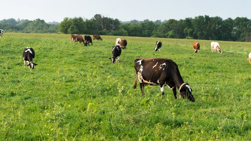
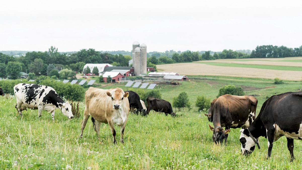
At Organic Valley, a national organic food brand and cooperative of small family farms, grazing is more than a requirement, it’s a point of differentiation and innovation. Their dairy farmers have always rotated cows across pastures, but now, with the help of data and maps, farmers are maximizing the productivity and sustainability in their grazing systems. With near-daily satellite images and custom mapping, Organic Valley provides accurate pasture condition reports to the farmer’s inbox or mailbox. Though high tech behind the scenes, the delivered product is a simple report that anyone can use, including the sizable percentage of Organic Valley’s membership that is Amish or Mennonite.
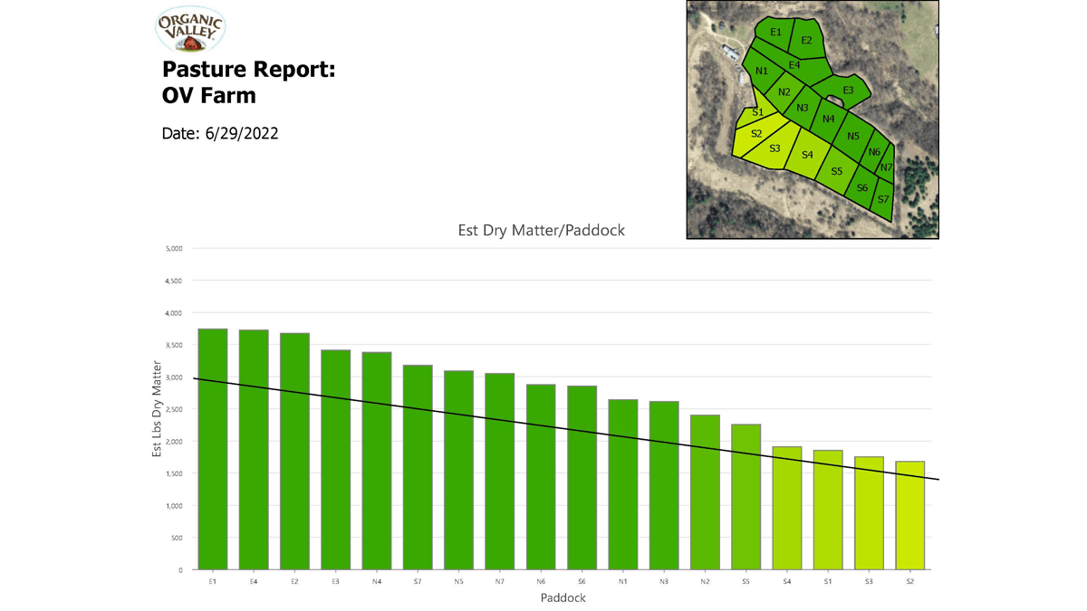
These personalized data-driven reports and images indicate the health of each paddock, including details used to determine which should be grazed, cut, or left to grow.
The reports using satellite imagery, automated with geographic information system (GIS) technology, contain precise information that’s difficult to capture otherwise. This information is used to help feed and raise organic cows on lush pastures, furthering Organic Valley’s sustainability efforts.
While Organic Valley dairies were already using rotational grazing, this program automates a precision pasture management approach that ensures cows will always be feeding on the best available forage with greater efficiency.
A critical component of the pasture reports is a “grazing wedge” that shows the estimated biomass availability for each paddock. Prior to this program, farmers who wanted this information had to estimate biomass with more manual methods. One approach involves walking paddocks with a plate meter to measure the height of the grass, recording figures in a notebook, and calculating grass cover alongside the amount of time the cows were left to forage. Such processes are difficult to repeat at regular intervals, so record keeping and implementation were inconsistent. Today’s pasture report automates this manual process, and the algorithms used to estimate biomass continue to improve through regular ground-truthing.
“Many farmers have their standard rotation and adjust based on what they’re seeing, but it can be difficult and time consuming to visually cover all those acres,” said Phil Marty, GIS administrator at Organic Valley. Now, farmers complement conventional wisdom with insights from imagery to make data-driven decisions that have produced notable increases in pasture utilization.
The benefit of a well-informed rotational grazing system is often an increase in harvest efficiency, or the percentage of the forage that goes into the belly of the cow. And this efficiency can be realized without overgrazing. Overgrazing can negatively impact pastures, water retention, and ecosystem health.
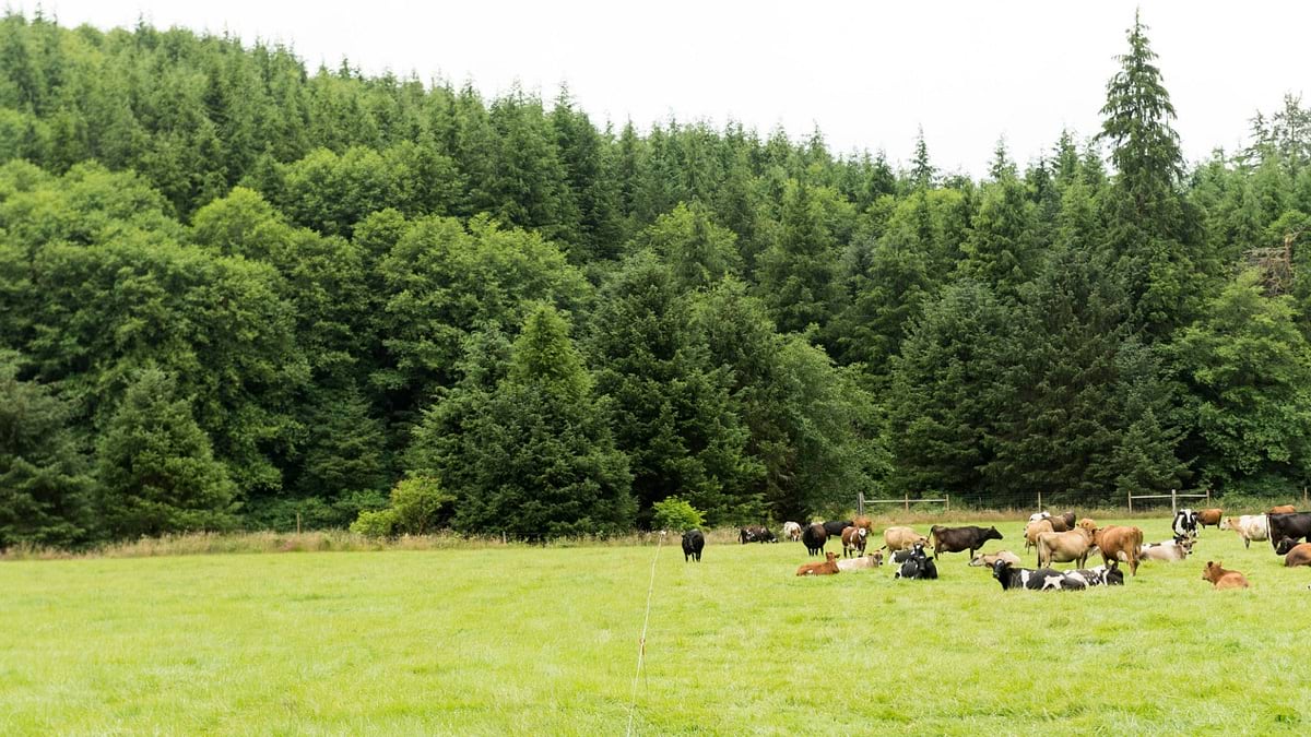
On the pastures of an Organic Valley family farm, as many as 200 different types of plants grow, including clovers, trefoils, brome, ryegrass, orchardgrass, and timothy. As Organic Valley points out, it’s designed to be a salad bar for cows, ensuring proper nutrition and leading to the best quality of milk. With careful rotation, a critical balance of grasses and legumes is maintained, and cow manure is spread naturally, leading to healthy soil and a healthier herd.
With current pasture reports, biomass and what cows have eaten automatically calculate from satellite measurements, allowing farmers to balance supply and demand with less time and effort. The report gives farmers timely information for important management decisions, such as how fast or slow to rotate the cows or whether to cut grass and make hay.
Organic Valley first tapped Esri partner, Planet, in 2020 to see if its satellites could be used to monitor the health of each paddock. Paddock growth provides a constantly moving target, particularly in Wisconsin near the company’s headquarters where sunny days mixed with generous rains often create a tremendous amount of growth.
Satellites measure plant health by detecting the amount of chlorophyll in plants—the more chlorophyll, the greener the plants and the more biomass are in the images. Images that appear yellow to red have limited pasture available, indicating it is time to rotate cows off and rest those pastures, or sometimes it is indicative of something environmental like excess or deficient moisture.
Planet was chosen because its constellation provides near-daily imagery at high resolution everywhere on Earth. Organic Valley piloted the approach on 20 farms, using ArcGIS Pro to analyze the imagery and automate custom reports for the farmers. For the first two years of the program, ground measurements were taken on a regular basis to compare against the analyzed Planet images. The initial 20 farms in the program demonstrated successful implementation, so Organic Valley expanded the program to nearly 100 farms in 2022.
For farmers, a superior degree of precision pasture feeding has the potential to fine-tune practices, tying what they see on their custom maps with what’s in their milk tanks.
Farmers in the program have shared some of the things they can now see thanks to the high-tech approach, such as areas slow to bounce back that need more nutrients; areas irrigators are missing; weak areas of growth that might perform better with a different plant; and knowing when they can cut forage early to stockpile feed for winter months.
With positive proof demonstrated to date and automation in place, Organic Valley is offering the precision grazing program to any of the small family farms within the cooperative interested in the technology—more than 1,650 farms spread across 35 states—beginning in 2023.
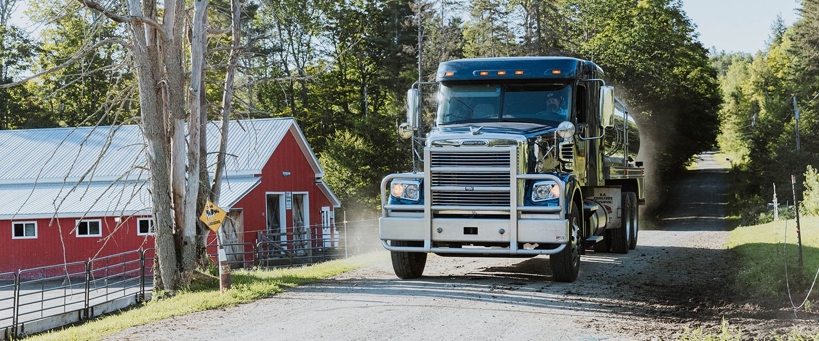
GIS is one of many enterprise systems at Organic Valley that keeps track of the variability of farming. The cooperative applies GIS to help determine the daily “assembly” side of the business, which encompasses hauling milk to processing plants as well.
Organic Valley contracts with a number of regional milk haulers, using GIS to determine best routes to farms with volumes that will aggregate to a full truck. “This is a biological system, so if the grass withers up, milk dries up,” Marty said. “It’s a volatile supply and demand problem, so we’re doing lots of vehicle routing, looking at volumes.”
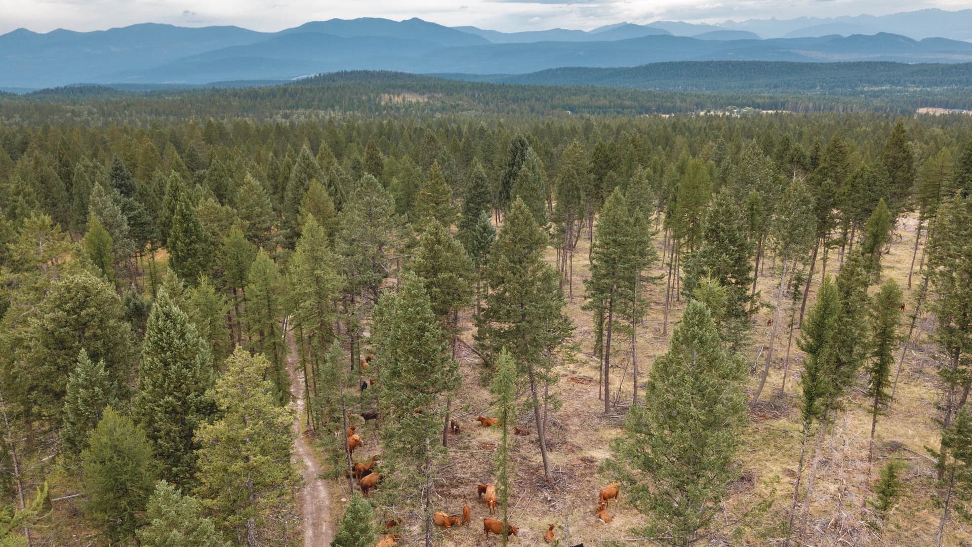
Grazing is a fundamental pillar in organic dairying. With regular refinement to monitoring and measuring efforts, Organic Valley is helping farmers innovate and steward the planet. One of its next aims is to quantify the amount of carbon that’s being sequestered through rotational activity and perennial pasture systems.
“If you just let a pasture grow up and it gets harvested one time, there’s less carbon being sequestered than if it’s continually grazed and re-growing,” Marty said. The imagery insights help identify and monitor carbon sequestration capacity related to grazing, which could be a future source of revenue in a practice known as carbon farming.
In addition to putting actionable tools in the hands of dairy farmers and helping their grazing systems be more efficient and effective, optimizing carbon capture on working lands holds great promise to return more value from the effort. This is part of a larger effort to facilitate climate smart farming across the cooperative.
Organic Valley was recently selected for an approximately $25 million grant from the United States Department of Agriculture to establish and measure on-farm practices that reduce greenhouse gas emissions. The funds will finance 1,200 new carbon reduction and removal projects on approximately 500 Organic Valley member farms over the next five years, and of course these projects will be monitored and analyzed to report on progress.
“Sustainability and carbon sequestration are things we should all be working on,” Marty said. “We’re happy to discuss what we do, it’s in our cooperative mentality. We look forward to meeting and collaborating with others in this space.”
Learn more about how GIS supports farmers for data-driven sustainable production.

November 1, 2022 | Multiple Authors |
November 17, 2020 |
August 6, 2020 |