
March 30, 2021 |
January 3, 2023
All mobile network operators offer a coverage map that allows anyone to see where signals reach, the quality of coverage (2G, 3G, 4G, 5G), and if the signal is strong indoors and out. At Vodafone, a high-resolution digital twin provides a far more granular understanding of the network than was possible previously.
“Initially, it was purely a question of producing a better map,” said Boris Pitchforth, lead architect at Vodafone. “Now it has become a much smarter way for us to plan.”
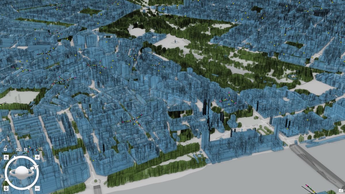
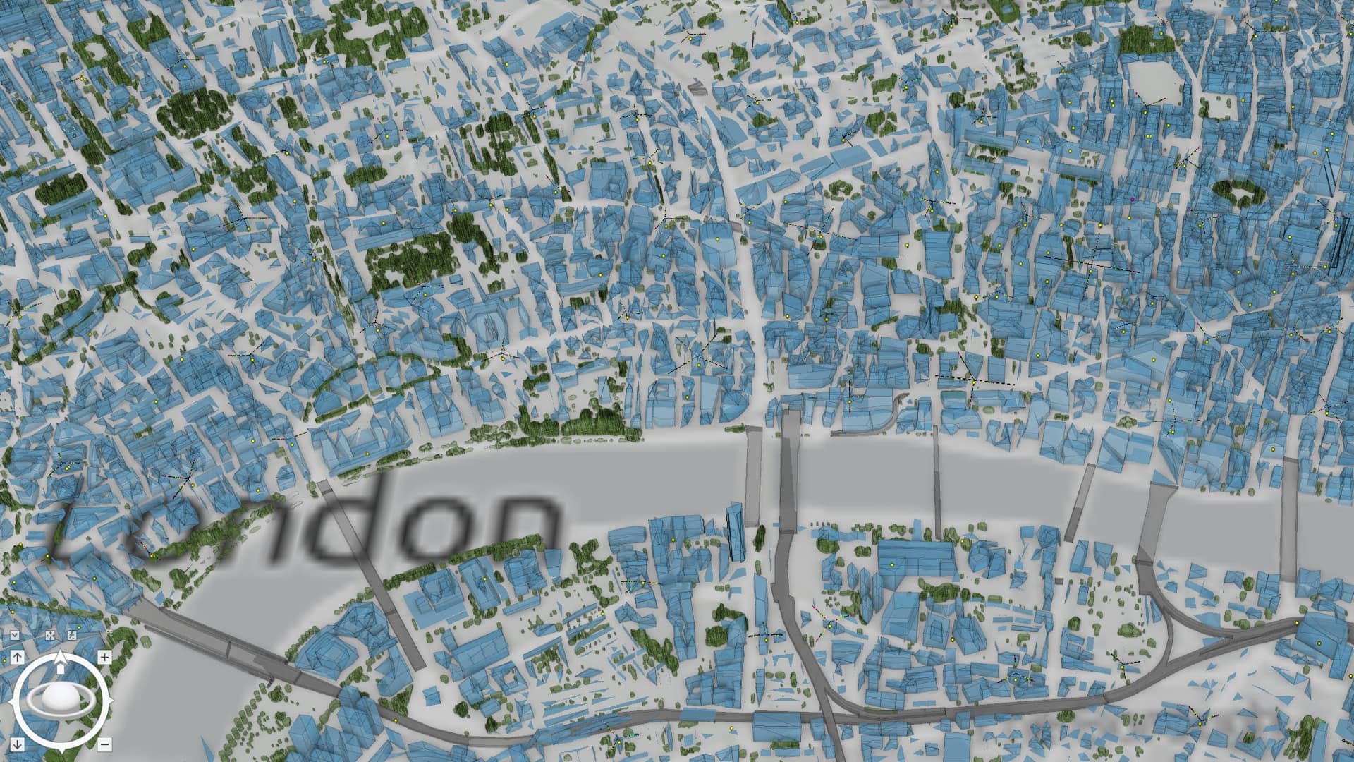
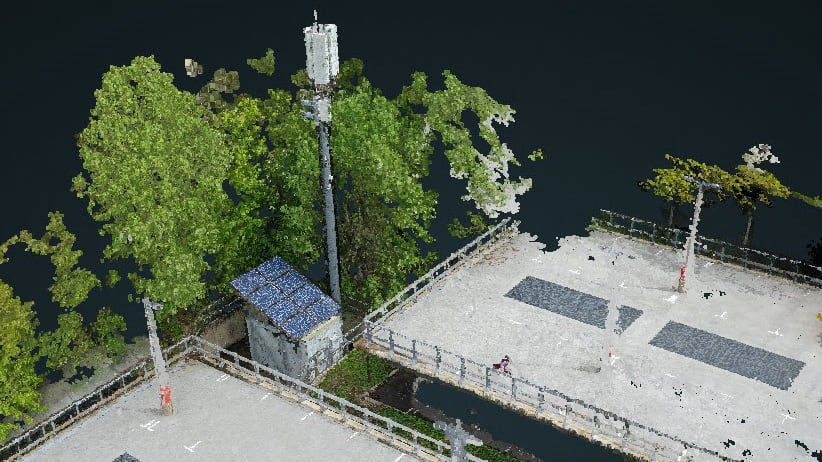
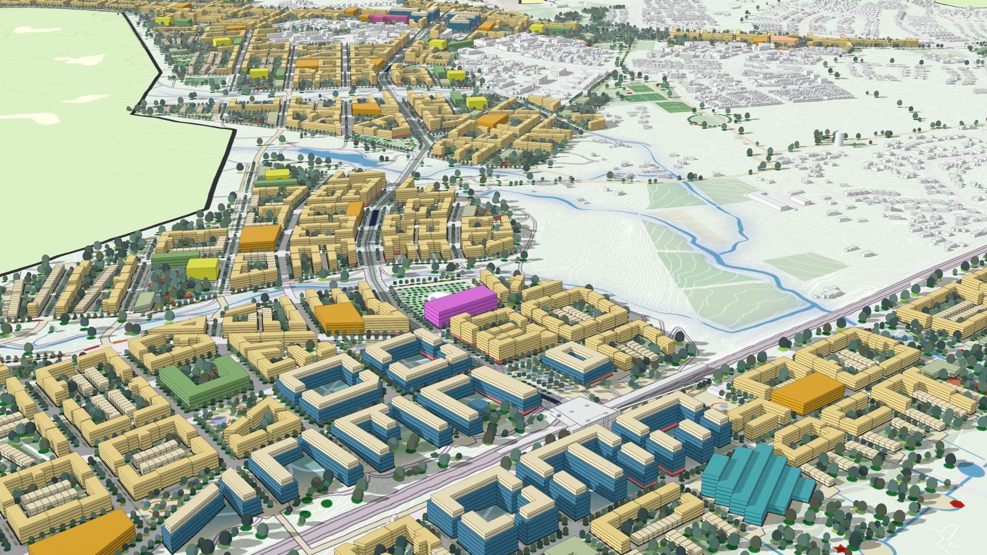
The Vodafone digital twin for Britain—representing 245,000 square kilometers—was created using geographic information system (GIS) technology. It contains various levels of immersive 3D detail that gives anyone at the carrier the ability to see the invisible signals the company creates and sells.
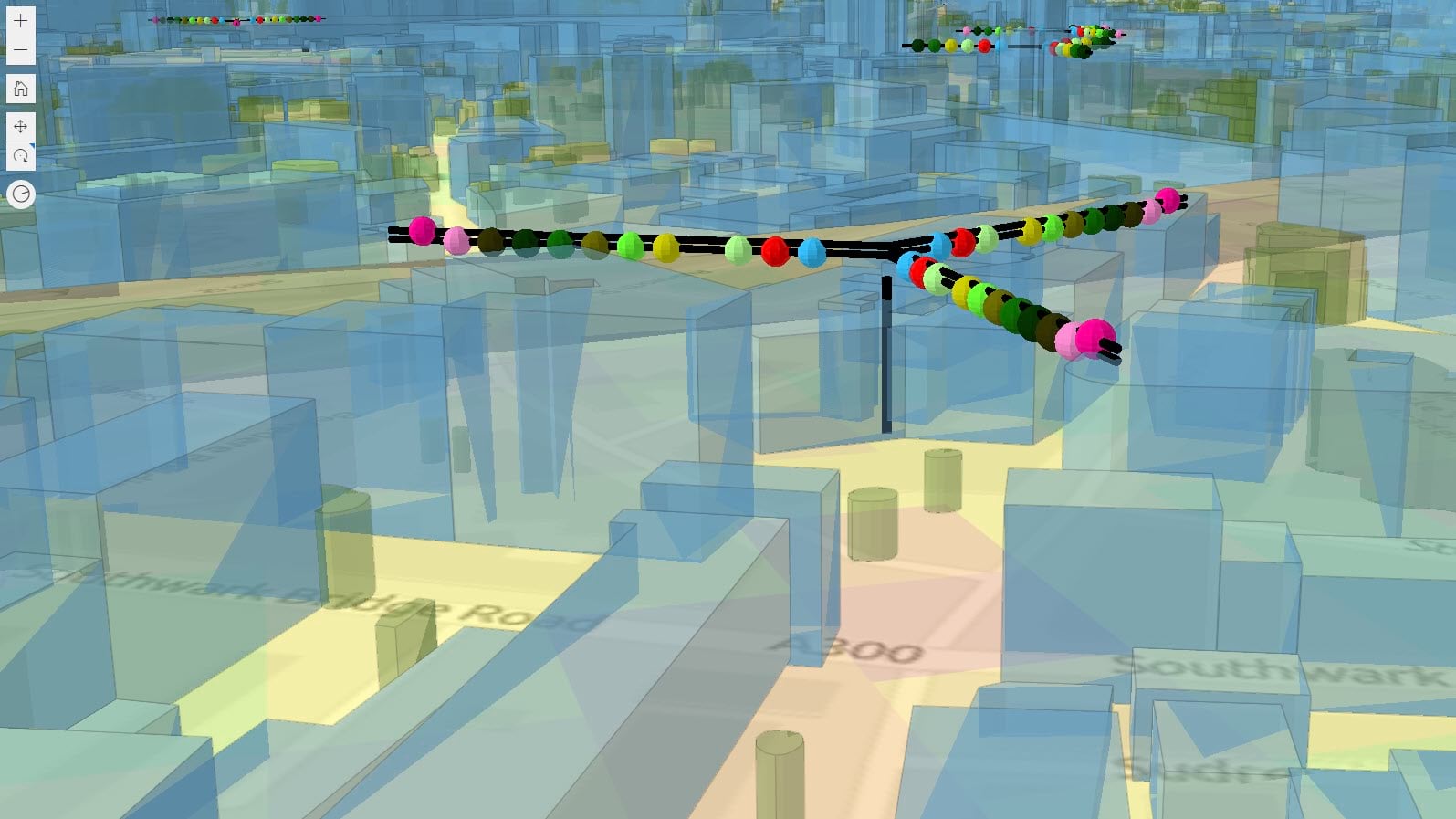
For engineers, the digital twin enables signal propagation modeling across coverage areas to guide constant maintenance and upgrades that strengthen signals and increase coverage area.
Vodafone’s digital twin enables the company to stay on top of plans for developments such as new housing, shopping centers, and sports venues. This helps ensure Vodafone’s signal is strong wherever demand is growing.
The UK has been Vodafone’s test ground for its pioneering digital twin. The company is now looking to adapt this approach to cover the millions of customers Vodafone serves in 12 countries across Europe.
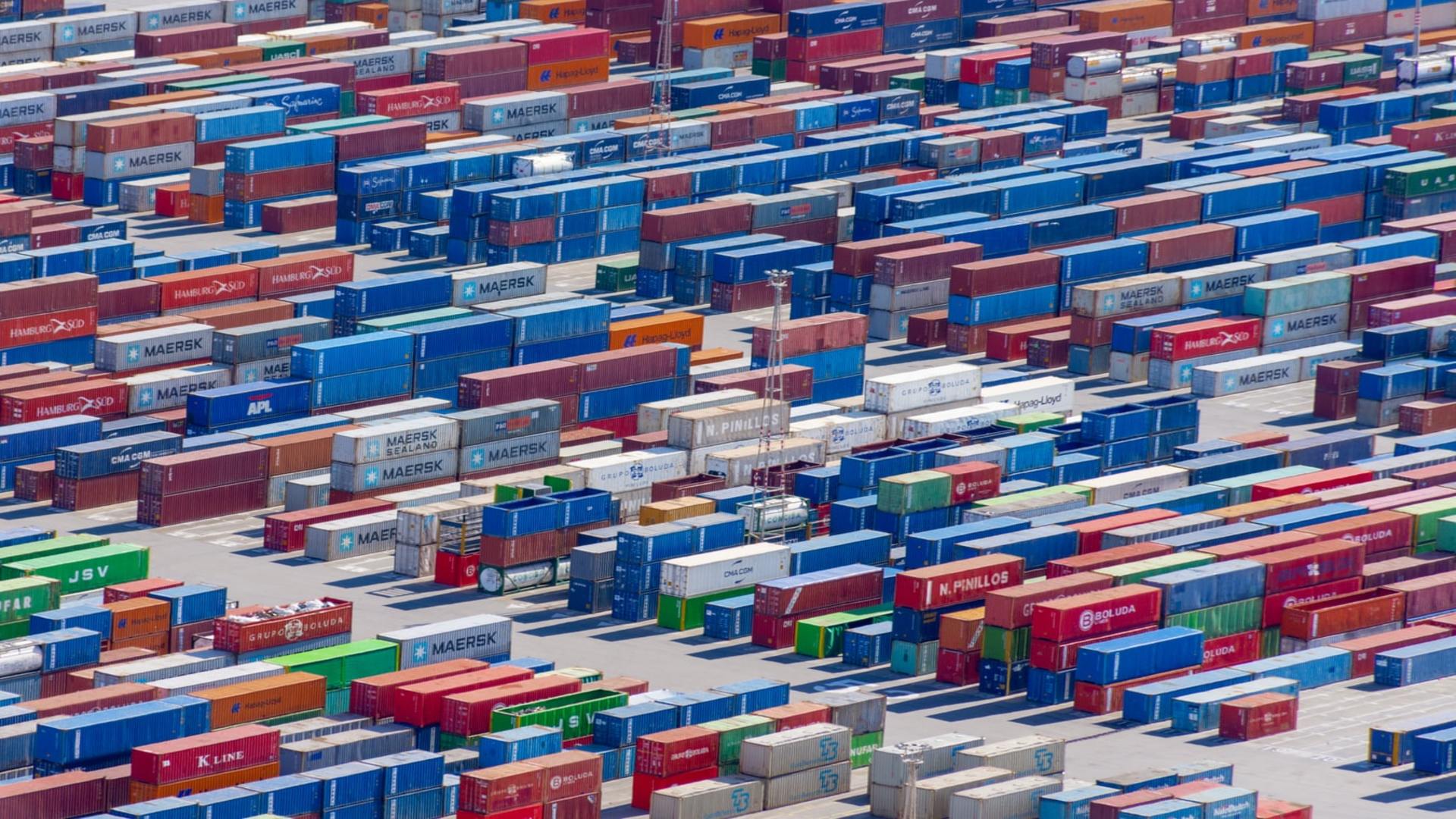
In the beginning, Boris Pitchforth and his team used the digital twin to combat clutter—objects that obstruct cellular signal. Trees were an early consideration, especially tree growth. To model tree growth, the team has acquired tree data spanning many years, with details about seasonal changes that impact signal.
“We don’t know individual tree types,” said Rebecca King, GIS lead at Vodafone. “It might be unrealistic to think we could capture whether each tree is an oak, hazelnut, or conifer across the whole country, but we would capture that if we could.”
Vodafone’s 360-degree view of the network and signal strength is stored in the Amazon Web Services (AWS) cloud; attributes are cataloged and visualized with ArcGIS Enterprise.
The country-scale details about clutter include more than 40 million environmental features. Network features, such as towers and equipment, add another 500,000 records. Network performance data adds billions of rows of data to the database to depict signal strength across space and time. And there are population volumes, such as how many people are on the road or travel through each train station, so Vodafone can conduct capacity planning.
The digital twin has become instrumental to planning. With details about topography, cell towers, and the equipment on each tower, engineers can do preplanning for work on individual towers or whole sections of the network. They can look at how a new tower could fill a gap in coverage, or model how adding or removing a component might impact signal strength.
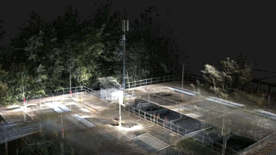
The digital twin also enables engineers to measure infrastructure remotely, which saves time and money because they don’t need to go to the field every time to take a measurement. It can also be used to direct them to the cell tower in the middle of a field or in a dense urban environment, where finding the path or access road can be tricky.
With the digital twin, major landmarks—like London’s Paddington Station with railway lines, skyscrapers, a canal, a bridge, and a busy road—are modeled in particularly fine detail.
The amount of place-, equipment- and signal-related data that the digital twin integrates is staggering. But as Boris Pitchforth points out, no digital twin is perfect. Vodafone has built its digital twins so that people across the company can correct inaccuracies and fill in missing information. “The more people who see the network and know the network, the more people who can report any gaps,” he said.
The digital twin also contributes to Vodafone’s pledge to ensure that its UK operations achieve the goal of net-zero carbon emissions by 2027.
“We’ll always need engineers to go out—there’s no way around that. But we want to reduce multisite visits,” Boris Pitchforth said. “Instead of driving all those trips, the digital twin allows an engineer to visit the site virtually while sitting at a desk. It’s surprising how the emissions savings add up.”
Learn more about how GIS creates dynamic digital twins and supports all types of telecommunications operations.
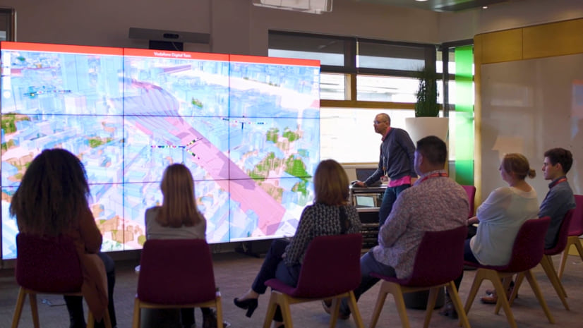
View the Esri UK video below to see how Vodafone’s digital twin guides decision making.

March 30, 2021 |
January 21, 2021 |
May 4, 2021 |