Last week Jack Dangermond joined Esri’s policy team to host the first GIS and Policy event at the U.S. Capitol Visitors Center. Nearly 100 policymakers convened to learn firsthand how the growing community is using GIS to inform and disseminate public policy.
Congress and its staff are increasingly relying on digital over print information sources, and naturally that drives demand for interactive data products. Most recently, this has led the Congress’s research institution, the Library of Congress, to expand its web GIS offerings. The Congressional Research Service’s GIS Team provides Congress and its staff with many GIS services, including cartographic maps, geodata, and interactive web maps. This shared geospatial analysis enables policy makers to identify how features intersect with proposed policy, and sometimes how those features intersect with a member’s geography.
Maps Communicate Complex Policy
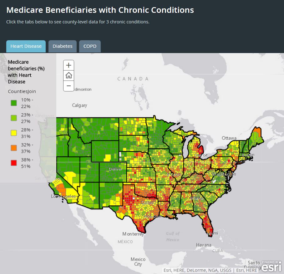
Many communications, digital directors, and press secretaries use web maps to compliment legislative text. Offices are finding that a compelling, trustworthy map noticeably increases the number of times a story is picked-up and shared. Some are using maps to communicate complex policy ideas in an easy to understand way. Readers can identify with policy on a map, understand its impact at the local level, and decide how to act. For example, Senator Wyden’s Medicare Beneficiaries with Chronic Conditions interactive web map enables readers to understand how the standard of care for Medicare beneficiaries with three chronic conditions varies by local geography.

Information Sharing Made Easier
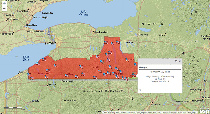
Offices are finding more and more ways to communicate Member, district, and constituent services information through web maps. For example, Congressman Tom Reed’s town hall map was tweeted out to followers in early 2016 to highlight the town halls hosted by the Congressman across the district in 2015.


To explore how GIS is being applied to policy making, visit go.esri.com/policy. For questions, or to activate your Senate Analytical Mapping System (SAMS) or HouseMAP account login, please contact policy@esri.com.
insider