By Gary Sankary – Head of Industry Marketing, Retail
Every year, more than 30,000 retail analysts, executives, and professionals meet for three days in New York City’s Javitz Center for the National Retail Federation’s annual Big Show. As a retail veteran, believe me when I say there’s nothing in our industry quite like it. It is the largest and most important trade show of the year for retail and retail technology. Retail professionals from every aspect of the industry come to the show to connect, meet with technology partners, and see what’s new in the industry.
The Esri Retail team is excited to showcase many of the ways ArcGIS can help retailers bring precision to their enterprise and extend their capabilities in merchandising, marketing, operations and business intelligence. With the release of ArcGIS 10.5 and Insights for ArcGIS, it’s never been easier for retailers to understand why things happen where they do.
ArcGIS brings precision to retail by enabling retailers to leverage the power of geography in their decision making and execution. Every retail transaction happens in a location for a reason. By connecting data, events, and transactions, retailers can discover the insights they need to find target customers, drive sales, reduce expenses, and engage with their customers. As retailers continue to develop and execute their strategies to support unified commerce, a location data management strategy enabled by ArcGIS is critical.
In booth 3871, we’ll be showing retailers how ArcGIS can extend their core capabilities in a variety of areas to drive greater engagement and loyalty with their customers:
–Â Â Â Â Â Â Â Business Analyst, a data-driven mapping and analysis tool that puts the most critical business data, demographics, lifestyle segments, household spending, and competitive data in the hands of everyone in a retail organization, from BI professionals to market analysts and merchants.
–       ArcGIS, Esri’s flagship tool that allows everyone to easily discover, use, make, and share maps on any device, anywhere, anytime. ArcGIS fuses the power of leading spatial analytics tools with the Living Atlas, the world’s largest collection of open source geographic data, to create maps and data products that allow retailers to quickly analyze and understand any situation.
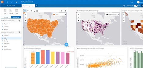
–       Insights for ArcGIS, a new data interrogation tool in ArcGIS that lets retailers extract geographic insights from big data in real time. Insights allows users to interactively explore their data in multiple ways to see patterns, understand relationships, and correlate results based on geography. And, when the analysis is complete, it’s easy to share those results with other key decision-makers across the business.
–       ArcGIS Maps for PowerBI, a new integration that leverages the power of ArcGIS’s simple mapping technology and spatial analytics directly within Microsoft’s flagship business intelligence platform. We’ll actually have a special area within the Microsoft booth (booth 2803) where we’ll walk through all the ways Esri and Microsoft empower retailers together.
In addition to Insights for ArcGIS and Power BI, we’ll also be showcasing our new Location Strategy for Business initiative. As businesses, and retailers in particular, cope with the new realities of empowered consumers and easy access to data, a location strategy is critical to unlocking the full potential of that data and using it to delight customers, crush competitors, and profitably grow.
Special Offers for NRF Attendees
I truly believe that 2017 will bring greater awareness about the importance of location in retail. To help retailers themselves understand this first-hand, we’ve put together some special opportunities for people who visit us in booth 3871:
- Every attendee who comes to see us will receive a complimentary market profile about any place in the United States. Normally valued at $50, these reports provide unparalleled insights into the demographics, behavior, and dynamics of any market.
- We’re giving away special codes that let attendees save 20% off the regular price for our Business Analyst suite of products.
If you’re planning to be at the show, make sure to come see us. You can even schedule an appointment with us online.
