I’m here in Denver, Colorado for the New Partners for Smart Growth Conference (2/13-15/2014), a perfect location for an event that illustrates the importance of triple bottom line planning that addresses the environment, the economy, and the social sphere of culture, justice, and equity.
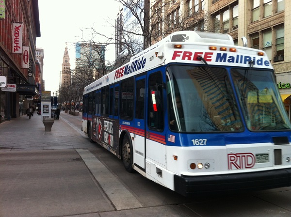
For more than ten years, Denver has been adding light rail and commuter rail to their transportation infrastructure to help reduce traffic and improve accessibility. In the last six years or so, a lot of work has been done to revitalize historic parts of downtown to increase its vibrancy and livability. New shops and trendy restaurants have moved in; planters, trees, and artwork dot the streets; and in the summer, colorfully-painted upright pianos are randomly placed along the walking mall on 16th Street, with free bus rapid transit attracting the young and old to explore and maybe play a tune.
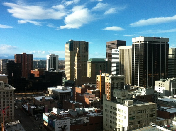
The mix and match of historic buildings, high rises for density, transit options, proximity to ski resorts, biking and climbing, and creative atmosphere attracts people to want to live in Denver. But there is another element, rarely talked about. It is also a metropolitan area with a plethora of companies that specialize in the multi-billion dollar geospatial industry. Companies like Esri, Trimble, Placeways, Critigen, Compass Tools, EI Technologies, Digital Globe, Sanborn, Merrick, and many more have sprouted up here partly because of its central location, partly to be near each other, and partly to be near the many Federal and Department of Defense agencies focused on satellite imaging of the Earth and global positioning.
Today, with advances in cloud computing, pervasive data, mobile devices, and location analytics, mapping applications have moved from the defense and intel space right through the hardcore GIS user and into the commercial space–and by commercial, I mean easy-to-use apps that can be used by anyone and everyone to solve everyday problems. The explosion of apps for smart growth will be well represented during a tech fair at the New Partners for Smart Growth Conference with folks like Placeways, Fregonese Associates, Placematters, and many more, demonstrating opportunity mapping, scenario mapping, crowd sourced planning, and community engagement.
Many of these apps form an ecosystem of products often used within a geodesign process to allow stakeholders to collaboratively co-create a place they’d want to live. As Tom Fisher, Dean of the College of Design at the University of Minnesota puts it, “geodesign, the marriage of design (and planning) with the science of geography” allows us to test the impacts of our planning decisions and get input from the public before we build.
Denver used geodesign while working with the Trust for Public Land during their Greenprinting process. By connecting existing parks and open space with trails, they were able to increase active living and access while sequestering carbon and improving air and water quality. I’d say that Denver, a city on the rise, is doing a good job using mapping technologies of all kinds to plot its future.
And it would be great if the Denver metro area and nearby cities were to capitalize on the fact that they have a mature geospatial innovation hub with companies creating the tools and data that will help us better understand how to build sustainable, livable cities for the next 3 billion people. That’s smart thinking.
insider
