Our water supply is finite. From areas of abundance to places struck with drought, ensuring access to a clean, reliable source of water is critical.
World Water Day is an international observance and an opportunity to learn more about water related issues, be inspired to tell others and take action to make a difference. World Water Day dates back to the 1992 United Nations Conference on Environment and Development where an international observance for water was recommended. The United Nations General Assembly responded by designating 22 March 1993 as the first World Water Day. It has been held annually since then.
Maps help us protect water supplies and their integrity by understanding how human behaviors impact the natural system, document water sources and quantify their capacity based on current and historic data, and then share the story of the water system through engaging maps so everyone can see how today’s actions affect tomorrow’s water system.
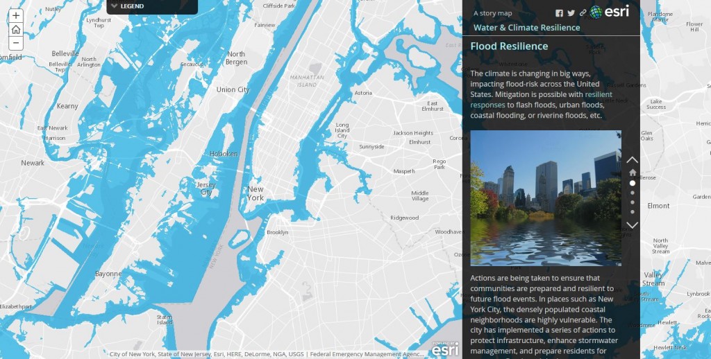
Water & Climate Resilience
“Water is life,” many would say, yet access to clean water is decreasing as temperatures and drought increase. Local, state, and federal governments have taken actions to protect water as a precious resources and mitigate coastal flooding. National flood insurance programs, sustainable agricultural policies, and clean water infrastructure are just some of the resilient actions being implemented.
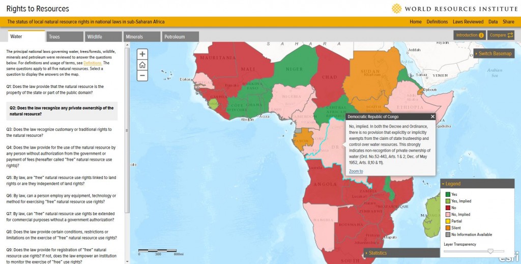
Water Rights In Sub-Saharan Africa
The principal national laws governing water, trees/forests, wildlife, minerals, and petroleum were reviewed to answer a number of questions, such as:
- Does the law provide that the natural resource is the property of the state or part of the public domain?
- Does the law recognize any private ownership of the natural resource?
- …and more.
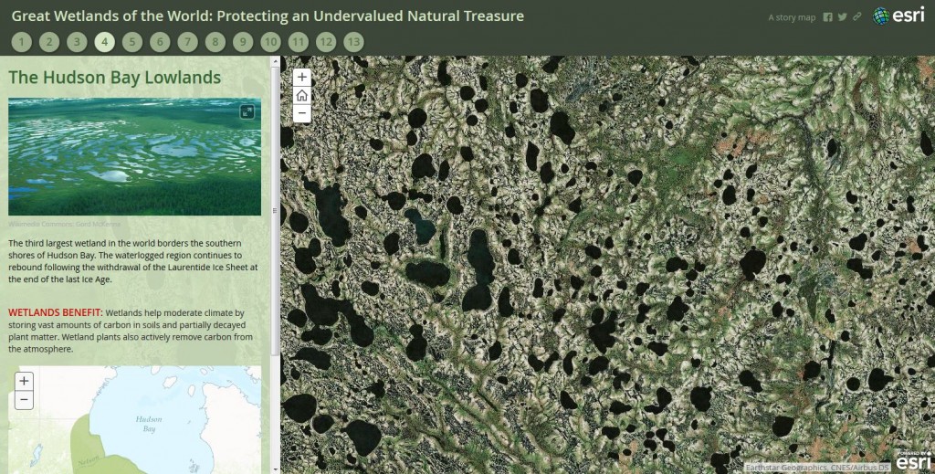
Great Wetlands of the World: Protecting an Undervalued Natural Treasure
Wetlands, perhaps nature’s least appreciated landscapes, are vital to the health of ecosystems, maintenance of water quality, and moderation of climate change. In this interactive map, you can explore the worlds largest wetland areas and understand the benefits of protecting the world’s waterlogged lands.
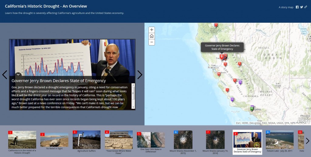
California’s Historic Drought
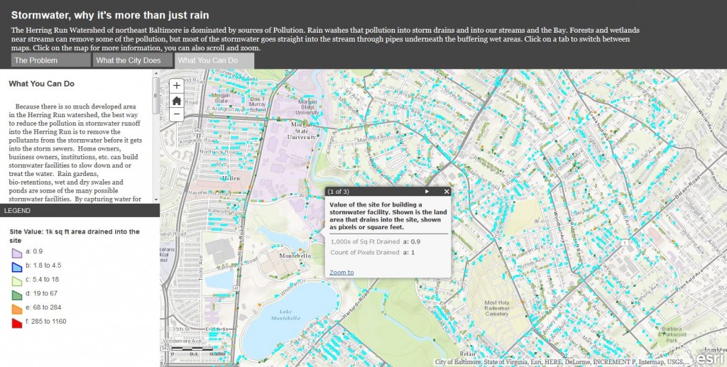
Stormwater: Why It’s More Than Just Rain
The Herring Run Watershed of northeast Baltimore is dominated by sources of Pollution. Rain washes that pollution into storm drains and into our streams and the Bay. Forests and wetlands near streams can remove some of the pollution, but most of the stormwater goes straight into the stream through pipes underneath the buffering wet areas.
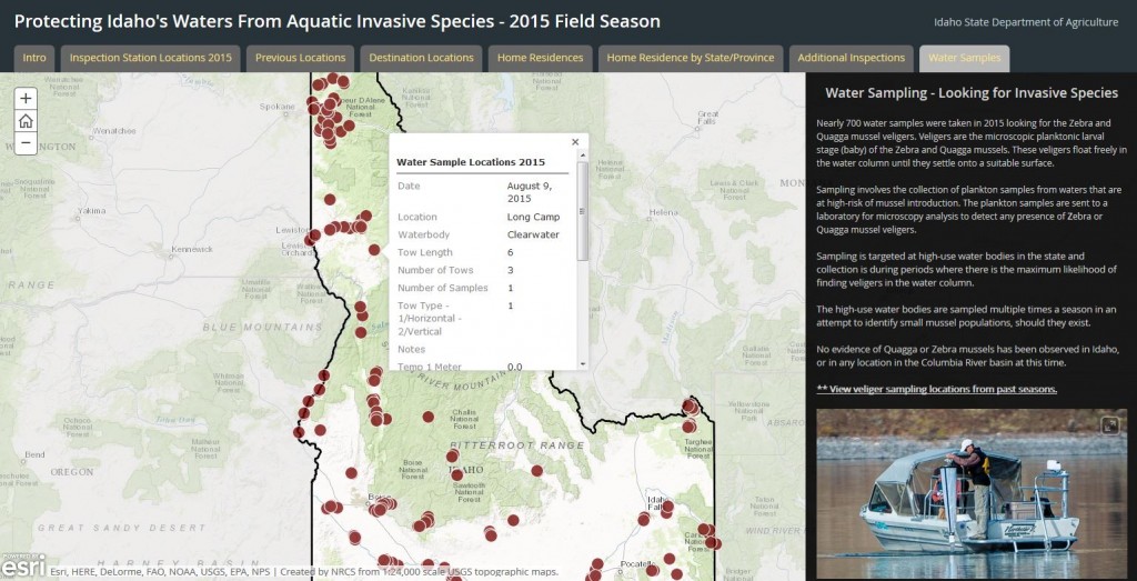
Protecting Waters From Aquatic Invasive Species
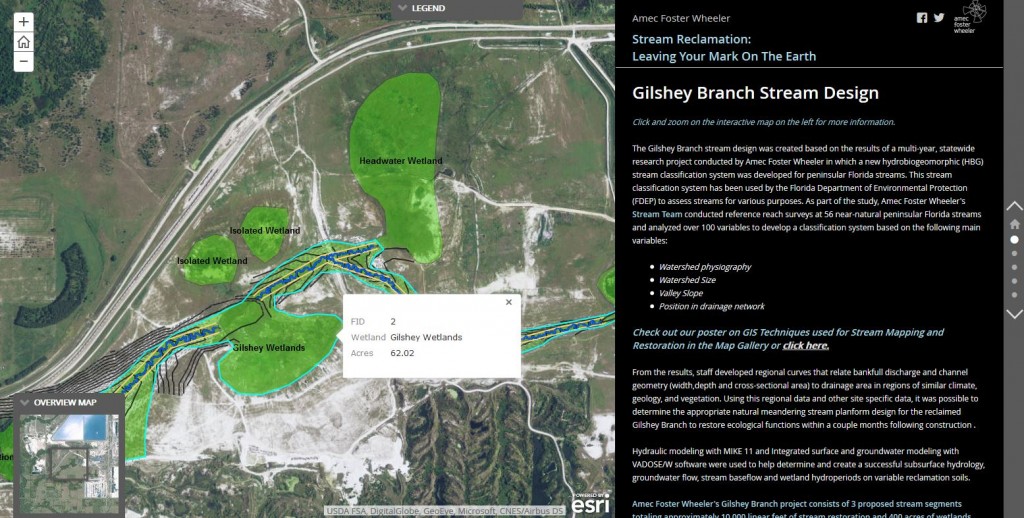
Stream Reclamation: Leaving Your Mark On The Earth
In the Florida phosphate mining industry, reclamation of stream channels is rigorously regulated at the State and local level with requirements to maintain or improve the biological functions of systems affected by surface mining operations. This Story Map takes you through the planning , design, and construction phases of stream reclamation.
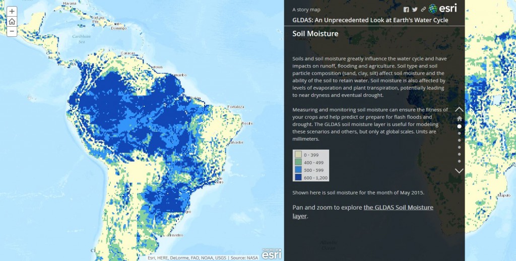
GLDAS: An Unprecedented Look at Earth’s Water Cycle
One of many data sources available in the Living Atlas of the World is Global Land Data Assimilation System (GLDAS) data. The goal of GLDAS is to ingest satellite- and ground-based observational data to create information products that help in weather and climate prediction, water resources applications, and water cycle investigations.
—–
Learn more about how maps help us manage our most precious resource.
