Updated January 6, 2017
Science at Esri continues to be an exciting initiative where we are concerned with supporting both basic and applied science, while also recognizing that there are many major themes of compelling interest to society that will drive scientific research for the next two decades. Thus we view science as helping us to understand not only how the Earth works, but also how the Earth should look (e.g., by way of geodesign), and how we should look at the Earth (i.e., by way of Earth observation in varying forms and the accompanying data science issues of analysis, modeling, developing and documenting useful datasets for science, interoperating between these datasets and between various approaches). In addition to supporting the science community, we seek to do good science at Esri ourselves, as it underpins much of what we do as an organization. This is helping us to evolve ArcGIS into a comprehensive geospatial platform for science; a platform that supports research project management and collaboration, spatial analysis, visualization, open data, and communication of science, all at multiple scales (i.e., from individual researcher to lab workgroup, to multi-department, multi-university, university-to-agency collaboration, to citizen engagement).
You can always track the totality of the Esri science initiative at esriurl.com/scicomm,Hot! but in this post I’ll share some highlights from 2014, and as we near the end of 2015’s first quarter, talk about the immediate road ahead.
Highlights from 2014
- Climate Data for Climate Resilience: Esri’s support of the The White House Climate Data Initiative and related resources + the Climate Resilience App Challenge + the Global Disaster Resilience App Challenge
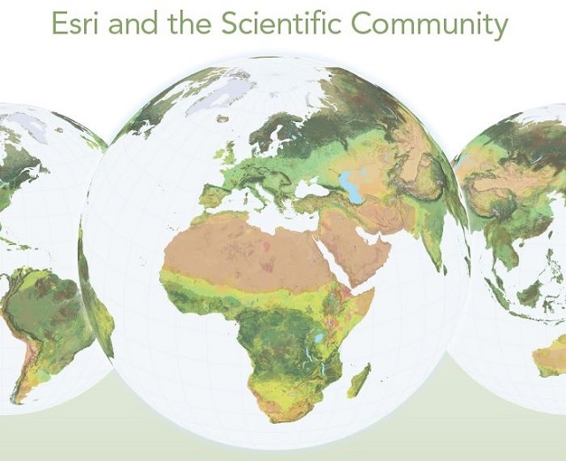
- Release of The First Ecological Land Units Map of the World
- Integration of SciPy into ArcGIS. See also the video Python: Working with Scientific Data.
- Increased use of story maps for science communication and spatial analysis, particularly with the release of the Map Journal app
- New partnerships on a range of projects, for example with
- the Southern California Coastal Water Research Project (SCCWRP)
- the National Ecological Observatory Network (NEON)
- and into 2015 with the Global Lake Ecological Observatory Network (GLEON)
And Speaking of 2015 into 2016…
- Three new science books from Esri Press: Mapping and Modeling Weather and Climate with GIS, already out, features leading climatologists, meteorologists, and other experts sharing approaches to advance atmospheric and ocean science through GIS. Ocean Solutions, Earth Solutions, due out in the summer, is an externally peer-reviewed research monograph based on papers presented at the inaugural Esri Ocean GIS Forum. It is about use-inspired science and realistic solutions for mapping, monitoring and protecting the ocean, hence the entire Earth. It is the first Esri Press book to employ Digital Object Identifiers (DOIs) for citation of both the book and its supplementary datasets (further reading on citations). In addition, GIS Research Methods: Incorporating Spatial Perspectives shows researchers how to incorporate spatial thinking and GIS technology into research design and analysis. It should also be incredibly useful in the classroom.
- Citizen science taking more center stage, including Esri participation at the inaugural Citizen Science Association Conference, a range of apps to support citizen science projects, and exciting implementations, including at the White House Science Fair. Apps include Collector for ArcGIS, Geoform Web App Template, Survey123, Crowdsource Reporter for Citizen Science, Water Quality Status, My Hazard, and for your own customized apps from scratch, Web App Builder for ArcGIS. The Story Map Crowdsource Builder for citizen science is due for release in December 2015. See also this great overview of the latest Citizen Science Resources from Esri and partners, as well as the Federal Crowdsourcing and Citizen Science Toolkit
- Continued progress with SciPy and multidimensional scientific datasets including the new Scientific Data Workflows package and the Dimension Explorer.
- New Python Raster Functions, a curated set of lightweight but powerful tools for on-the-fly image processing and raster analysis in ArcGIS. Available from Esri’s open-source community on GitHub.
- Improvements to both the Ecological Land Units map, as we are currently seeking improved and higher-resolution land cover layers, and to our Global Population Map. See info on Esri’s new World Population Estimate layer.
- To complement the Ecological Land Units, we have now turned to Ecological Marine Units (EMUs), and are building a first ever, robust, standardized, data-derived map of global marine ecosystems. It has been commissioned as an official task for the second decade (2016-2025) of the Group on Earth Observations (GEO), as part of the GEO Global Ecosystems (GECO) initiative. An initial advisory group includes scientists from the USGS, Duke University, GRID-Arendal, the Marine Conservation Institute, NatureServe, and NOAA. The environmental stratification approach will involve creating an empty, volumetric column-based mesh as a global, spatial reference standard and analytical framework, populating the spatial framework with relevant marine physical environment data including water column variables and seafloor geomorphological features, and clustering the abiotic data into ecologically meaningful, 3D regions represented as volumetric polygons. The EMUs will subsequently be analyzed against species distribution data to assess strength of relationship between distinct abiotic environments and species biogeography. Initial results were presented at the Global Marine Protected Areas Summit and the Esri Ocean GIS Forum, both in November. See video 1 and video 2.
- Closer integration with R: See this blog post for information on an open source bridge library on GitHub that will facilitate the passing of data between ArcGIS and R, with an aim toward building a community of people who develop R-based geoprocessing tools that are shared freely and openly, along with sample data. Please see the announcement video from the 2015 UC. See also this comprehensive video on integrating open source statistical packages with ArcGIS. In addition, see Python: Working with Scientific Data.
- The open source Esri Geoportal Server continues to be a popular and valuable contribution. The latest version, 1.2.6, includes increased support for the Project Open Data catalog format, various search and publication enhancements, and further integration options with ArcGIS Online/Portal for ArcGIS. You can access the release at github.com/Esri/geoportal-server/wiki.
- A new site license (also known as the science kit) for standalone research organizations in the US.
- Many are still unaware of our Visiting Faculty/Sabbatical Program. If considering an extensive time in residence at Esri headquarters, please see these guidelines.
