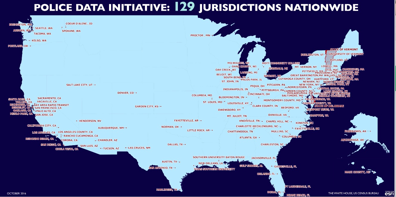
The tremendous support for open data demonstrated by this President has brought innovation and engagement to government and has been so impactful on citizen engagement. Esri, the global smart-mapping leader, has been in lock-step with the Administration on all of their Open Data initiatives. The ease of use of GIS technology has enabled our users to harness the power of open data in such creative ways. From the City of Fayetteville, North Carolina whose police department opened more than a 100 data sets to their community as a result of the Police Data Initiative, to DHS announcing HIFLD Open, which provided public access to over 250 datsets to help better prepare for upcoming disasters, to NOAA publishing their National Water Model to answer a call put forth by the White House Water Summit, we are blown away each and every day when we see what our users in the GIS community are able to do with this data.
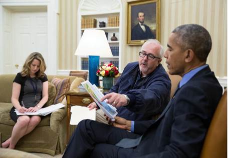
FEMA and POTUS with HIFLD Mobile Home Park Data on the Esri Map
Photo credit: Pete Souza, White House Photographer
The support of the White House has been influential at the state and local level as well, with communities across the nation seeing the value of opening their data sets for community engagement, education, and activism. The examples are powerful – counties in Florida sharing data on mosquitos to track Zika; disaster recovery workers in Louisiana providing inundation information to flood victims; the examples are inspirational. And this open data movement is only at the onset of its journey. My colleagues at Esri and I look forward to working with the Center for Open Data Enterprise and the next administration to continue this mission of opening data in a way that is actionable by every American.
insider
