Creating and Using Authoritative Geographic Data
ArcGIS Online is rapidly emerging as the platform of choice for the creation and dissemination of authoritative geographic data content. This post explains how this unique data ecosystem works, how to access that data, and how to contribute your own piece to the puzzle.
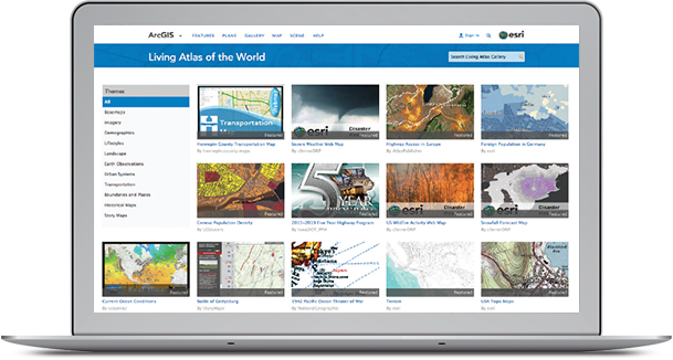
The Living Atlas
The Living Atlas of the World is a treasure trove of information, a dynamic collection of thousands of maps, data, imagery, tools, and apps produced by ArcGIS users worldwide (and by Esri and its partners). Think of it as the curated subset of ArcGIS Online as a whole, organized by the ArcGIS community. This deep and definitive catalog of information awaits you. And that’s the big idea of this chapter, that you can combine content from this repository with your own data to create powerful new maps and applications.
Hunting down good data used to involve a lot of work just to get a GIS project started. These days, using ready-made basemaps and authenticated data from ArcGIS Online, GIS analysts are able to spend more time thinking analytically, which really gets to the heart of what makes Web GIS work.
The ArcGIS Data Community
The mission of every GIS organization is to perform specific functions within its jurisdiction. Each of these departments, groups, or agencies is committed to building key authoritative data layers to support its work. This work includes the compilation of foundational data layers as well as standard basemap layers for their geographies and applications.
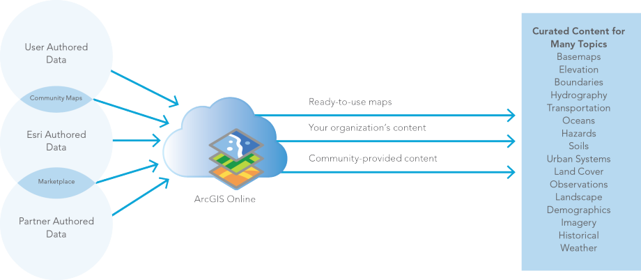
For such organizations—and they are myriad in local, regional, state, and national levels around the globe—this information has served as the basis for all of their comprehensive GIS applications. During the early days of GIS, the compilation of these data layers was one of the primary tasks of each organization. As this data was developed, GIS data developers were able to leverage their information resources in various kinds of GIS applications that extend their own work and help their constituents.
The result is that all these different agencies have created data that is considered, in legal terms, a system of record maintained to support their mandated domain. The pace of migrating this data into Web GIS is increasing, and we are now seeing much content coming online that fills in gaps for the entire world. The result is a continuous coverage of geographic information worldwide—the Web GIS of the world.
ArcGIS Open Data Community
Open Data allows organizations to use the ArcGIS platform to provide the public with open access to their geospatial data. Organizations use ArcGIS Online to create their own website and specify Open Data groups to share specific items. The general public can use Open Data sites to search by topic or location, download data in multiple formats, and view data on an interactive map and in a table. Here are some examples.
ArcGIS Open Data community provides direct access to thousands of open government datasets. Citizens can search, download, filter, and visualize this data through their web browser or mobile device. Let’s take a look at three examples.
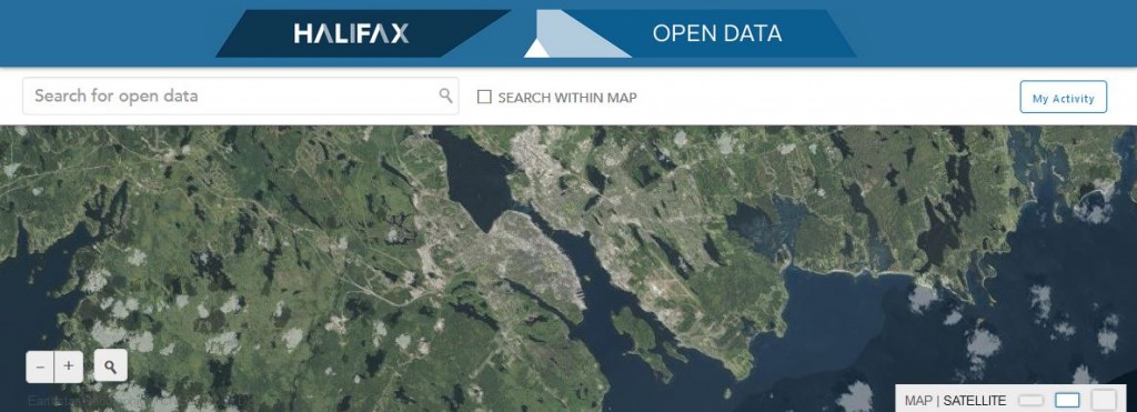
City of Halifax, Nova Scotia
As part of Halifax’s commitment to improving citizen engagement and enhancing transparency and accountability to its residents, the municipality provides public access to its datasets. The Halifax Open Data Catalogue is now a permanent service provided for citizens and businesses alike.
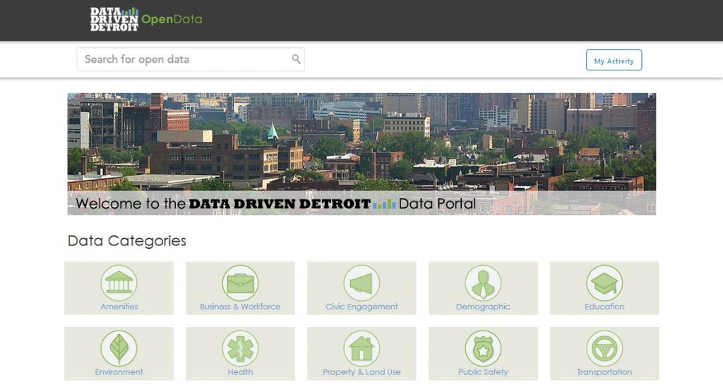
Data Driven Detroit (D3)
D3 believes that direct and practical use of data by grassroots leaders and public officials promotes thoughtful community building and effective policymaking. As a “one-stop-shop” for data about the city and metro area, D3 provides unprecedented opportunities for collaboration and capacity building in Southeast Michigan.
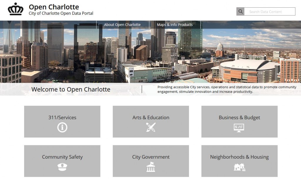
Open Charlotte
Charlotte, North Carolina’s open data site offers all of the city’s data, providing citizens with a higher degree of visibility into public services, which can foster trust in local government.
A World of Data
A huge variety of definitive, authoritative data is readily available today. This Living Atlas of the World is a highly active network of contributors and curators whose output is accessed billions of times monthly. ArcGIS Online is a massive global network for creating and sharing authoritative geographic information resources. And Open Data sites allow organizations to provide the public with open access to their geospatial data. Great maps need great data, and these data resources open up the world of possibilities for creating and using authoritative geographic data.
—–
This introduction to creating and using great data is excerpted from the new book, The ArcGIS Book: 10 Big Ideas about Applying Geography to Your World. The twin goals of this book are to open your eyes to what is now possible with Web GIS, and then spur you into action by putting the technology and deep data resources in your hands. The book is available through Amazon.com and other booksellers, and is also available at www.TheArcGISBook.com for free.
