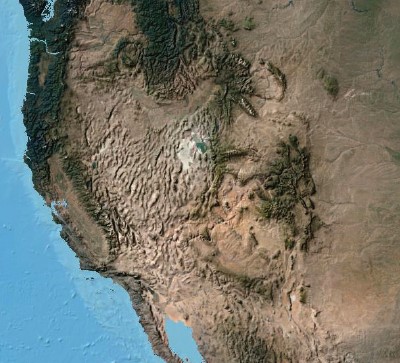
GIS technology is both intuitive and cognitive. It combines powerful visualization and mapping with strong analytic and modeling tools. Remotely sensed earth observation—generally referred to in GIS circles simply as imagery—is the definitive visual reference at the heart of GIS. It provides the key—the geographic Rosetta stone that unlocks the mysteries of how the planet operates and brings it to life. When we see photos of Earth taken from above, we understand immediately what GIS is all about.
The story of imagery as an earth observation tool begins with photography, and in the early part of the twentieth century, photography underwent extraordinary changes and social adoption. Photos not only offered humanity a new, accessible kind of visual representation—they also offered a change in perspective. The use of color photography grew. Motion pictures and television evolved into what we know today. And humans took to the sky flying in airplanes, which, for the first time, enabled us to take pictures of the earth from above. It was a time of transformation in mapping and observation, providing an entirely new way of seeing the world.
World War II: Reconnaissance and intelligence gathering
During World War II, major advances in the use of imagery for intelligence were developed. The Allied Forces began to use offset photographs of the same area of interest, combining them to generate stereo photo pairs for enhancing their intelligence gathering activities. In one of many intelligence exercises called Operation Crossbow, pilots flying in planes—modified so heavily for photo gathering that there was no room for weapons—captured thousands of photographs over enemy-held territory. These resulting collections required interpretation and analysis of hundreds of thousands of stereo-photographic pairs by intelligence analysts.


In the early 1960s, the majority of people would probably have said it was impossible for a human being to walk on the moon. But in July 1969, televised images transmitted to Earth from the moon showed Neil Armstrong and Buzz Aldrin bounding across the lunar surface, proving that moon walking was more than conceptually possible—it was happening right before our eyes. Seeing was believing.


In 1972, the same space technology that was developed to put humans on the moon led to the launch of the first Landsat satellite. The Landsat mission gave us extraordinary new kinds of views of our own planet. This was a breakthrough system and the first civilian-oriented, widely available satellite imagery that not only showed us what was visible on Earth—it also provided a view of invisible information, unlocking access to electromagnetic reflections of our world as well. We could see Earth in a whole new way.
In the run-up to the Apollo moon landings, Apollo 8 was the first mission to put humans into lunar orbit. And on Christmas Eve 1968, coming around from the far side of the moon during their fourth orbit, Apollo 8 commander Frank Borman exclaimed, “Oh my God, look at that picture over there! Here’s the Earth coming up! Wow, that is pretty!” Fellow astronaut Bill Anders grabbed his Hasselblad camera and shot this now-famous image of Earth rising above the moon.

—–
This post is excerpted from The ArcGIS Imagery Book: New View, New Vision. Imagery is suddenly a big deal, and those who are adept at finding it, analyzing it, and understanding what it actually means are going to be in demand in the years ahead. The purpose of this book is to help everyone from GIS professionals to app developers, and web designers to virtually anyone how to become smarter, more skillful, and more powerful appliers of image data. The book is available through Amazon.com and other booksellers, and is also available at http://www.TheArcGISImageryBook.com for free.