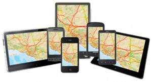
Many Workflows are Best Served with Targeted Apps
I get this said to me all the time: “We have this big GIS in the office. We use it all the time to make maps and export data into our outage systems or gas leak management system. It’s great! Can we put it into the field for the mobile workers?”
People want mobile GIS. But I respond like a psychiatrist when they ask for it: Instead of giving them a straight answer, I ask them a question: “To do what?”
Their answers span a big gamut. They range from, “It’s easier to get maps on a mobile device than to carry around paper maps,” to…
“The mobile GIS would be more current, so I’d get better data in the field,” to…
“Well, then I could access the entire electric or gas system with me!”
Again I ask the simple question: “To do what?”
In frustration, the common answer is, “Field work.”
Ugh! The more accurate answer is, “With mobile GIS, I could do all kinds of stuff: transformer inspections, pole inspections, damage assessment, customer surveys, staking, manhole cleaning, battery maintenance, meter testing, painting…” The list goes on! There may be hundreds of different workflows.
Mobile GIS Enables Countless Workflows
 The issue is that each one of these workflows requires a very limited set of information. So why load up field workers’ mobile devices with everything they could ever want–but really don’t need–on their ruggedized laptops? It’s a classic case of one-size-doesn’t-fit-all.
Instead, there should be no such a thing as mobile GIS at all. There should be an app for each workflow. We should be asking about a damage-collection app, a streetlight-replacement app, or a pole-inspection app. If my job is to do lamp replacements today for the city of Somerville, Massachusetts, then my app should show me only streetlights that need lamp replacements in Somerville. I don’t need or want data on line switches, gas leaks, or dirty manholes unless the workflow requires it–period.
Since the GIS is an information system, it has the ability to serve or publish just–and only just–the information field workers need to do their job. So the next time someone asks what your mobile GIS strategy is, answer this way: “I give the field worker just the right information for just the right place at just the right time on just the right device to do the work at hand.”
Mobile GIS? Never heard of it.
insider
