Five Ways to Extend the Value of GIS Across Organizations, Communities, and the World
Big things are happening in the world of maps and mapmaking. A convergence of technology and social trends has pushed geographic information systems (GIS) onto the Internet in a significant way, and the vision of a global Web GIS has been realized.
Web GIS gives GIS managers a new set of tools to help extend the value of geographic information well beyond traditional boundaries. Here are five tools you can start using today to spread the power of GIS throughout your organization, across your community, and to the entire world on the web.
1. Tell Your Story Using a Map
Storytelling carries the potential to affect change, influence opinion, create awareness, raise the alarm, and get out the news. Using a map to help tell your story gives you the power to inform, engage, and inspire people in your organization and across the globe.

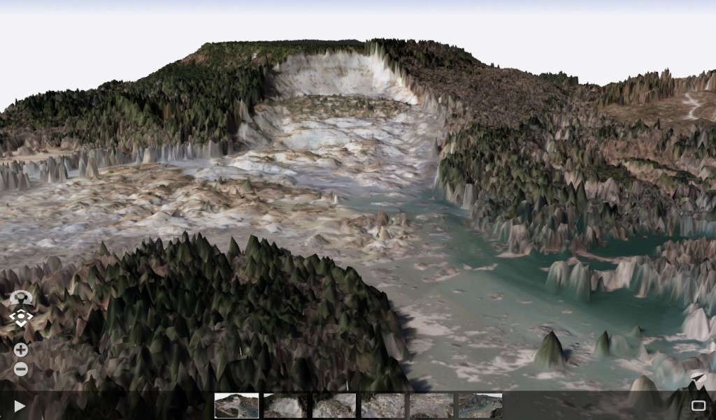
2. Mapping the Third Dimension
3D is how we see the world. With 3D Web GIS, people across your organization can see your data in its true perspective in remarkable photorealistic detail.
3. The Power of Apps
With billions of users worldwide, apps are a technology trend that has captured the world’s attention. Online maps provide the information that powers the use of GIS. And every map has an interface — a user experience for putting that map to use. These experiences are apps, and they bring GIS to life for users.
Apps are designed to guide users through specific tasks, to show just the data that is required for that task, and to allow ease of communication of your message. Today, they are the perfect vehicle for putting the power of GIS in the hands of non-GIS users. Learn more.
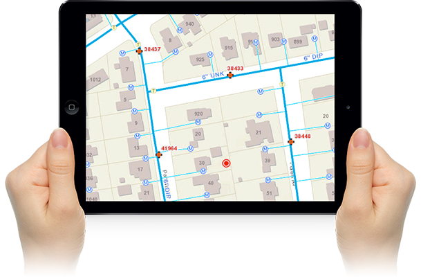
4. Your GIS is Mobile
GIS on mobile devices has changed how we interact with geography. With a smartphone you can access maps and data for anywhere on any theme, and because the phone can record where you are, you’re now in position to leverage your full GIS capabilities in the field.

With mobile GIS, organizations can put the full power of GIS in the hands of their field workforce. Cities can notify their citizens about road and bridge closures. In turn, citizens can report on problems and issues and provide geotagged comments and feedback about proposals and plans. Learn more.
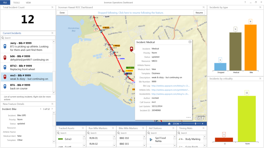
5. Real-Time Dashboards
Real-time dashboards provide a way to absorb and make meaning from the torrent of real-time information that is used to drive so many decisions. Dashboards are your secret weapon for visualizing and putting meaning behind all of these real-time feeds.
—–

This story is excerpted from my new book, The ArcGIS Book: 10 Big Ideas about Applying Geography to Your World. The twin goals of this book are to open your eyes to what is now possible with Web GIS, and then spur you into action by putting the technology and deep data resources in your hands . The book is available through Amazon.com and other booksellers, and also available at www.TheArcGISBook.com for free.
