It’s a decision many students are faced with as they prepare themselves for the working world: Do you pursue a career in technology (and get paid accordingly)? Or do you travel a more altruistic path, helping people and the environment?
It’s a tough decision. But it doesn’t necessarily have to be that way.
Northern Illinois University recently published a story titled Under-the-radar careers that lists “six careers that you might not be familiar with—but you might want to consider.”
So what’s the #1 “under-the-radar” career?
GIS Analyst/Technician.
What is GIS?
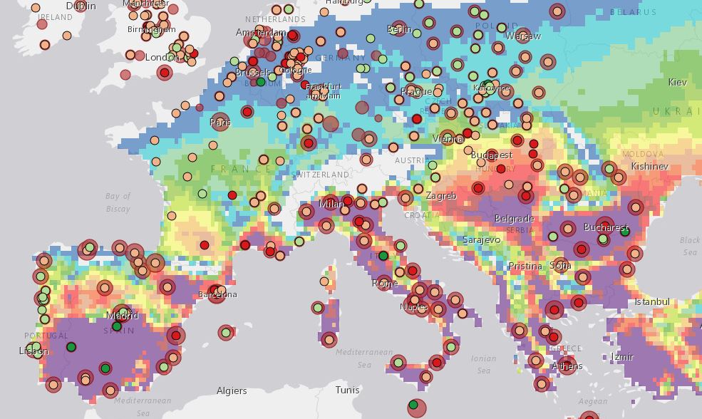
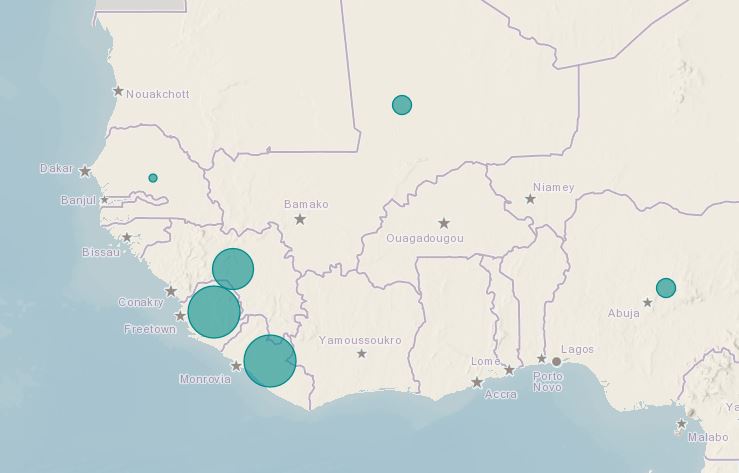
Simple stated, a geographic information system (GIS) is a technology platform that helps us visualize, question, analyze, and interpret data to understand relationships, patterns, and trends.

How is GIS used?
Because geography is such an important factor in almost everything we do, GIS can be used in a variety of ways in every organization and every discipline. For example, public safety personnel use GIS to support emergency response and planning. Health organizations can use GIS to leverage limited resources and positively impact individuals, families, and society. And natural resource professionals rely on GIS to help make critical decisions as they manage the earth’s precious resources.
Why is GIS a hot new career?
Previously the domain of the professional mapping community, GIS has now become so ubiquitous and easy to use that the only prerequisite is a desire to better understand online mapping and a roll-up-your-sleeves attitude.
How can I get started?
 To get started, check out The ArcGIS Book: 10 Big Ideas about Applying Geography to Your World.
ArcGIS is more than just mapping software running online. It’s actually a complete system for discovering, consuming, creating, and sharing geographic data, maps, and apps designed to fulfill particular objectives.
The twin goals of this book are to open your eyes to what is now possible with Web GIS, and then spur you into action by putting the technology and deep data resources in your hands via the Quickstarts and Learn ArcGIS lessons that are included in each chapter. By the end, if you complete all of the exercises, you’ll be able to say you published web maps, used story maps, built a 3D cityscape of Venice, Italy, configured a custom web app, performed sophisticated spatial analysis, and much more.
The book is available through Amazon.com and other booksellers, and also at www.TheArcGISBook.com for free!
insider
