The 2014 Winter Olympics are upon us, and there will be lots of stories to tell both during and after the games. Several ArcGIS story maps help tell different kinds of stories that complement and provide context for what we’ll be witnessing over the next couple of weeks.
Events and Venues at the 2013 Winter Olympics
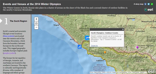
The Winter Games in Sochi, Russia, take place in two locations; a cluster of arenas located along the Black Sea, and another cluster of facilities located nearby in the Caucasus Mountains. This story map shows their locations, and delivers an overview of event venues.
This story map uses the ArcGIS for Storytelling Side Accordion app.
The Venues at Sochi
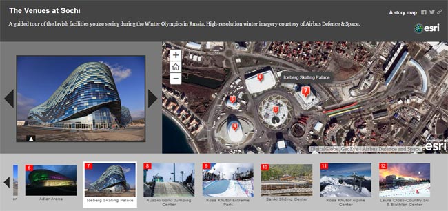
The venues are spectacular, and you can view them in detail using this virtual map tour guide. From the dramatic Iceberg Skating Palace to the Rosa Khutor Extreme Park, the tour features venue photos plus high-resolution imagery to place them in context.
This story map uses the ArcGIS for Storytelling Map Tour app.
Coastal Venues – Then and Now
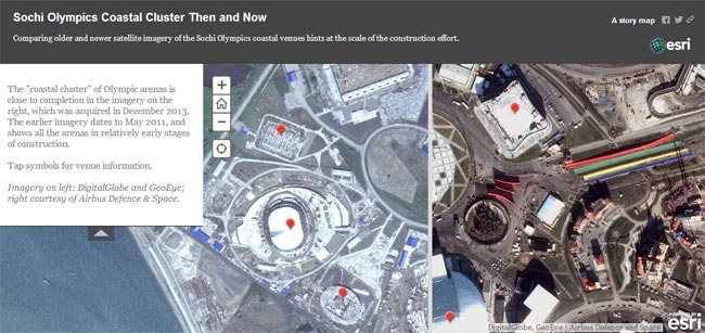
Preparing for an Olympic Games is a huge undertaking, typically involving major construction projects needed to support venues, housing, and logistics. This story map compares imagery from May 2011 (from Digital Globe and GeoEye) with imagery from December 2013 (courtesy of Airbus Defence & Space). The massive construction effort is evident.
This story map uses the ArcGIS for Storytelling Swipe app.
Learn more about how you can tell your own stories using these apps and more at the ArcGIS for Storytelling website.
