If you were unable to attend the 2015 User Conference last week in San Diego, here is a summary of my plenary remarks about recent and coming improvements to the ArcGIS product.
—–
ArcGIS is made up of a number of components: a server component, a desktop component, an apps component, and now a content component, an online component, and a portal component. That’s a lot of components, but in fact it’s all one integrated system.
Desktop
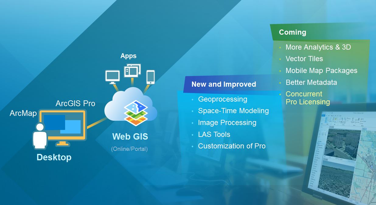
Desktop is the component of this integrated system that most of you work with and are familiar with. It supports mapping, visualization, and analytics, and it now embodies two main applications: ArcMap and ArcGIS Pro. These two applications run side by side.
We’ve been putting a lot of resources into ArcGIS Pro, the new 64-bit environment for visualization, over the last several years. We continue to improve and support ArcMap, and will continue to do so for long into the future. And over time, the power of ArcGIS Pro will become more attractive.
Apps
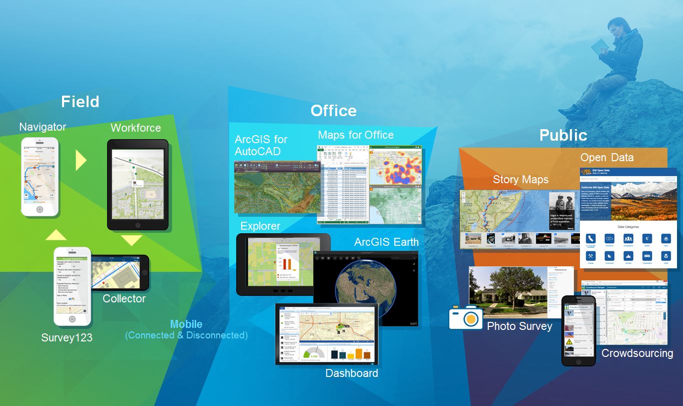
One of the things that’s making ArcGIS come alive is apps. Apps are opening up the ArcGIS platform, making it available to everybody in your organization as well as to the public. We have three main areas that we’re working on: field apps, office apps, and apps for citizen or public engagement.
In the area of field apps, Collector for ArcGIS is great, but where do you go? There’s a navigator app. And then what do you do when you get there? There’s a workforce app. So all of these apps work hand-in-hand to support field workers.
App Builders
If you want to build your own app, we have three mechanisms to help you do that.
- Web app templates are HTML5 and are easily configurable.
- There is a new Web AppBuilder that, since its release in January, has already resulted in tens of thousands of apps being built and deployed.
- This fall, we’re introducing a new builder called the AppStudio for building native apps. AppStudio is a native app builder that allows you to build the app and automatically deploy it on Android, iPhone, and Windows.. It lets you design it once and then implement it anywhere.
Developer Tools
For developers, we’ve “opened up the hood” of ArcGIS, exposing not just the apps and the templates that can be configured, but also runtimes. We have a rich library of open APIs, runtimes, content, and services that are integrated in all the different languages. This enables you to build our own applications for the enterprise and beyond.
Server
Last year, ArcGIS for Server was enriched with Portal for ArcGIS. This brought web mapping and the whole geoinformation model into the enterprise so you can have your own Web GIS inside of the organization, with the apps that I’ve mentioned and with total integration with ArcGIS Online.
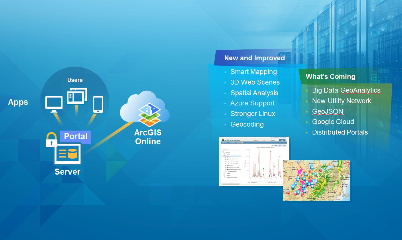
Online
ArcGIS Online is the complete hosted GIS in the cloud, supporting mapping and apps. Additions to this component have included smart mapping, formal metadata, better administration, and high-performance geocoding. What’s coming is improved search, so we can find each other’s work more effectively, advanced analytics, better support for OGC standards, and Bing map support.
Solution Templates
On top of these main pillars are what we call solution templates. There are now several hundred of these that you can use to make GIS come alive at the application level in your organizations. They’re configurable, built on best practices, free, and open sourced, and we also support them as part of the ArcGIS product.

Complementing these templates is a family of solution products. These are commercial products for supporting high-end map production in organizations like cartographic agencies around the world; or decision-support environments for uses such as real estate and business location, business analysis, and community analysis; or also the new world of geodesign to create and quickly evaluate the consequences of a design. Additional solutions products support specialized areas such as highways, airports, and advanced field data collection.
Advancing the Platform
We are incrementally releasing the ArcGIS product, and we’ll continue that this winter with the release of ArcGIS 10.4. The online environment is in a state of continuous development, and a number of new themes will be realized this winter.
