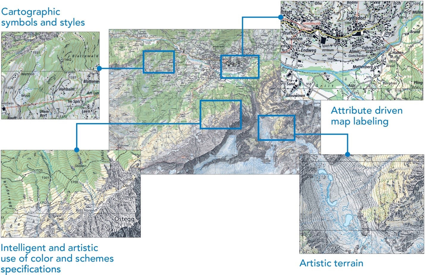
ArcGIS for Cartographers
The ArcGIS platform provides capabilities that enable everyone to make truly excellent maps, including support for highly sophisticated mapping workflows employed by professional cartographers. Desktop includes tools for rich data compilation, for importing data from a multitude of publication formats, and for integrating this data with your own data to create consistent, accurate, and beautiful cartographic products for both printed maps and online maps.
Get Inspired
What makes a good map? How can you engage people with a map? How do you make a map that offers unexpected insights and captivating appeal? We have been working on something at Esri that we hope will answer these questions: Maps We Love.
Maps We Love is an ongoing project where you will see the best of what’s possible with ArcGIS. This is where you come for the inspiration, ideas, and information you need to turn your data into brilliant maps. We give you a behind-the-scenes look at important steps, plus resources (lots of links) so you can dig deeper into these topics. Maps We Love is designed to demystify mapping, to give you the confidence and assurance that you can make maps.
Get inspired and learn current mapping techniques using curated selections of exemplary cartography at the Maps We Love website.
—–
This post is excerpted from The ArcGIS Book: 10 Big Ideas about Applying Geography to Your World. The twin goals of this book are to open your eyes to what is now possible with Web GIS, and then spur you into action by putting the technology and deep data resources in your hands. The book is available through Amazon.com and other booksellers, and is also available at www.TheArcGISBook.com for free.
