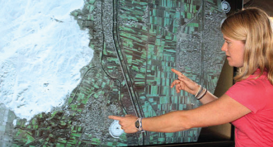
There may be hundreds of thousands, if not millions, of undiscovered ancient sites across the globe, and Sarah Parcak wants to locate them. As a satellite archaeologist, she analyzes infrared imagery collected from far above the earth’s surface and identify subtle changes that signal a man-made presence hidden from view. Doing so, she and her colleagues aim to make invisible history visible once again—and to offer a new understanding of the past.
In partnership with her husband, Greg Mumford, they have directed survey and excavation projects invarious places in Egypt. She’s used several types of satellite imagery to look for water sources andarchaeological sites.
Her latest work focuses on the looting of ancient sites. By satellite-mapping Egypt and comparing sites over time, the team noted a 1,000 percent increase in looting since 2009 at major ancient sites. It’s likely that millions of dollars’ worth of ancient artifacts are stolen each year. The hope is that, through mapping, unknown sites can be protected to preserve our rich, vibrant history.

—–
This post is excerpted from The ArcGIS Imagery Book: New View, New Vision. Imagery is suddenly a big deal, and those who are adept at finding it, analyzing it, and understanding what it actually means are going to be in demand in the years ahead. The purpose of this book is to help everyone from GIS professionals to app developers, and web designers to virtually anyone how to become smarter, more skillful, and more powerful appliers of image data. The book is available through Amazon.com and other booksellers, and is also available at http://www.TheArcGISImageryBook.com for free.