I can remember turning eighteen and being so anxious to vote for the first time in the presidential election. It never occurred to me that others did not feel the same way.
It wasn’t until I was an employee of a southern California city, heading up a GIS team, that the notion that people did not vote came to light. In a meeting with the City Clerk, she explained that many times, people simply did not know where to go vote. She told me that on election night, city staff would field hundreds of phone calls asking where to vote. I later learned people even contacted the local library to find an answer to this question.
As a city employee, I felt the need to do something about this. My team and I developed a polling place look-up tool and proudly placed it in the hands of the city clerk, elections volunteers, and library staff. The tool allowed themselves and the public to search for polling stations on maps, on a computer. Using this tool, they were able to handle hundreds of calls at lightening speed, getting voters to their polling place.
This all took place a while ago. But even with the advancements in web applications and smart devices, the problem of not knowing where to go vote still persists nationwide.
What’s Your Excuse?
It seems there are a lot of excuses people give for not voting.
- I don’t know where to vote.
- The process is not convenient.
- I’m too busy.
- I don’t think my vote counts.
- I don’t understand how the issues affect me personally.
Esri has taken steps to solve these problems. Working side by side with our peers in government, we have developed a series of apps that can be used by any municipality, county, state, or private group wishing to help people engage in one of the greatest civic opportunities of our time.
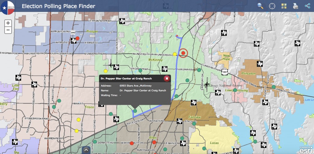
Tackling the first group of reasons not to vote (don’t know where to vote, it isn’t convenient, and people are just too busy) was fairly straight forward. A series of free elections apps were developed under the ArcGIS for State and Local Government solutions. These apps include polling place locator, polling place wait times, and an early voting app.

With any application the real question is, “will anyone use it?” Collin County, Texas staff used these smart elections tools as a warm up with great results:
- They received 174,242 total page views
- 19,020 visits to the Election Polling Places Finder App
- 26,842 routes generated from Mobile App
Not bad for such a focused application!
Vanderburgh County, Indiana developed a similar app consolidating voting locations, resulting in a cost savings of $85,000 per election.
Your Vote Counts
Turning the tide of the disenfranchised voter may be more of a challenge. The approach requires a system of engagement between the voter and data. Simple mapping applications put complex ballot initiatives into context of where the voter works, lives, and plays.
Who would ever think that a real time elections results app could change a citizen’s perception? On the one hand, we watch our favorite programs on election night with a scrolling screen that provides elections results. No context. The map based elections reporting solution shows elections results in real time by precinct. What’s unique with this app is that a voter can see how their precincts voted or did not vote. A bit of a “what the Joneses are doing approach.” People can see where votes are coming in and how they could have made a difference in the outcome precinct by precinct. If only they had voted!

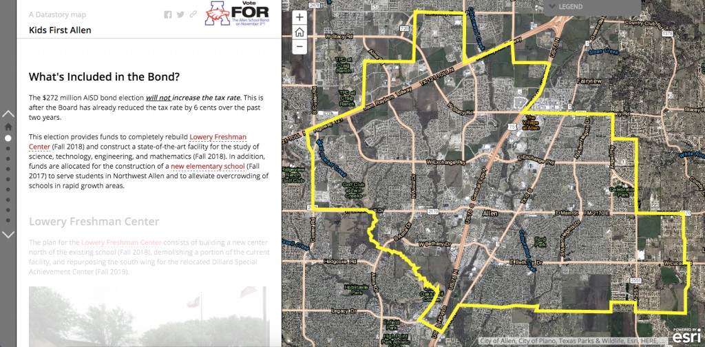
Story maps, a series of free tools that can be used as a voter education vehicle, rounds out the plan to get people to vote. Tailored to answer questions such as ‘why is a ballot, proposition, bond, or any other election item important to me?’ Story maps can move people to vote.

So no more excuses – download, configure, and support the voter.