displaying 261 results
Collaboration with GARE and Five Jurisdictions Produces Mapping Tool for Government

Somerset County in New Jersey has created a GIS-based website that provides details on affordable housing options and more.

ArcGIS products such as ArcGIS Online and ArcGIS Enterprise provide a way to comply with the European Union’s Open Data Directive.

The American Association of Geographers’ Elevate the Discipline program helps geographers connect with the media and key stakeholder groups.

A new accessible color palette for syntax highlighting has been added to the editor in Map Viewer to add people with low vision.
Bridging the gap between physical and human geography will better address climate justice—and improve climate science.

ArcGIS Solutions has been developed to assist communities dealing with homelessness.

To help high schoolers tackle problems ranging from food insecurity to the digital divide, one instructor champions the geographic approach.
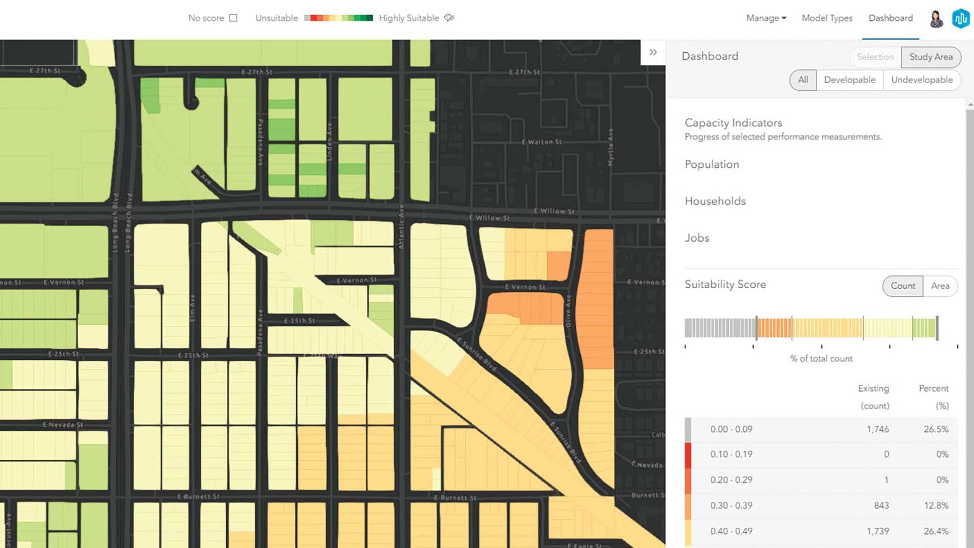
A data-driven approach to planning is key to justifying specific designs and developments for a community.