displaying 1006 results
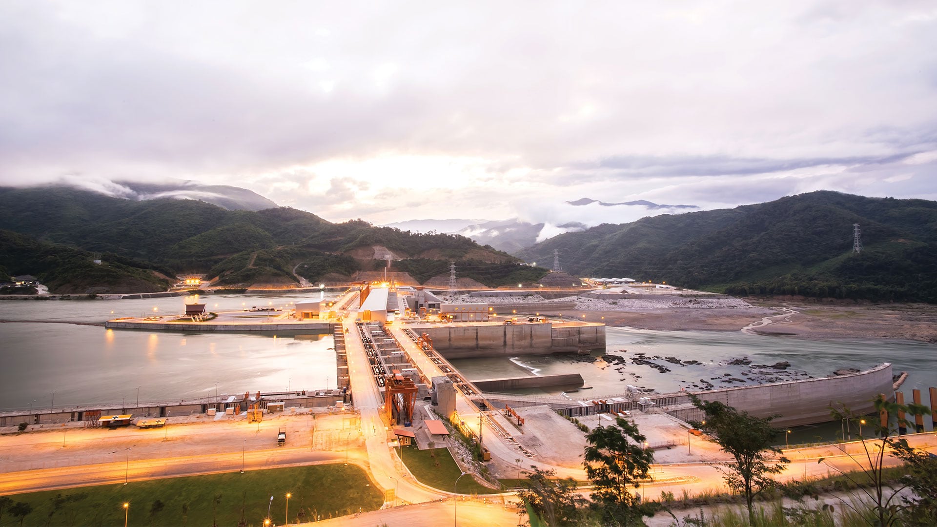
Scientists at the Stimson Center monitor the impact of hydroelectric power projects on the Mekong River in Asia.

ArcGIS Platform provides a new option for developers to access powerful ArcGIS location services and high-quality geospatial content.

Three new books from Esri Press focus heavily on the analytical capabilities of GIS.

The Maryland Department of Information Technology Geographic Information Office deployed a COVID-19 information dashboard.
Nate Ebel was 13-years-old when he gave a presentation at the 2002 Esri User Conference. What he did with GIS from then on impacted him greatly.
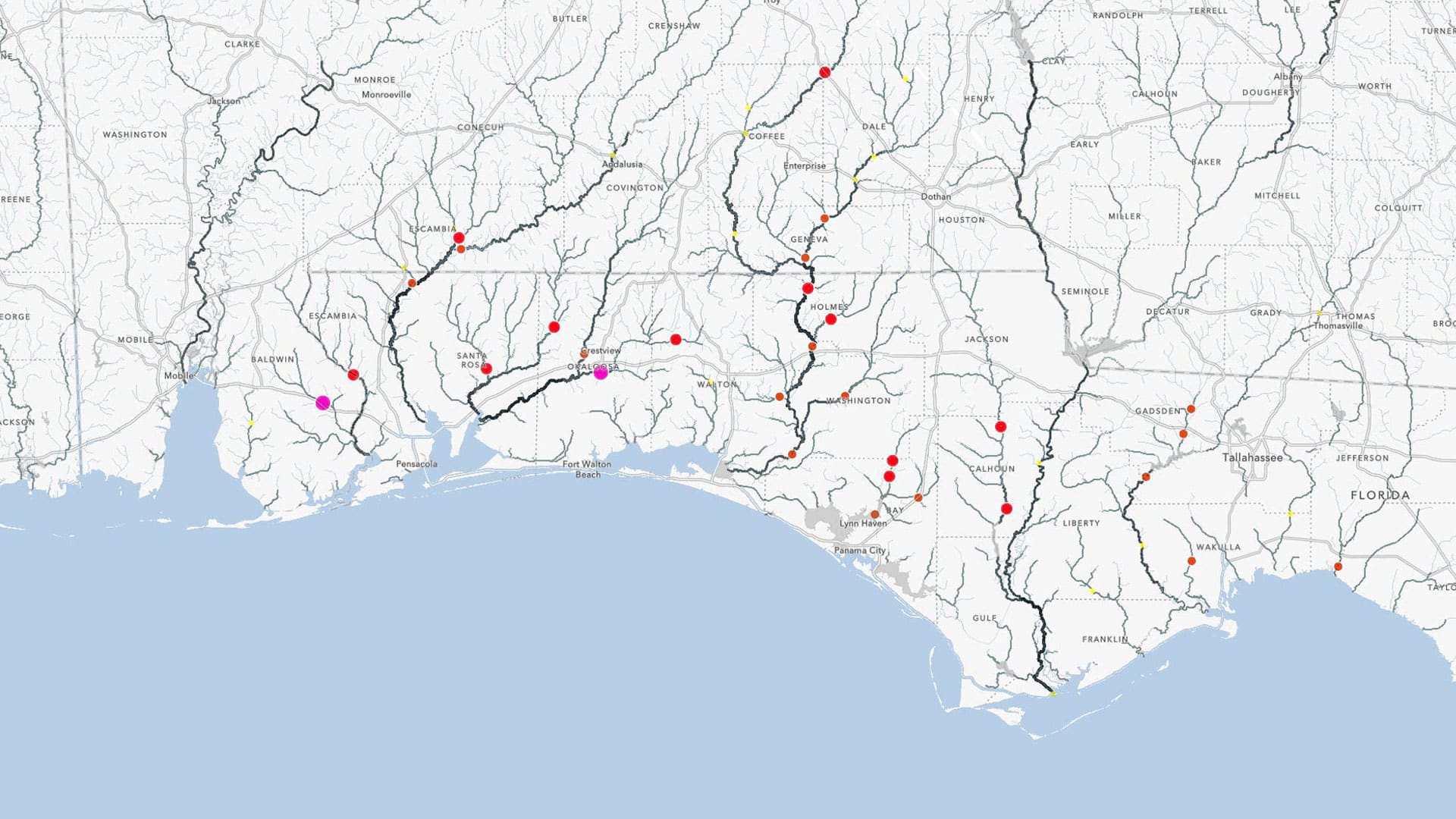
Esri technology evangelist Bern Szukalski uses content from the Living Atlas to show you how you can make your own flood map in a minute.

At the 2020 Esri Partner Conference, Esri recognized 19 partners for their important and innovative contributions to GIS.

The big challenge in the early days of GIS was a lack of digital geographic data. In much of the developing world, this is still the case.

Numerous geodesign projects, including one to make a US Air Force base more climate resilient, were presented at the Geodesign Summit.
With their innovative solutions and comprehensive services, Esri partners help users get the most out of Esri technology.
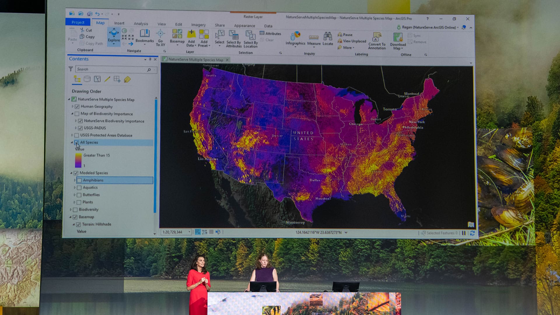
At the 2019 Esri User Conference, a range of users demonstrated how their GIS implementations work as an intelligent nervous system.

Police in Ogden, Utah, used Esri technology to help manage security, traffic, and other issues at a historic railway celebration.