Phuc Minh Quang Tran from Portcoast, an engineering consulting firm, explains how a digital twin helps Vietnam directly access European and North American markets.
If you like this episode, please share it with a colleague.

October 20, 2026
ESRI AND THE SCIENCE OF WHERE PODCAST: PORTCOAST
INTRO:
Welcome to the Esri and the Science of Where podcast.
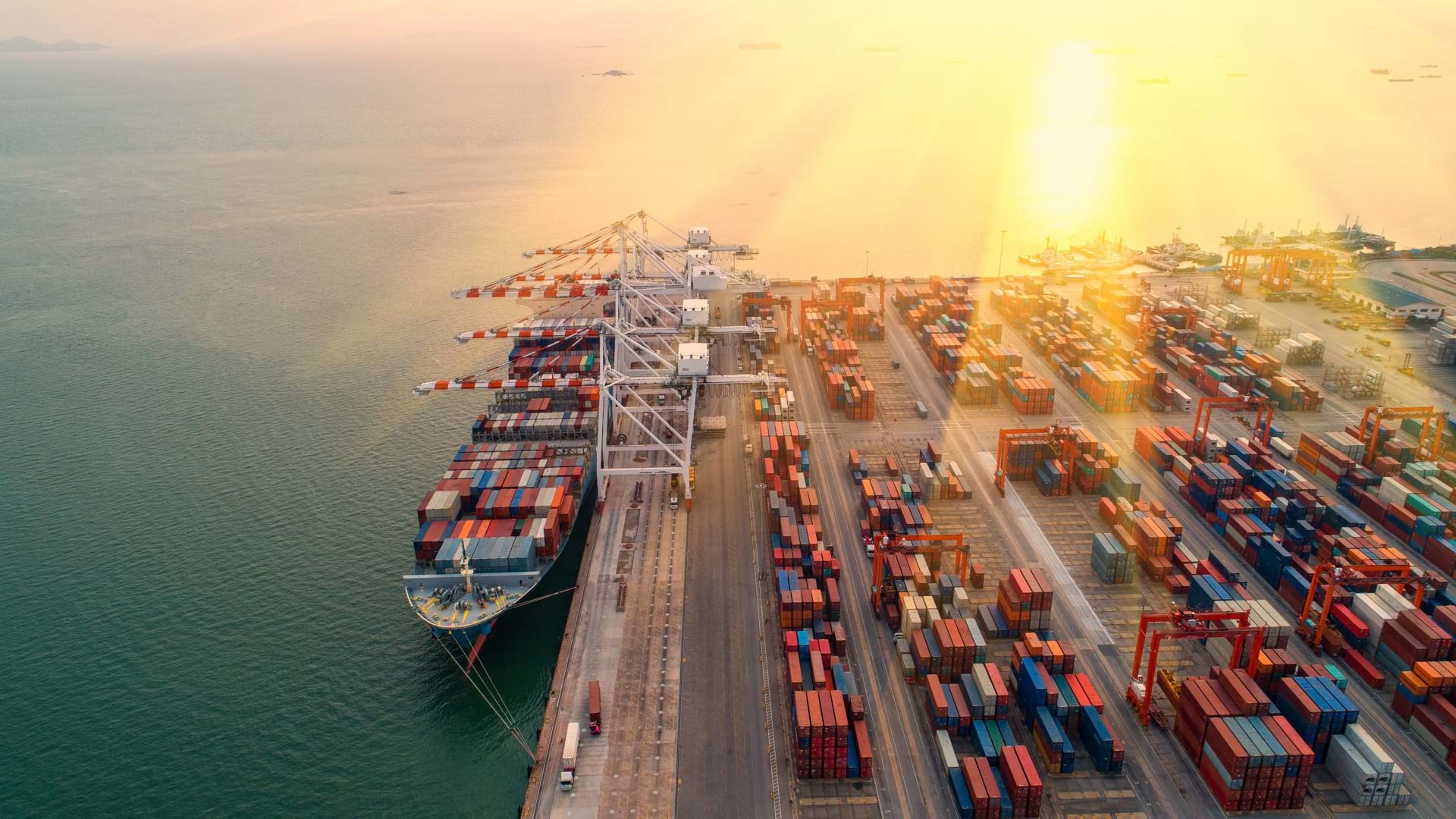
Vietnam’s growing port system is critical to its economy and bringing its goods to global markets. PortCoast, an engineering consulting firm, specializes in modernizing ports. To communicate the complexity of such large-scale operations to stakeholders, who are mostly non-engineers, they created a digital twin. The visual language did the trick.
PHUC MIHN QUANG TRAN:
The stakeholders, the officials, the investors, maybe they don’t have the same technical background. They can’t really interpret the layers and layers of design drawings that we give them.
But if we put that model in the digital twin, if we show them that geographic context, this is the map of the port, this is what the terrain looks like. It’s beautiful. It’s lifelike. How our stakeholders can understand and interact with data is much more human, approachable.
INTRO:
Phuc Mihn Quang Tran describes to Esri’s John Lenahan how a digital twin helps Vietnam directly access European and North American markets.
JOHN LENAHAN:
Welcome to the Esri and the Science of Where podcast.
PHUC MIHN QUANG TRAN:
Hi. Thanks for having me.
JOHN LENAHAN:
PortCoast is a very impressive company. You’ve had hundreds of engineering projects, but I want to talk about the renovation of the Cai Mep–Thi Vai port system and your role in that renovation.
As Vietnam continues to grow as a hub for manufacturing, your government has set aggressive goals to double the country’s cargo capacity by 2030. Can you tell me what this increase in capacity at the port means for Vietnam?
PHUC MIHN QUANG TRAN:
Yeah, of course. Our ports have historically been very significant, very important for Vietnam’s economy because of our location in the world and the fact that so much of our country consists of coastline.
Port capacity is closely linked to Vietnam’s ability to trade and to export its manufactured goods, not just to markets in Asia, but also to the global market as a whole.
Vietnam’s economy has grown rapidly over the past decade, and the government intends to maintain that GDP growth into the future. That creates enormous pressure on our infrastructure, our roads, our bridges, our rail connections, the whole logistical system.
Increasing capacity, I would say, is not just about making one or two port operators more profitable, but rather improving the logistical efficiency of the country as a whole. That will support our manufacturers and our exporters so they can be more competitive and, hopefully, make Vietnam more competitive as a whole in terms of being a regional trade hub, like Singapore, or a production hub, like China.
One of the strategic advantages of the Cai Mep–Thi Vai port region is that it allows for deepwater ports, which can accommodate much larger international container vessels. What this means is Vietnamese cargo can be transferred directly through these ports to markets like Europe or the United States rather than relying more on traditional transshipment hubs such as Singapore.
JOHN LENAHAN:
In order to do that, you need to reimagine and redesign operations across your ports. You turned to a digital twin. Can you tell me more about your work with the port?
PHUC MIHN QUANG TRAN:
As you know, PortCoast is one of the largest and also one of the older engineering consulting firms in Vietnam that specializes in port projects, waterways, coastal infrastructure, and so on.
Over the years, we realized from working on our projects that they were generating enormous amounts of information, survey data, drawings, and now, as the Vietnamese government begins to mandate the use of BIM, BIM models. It’s a massive amount of data, and it all existed in separate silos.
Our work with the port has really been about connecting all those disparate pieces using reality capture, BIM, GIS, and hopefully AI in the future, all to create this digital twin that can help our port owners have a much more complete understanding throughout the entire project life cycle.
JOHN LENAHAN:
You talked about BIM. Can you define BIM? And you also talked about GIS. Can you define GIS for our listeners?
PHUC MIHN QUANG TRAN:
Of course. BIM stands for building information modeling, which is basically how we utilize a 3D model to create a sort of digital representation of the physical built asset and the necessary engineering information.
It’s not just a 3D model. It contains information embedded within that model of the building, such as the dimensions, materials, and specifications. For operations and a digital twin, you would include things like operation and maintenance information for the building.
GIS stands for geographic information systems, which is a way for us to manage, analyze, and visualize information based on locational context.
For a project, that basically means how we can include the wider geospatial context, such as the terrain of the port, the waterways that it’s connected to, connecting roads, boundaries, infrastructure networks, environmental information, and so on.
JOHN LENAHAN:
So you’re taking the building information model and that data, the physical structure or structures, and you’re overlaying that or integrating that into a geospatial map that gives it context and puts the building in context. Is that accurate?
PHUC MIHN QUANG TRAN:
Yeah, perfect. That’s exactly it. It gives us that geospatial context, how the building relates to the environment around it, because buildings don’t exist in vacuums.
JOHN LENAHAN:
The next step is reality capture, and I think you mentioned drones. How does that get brought into the digital twin, and what does that add?
PHUC MIHN QUANG TRAN:
For us, it’s basically about capturing and then recording the existing conditions of the physical world surrounding the port or the project area in a digital way.
That includes using our fleet of UAV drones and equipping them for photogrammetric capture and LiDAR scanning of the area around the port. We also have a terrestrial laser scanner and a USV, an unmanned surface vessel, to do things like get the point cloud, the terrain, and the bathymetric surfaces of the surrounding area.
This is important with regard to the digital twin because it gives us this sort of physical foundation for the digital twin. We get the accurate location and coordinates of where the port actually is, what it actually looks like in the real world, and what the physical features of the port are. That acts as a foundation so that we can connect that reality capture data with the BIM, GIS, and other information.
JOHN LENAHAN:
Does that also provide the ability to do that on an ongoing basis, so you can capture new data every month or every couple of months?
PHUC MIHN QUANG TRAN:
That’s correct. This existing data gets outdated. It changes over time. So naturally, you have to refresh the information on an ongoing basis.
JOHN LENAHAN:
I understand that PortCoast has hired all kinds of engineers and architects, but you’re a family company: you, your brother, your father. Sometimes families can make things move much faster. There’s a shorthand that helps you understand your goals. How does it work for you? How do you actually operate?
PHUC MIHN QUANG TRAN:
We are a family company. It started with our father, Mr. Phuc, who is currently the chairman of PortCoast. Currently, there are two sons, myself and my brother, Mr. Khoi, who are involved as part of the company leadership.
I would say that being a family company gives a very strong level of trust and a long-term perspective. When there is an important decision to make, especially around new technology, we can often align really quickly because we have this shared understanding and a shared vision of the company.
The family structure does help move decisions more quickly, but a lot of the quality and performance of our work still depends greatly on the work of our very professional, very competent teams.
I would say that it’s not really a family company in the sense that currently we have over 250 engineers. And not just engineers. We have architects, surveyors, and now we have BIM and GIS specialists, even software developers and other administrative roles, as well as other executives on the management team.
JOHN LENAHAN:
Let’s talk about that. The family structure really helped create the shared vision, which led to buy-in from your team members and employees. But those employees still need to understand and learn about creating and running a digital twin on such a large scale. Can you talk about how you persuaded them and how you enabled them to do that?
PHUC MIHN QUANG TRAN:
Of course. It doesn’t work just because management decides it to be the case. Our other employees need to understand not just the how, but also the why. Why are we doing a digital twin, and why is it relevant to the work?
For us, training and demonstration and maintaining that company culture are very important. We’re not the kind of company that just tells the team, “Okay, this project requires a digital twin. Go do it,” or “The digital twin is our new strategy. Go execute.” We don’t do that.
We try it ourselves, of course. That’s the whole reason we visit Esri UC every year. We learn how it works. We see the benefits for ourselves. We show our team, first our team, then our external clients and stakeholders, how the projects can exist inside the system, how we can integrate the work of the BIM team, the GIS team, and the engineering team all together and demonstrate the benefits.
What can they do with this twin now that they were not able to do before? Once our team sees all the benefits, not just to themselves but in providing better service to our clients, the adoption becomes much smoother and much more natural.
Being a family company does help in terms of aligning on that vision and the investment. But we are very fortunate to have our employees be so receptive and to be able to help enable them through constant training. Having the right culture and purpose is very important to us.
JOHN LENAHAN:
I heard you talk about “flattening” the process for your customers, going from design to build more quickly. Can you talk about that and maybe provide some examples so the audience really understands what you mean by flattening the process?
PHUC MIHN QUANG TRAN:
What we mean by flattening is that, from our experience with engineering projects, there is a lot of disjointedness during the traditional handoff stages between planning, design, construction, operation, and maintenance.
After each stage, you have a set of documents and a set of design drawings that are then handed over to the owner and handed off to a different consultant or contractor. But you don’t have the same sort of shared understanding throughout.
With the digital twin, for example, the BIM model includes all the information from the design to construction to operational stage. The GIS information as well carries that geospatial context of the project throughout the project life cycle.
That same environment, that same understanding, is continued throughout the entire project, as well as into the operation and maintenance phase.
Coordination is one example. During the design phase, a lot of the time, the design team might not have that geospatial awareness or a full picture of the existing conditions where the design is going to be placed.
With the digital twin, when the port is trying to open up a new warehouse or a new berth, for example, the team can open up that existing source of data, and they’re confident in it because they know it’s reliable and accurate and contains the historical and existing conditions of the port.
They can place the proposed structure directly into the digital twin. They can see, “Okay, this is how our expansion of the berth is going to relate to the terrain. This is how it’s going to connect to the existing utilities, waterfront, or other infrastructure. Does this pipeline we’re running cut into any existing infrastructure or an existing building?”
That can really help reduce mistakes and duplicated effort and make it easier to move efficiently and cut down the time involved in moving from the design phase to the construction stage.
JOHN LENAHAN:
So you’re really able to see this new data in a 3D environment. It would be like you’re standing in the building, understanding how elements or assets are interacting with each other, and it really facilitates better decision-making.
I’ve heard you say that it “humanizes” geographic information systems. Can you expand on that a little bit?
PHUC MIHN QUANG TRAN:
A lot of our stakeholders may not necessarily have the same technical backgrounds as our engineers. They are decision-makers, operators, government officials, investors, and executives who are interested in and discussing the same project.
What we do notice is that GIS, maps, actually, is naturally a very intuitive platform. The stakeholders, the officials, the investors, maybe they don’t have the same technical background. They can’t really interpret the layers and layers of design drawings that we give them.
But if we put that model in the digital twin, if we give them and show them that geographic context, “This is the map of the port. This is what the terrain looks like,” it’s beautiful. It’s lifelike.
They can easily say, “Oh, okay, this is how our port is. This is how far it is from the nearest train station, for example. This is how deep the water channel is for the boats that are coming into my port.”
The underlying information is still rigorous engineering data, but how our stakeholders can understand and interact with that data is much more human, much more approachable.
JOHN LENAHAN:
So what is next for PortCoast and, maybe as importantly, what’s next for PortCoast customers?
PHUC MIHN QUANG TRAN:
I think if you talk about the future, the elephant in the room is artificial intelligence, or AI.
Today, we have reality capture. We have the BIM and GIS integration. But in the future, I think AI can help us process that information much faster than what we’re capable of today.
It can detect changes. It can simulate and predict future events or future needs for maintenance, for example. We think AI can represent a potential source of massive value added to a customer. But it shows up in the form of making better decisions with the data that they have about their port.
Instead of having executives ask an engineer or analyst to provide a report, they can instantly get live updates on what’s happening to the asset within minutes or hours.
And then there is how you can connect all that information, all that data, not just from one port, for example, but multiple ports together in a countrywide system, because AI can help interpret all that data and connect all that data within the GIS context.
JOHN LENAHAN:
Well, I really want to thank you for being here, helping us understand how PortCoast is leveraging reality capture, AI, and geospatial technology to redesign and reimagine maritime operations. Thank you.
PHUC MIHN QUANG TRAN:
Thank you very much. Thanks for having me. It’s a pleasure.
OUTRO:
Thanks for listening to the Esri and the Science of Where podcast. If you like this episode, please share it with a colleague.
Phuc Minh Quang Tran from Portcoast, an engineering consulting firm, explains how a digital twin helps Vietnam directly access European and North American markets.
If you like this episode, please share it with a colleague.
Listen to and subscribe on