Daniel Kligerman, director of Intelligent Transportation Solutions at Esri Canada, talks about how location intelligence is helping cities save lives, reduce traffic congestion, and make smarter transportation decisions.

September 10, 2026
The Safety Technology That Can Prevent Traffic Collisions in Real Time
The Safety Technology That Can Prevent Traffic Collisions in Real Time
The Safety Tech That Could Prevent Vehicle Collisions in Real Time
Welcome to the Esri and the Science of Where Podcast. Traffic congestion, oddly timed stoplights, and closed lanes all put pressure on drivers and hurt a city's economy. Daniel Kligerman, Esri Canada's director of intelligent transportation solutions, has been studying city traffic for a long time and thinks that geographic information systems are the right technology to address these issues.
So we can't avoid construction, but we can coordinate it better. GIS is so critical here because it can help us understand what will happen if I close these three roads at the same time, or what if I split them apart? Pros and cons, right? Maybe it'll cost less if I do them at once because I can share resources, but what is the impact going to be on construction?
Daniel Kligerman talks to Esri's Citabria Stevens about how cities use location technology to make streets safer for everybody. Hello, Daniel, and welcome to the Esri and the Science of Where podcast. Thanks so much. Great to be here. You've been working in this tech and safety space for a long time, so let's start with safety, which is the first concern for most people.
In the US, 40,000 people die in traffic accidents every year. So how is GIS, or geographic information systems, being used to reduce that number? That's such an important question. I always, think to myself, if, humanity were to invent a new way of getting around, and we said, "It's fantastic, it's convenient, everyone will love it. The only downside is, 40,000 people in the US or a million people, globally will be killed every year," we would never do it. obviously, it's something that we've gotten used to, but it's still just as tragic, even if it's not front-page news every day. So it's one of the things that actually drives my passion for this space is, we need to improve that.
So there's lots of different ways. It's obviously not so simple or we would've done it already. location intelligence or GIS is all about, understanding the next level of detail as to what is actually happening, what is causing these collisions. What location intelligence really helps us with is seeing those hidden patterns.
Where are the intersections that are the most dangerous? And more importantly, why are they dangerous? There's lots and lots of data, that we can collect about all of this stuff. Connected vehicles collect massive amounts of data as they're driving around every day. So there's lots of information, lots of data that we can use from the vehicles, from the intersections.
You might see cameras around the roadways all the time. What GIS helps us do is bring all that data together and get to the heart of what is actually causing, these safety issues. So that's where we start. What are some examples of the data that you can take to maybe identify an intersection that's dangerous and what to do from there?
Sure. So the number one thing is, a near miss. You know that feeling, right? If you're riding on a bicycle or driving in a car and something happens, and it was so close, you almost collided, but you didn't. You have that, you know, heart-racing kind of feeling. This is something we experience, but this can actually be measured.
So in GIS, we can say, "Oh, that was one near miss. why are there so many near misses at this intersection?" Right? Then we can correlate that to other factors. Did those near misses happen more when there was rain, when there was snow, when there was ice? Different times of day, when people were coming from or going to different things, right?
Were they coming from a sporting event, going to a shopping mall, coming from home, going to work, whatever? There's tons of different patterns that you can start to see and say, "Okay. Based on the patterns, here are the top one or two things that could be done to improve the safety of that intersection." Is it an engineering change?
So changing the physical, aspects of the intersection, right? Changing something about the speed limit, changing something about the signal timing. There's many changes. So again, there's tons of data, tons of things that we can detect as to why are these things happening, why are these safety incidents happening, and then what can we do about it?
I'm gonna use an acronym, but I'll tell you what it means. It's called V2X. V2X stands for vehicle-to-everything communication. So this is a technology that allows vehicles to communicate with each other. It allows vehicles to communicate with traffic signals, with other aspects of the roadway.
Anything can talk to anything. With V2X, seeing those two entities that are about to collide, they could both receive a safety alert in real time. So it could be an audible alert in the vehicle. It could be an audible alert, either from the smartphone or on the bicycle saying, "Danger. Stop," and that collision will not occur.
So this is where V2X, gets really exciting in terms of avoiding those collisions, avoiding those safety incidents, Saving lives is the number one objective of V2X. It can do a lot of other things, but that's, to me, the most important thing. You know, it's easy to understand how those collisions will not occur with V2X.
The question is, how do we implement it? It's, it's actually not a new concept. V2X has been around as a concept for 20 years. It's a challenge to actually get it rolled out and scaled. That's, that's what we're working on now. Let's shift to traffic congestion. I've heard that something called adaptive signaling can mitigate this problem.
What is adaptive signaling? So adaptive signaling is trying to address two main issues that all of us have experienced as we're driving around. The first issue is you get to a red light, and there is nobody coming in the other direction. You're sitting there, and you're sitting there, and you're like, "What is going on? Why is this light not turning green? I literally see nobody else coming for miles away." so that's the first problem we're trying to address with adaptive signaling. The second problem is, when you hit every red light. So you're going from home to work, let's say, and there's 12 signals between you and work, and it seems like every...
like 12 out of 12 is red. Most traffic signals are on a set schedule, so if you're not adaptive, you're on a set schedule. What does that mean? Every certain number of seconds, they go from green to red, and that's it. Some signals will have a different schedule for the morning rush hour, for the afternoon.
Fair enough, but it is still a set, static schedule that never changes. Adaptive is, turning that completely around and adjusting the timing based on what's happening in real life on the roadways. So if you have cameras in the intersection, they're detecting how many cars are coming from which direction.
So if you're approaching a light, a traffic signal, and there's nobody coming in the other direction, adaptive will know that. So the question is, how do we move the maximum number of people, and notice I didn't say cars but people, from point A to point B in any given time? And adaptive signaling is one way that we can help to address that.
This reminds me. From my house to my doctor's office is one where if you hit the first red light, you're done, and you hit all of them. And then I drive a Fiat 500, and my car doesn't trip the signal sometimes. Right. So I just sit there until someone comes behind me. Exactly. There's not one answer, right? I can't say, "Oh, install adaptive signaling in 100% of intersections," There is a cost and complexity to doing that.
It will fix everything. That's not the case. It's... this is a system, so if you change one thing, and it changes many other things about the system, right? So we actually have to think in systems. So that's another fancy way of saying we have to think of what are, you know, what are the series of changes that we have to make to our roadways in coordination at the right time in order to get the best possible outcomes.
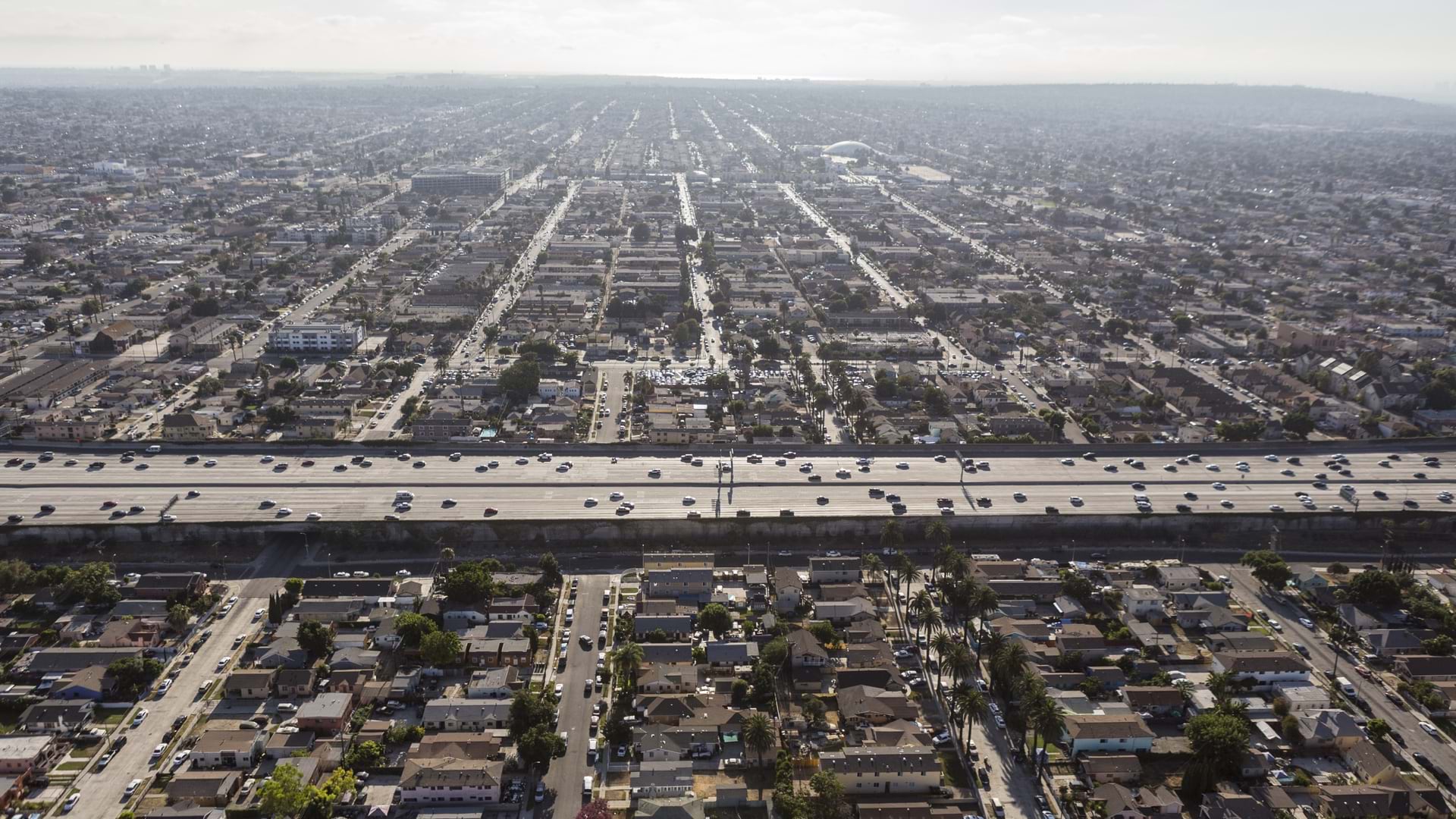
So let's talk about how cities can improve their work on traffic problems. What do you suggest a city council could do when trying to deal with traffic issues? So we've already mentioned adaptive signaling, but the other major impact on congestion is lane closures. So lane closures for all kinds of reasons.
We've all experienced driving around, why is this lane closed? Is there construction? Has there been a collision? Lots of reasons for a lane to be closed, but lane closures have a major impact on traffic congestion. In some major cities, the data tells us that up to 20% of live lanes are closed at any given time for some reason.
For some reason. A lot of that is construction. So this is a major area of focus for city councils, around the world, and for good reason. There are many things that they can do to help improve, and reduce the impact of lane closures on traffic congestion. Construction is the first thing that comes to mind.
So obviously, construction has to happen, right? You have to maintain or repair the roadways. there's, you know, new, buildings going up and that's a good thing. The city is growing. Every city needs to develop. So we can't avoid construction, but we can coordinate it better. GIS is so critical here because it can help us understand what will happen if I close these three roads at the same time, or what if I split them apart?
Pros and cons, right? Maybe it'll cost less if I do them at once because I can share resources, but what is the impact going to be on construction? So one thing that we're working on is a next-generation modeling and simulation solution. What does that mean? We can predict the future with a high degree of accuracy.
We can say, "If we were to close these three roads at the same time, what would the impact be on traffic congestion? And if I only close two and save the other one for two months later, what would the impact be then? Not only on those roads themselves, but on the whole city." So there's lots of ways we can help bring together that full picture with location intelligence to help a city understand, how do I get that lane closure reopened as quickly as possible?
Create the digital twin, get an insight, make a decision, reopen the lanes, and improve traffic congestion. You've used virtual reality to help city councilors better understand their city's traffic patterns. How has that worked in Montreal? So virtual reality is a really exciting technology. It's, I think, best known in video games, right?
But there's a real-world application here. So it is very hard for a city councilor who has probably no background, no training as a traffic engineer to understand how to make the best decision for their transportation network, and yet that's what they're being asked to do. If a city councilor receives a 200-page technical report on a complete street, should we put bike lanes on the street?
Should we widen the sidewalk? Should we make it safer? What will the impact of that be on traffic congestion, on everyone's safety, and so forth? Very hard for that city councilor to read 200 pages of technical information with jargon and terms and say, "Yes, I get it, and here's the best decision." So what we've got with virtual reality is an ability to make an emotional connection.
So when it comes to safety, if there is no bike lane, it can be scary. There's cars whizzing by, they might be distracted, but it's difficult to convey to someone who hasn't actually done that. With virtual reality, we can put someone on a bicycle in an immersive view, so they feel like they're actually there, and we can allow them to turn on and off the bike lane.
Right? So in the real world, it would take a long time to build a bike lane. In virtual reality, you click a button, the bike lane appears, and you have a completely different experience. So that city councilor with the, with the virtual reality headset on can say, "Wow, now I really get it. I really feel how unsafe it is when I'm riding a bike without a bike lane on this street."
but it is not all positive. There could be negatives, right? There could be downsides. We're reducing the number of traffic lanes. Will that create more congestion? The short version of the answer is yes, for a while, and no, in the long run. So there will be more congestion at first until enough people start riding their bicycles, right?
But that doesn't happen in a month or two months. It can take a number of years. It's multifaceted. There are many impacts of making different decisions, and virtual reality is one way that we can help to explain and get people making the decisions to really understand the impacts in a, in a very visceral way.
Yeah, it's really neat to put somebody right there in the bike lane because you just can't experience that on a busy road if it's not there. Exactly. Yeah, such a big difference compared with, you know, than any other interface. And I will say we have to complement virtual reality with other user interfaces, right?
Maps, dashboards, digital twins are something we talk about a lot these days, 3D representations. It's really a question of what information, what insights does that person need at that moment, and how can we best, deliver that to them? Traffic patterns are deeply complex, and you mentioned digital twins.
How does a digital twin help with traffic flow? I would say that when it comes to the roadway transportation system in general, taking what's happening in the real world and putting it into a digital environment lets us analyze that and get insights from that in a way that you couldn't do if you were just standing on the street corner, right?
So this is also where systems thinking comes in because, yes, I can improve safety. I can get to zero injuries, zero deaths, zero collisions if I make everyone drive at one mile per hour, right? Like, if we go to an extreme. obviously, if I over-optimize for one thing, then I'm gonna impact another thing, right?
So this is what systems thinking means. I have to find that balance, and, difficult to do unless you can try different things, right? I don't think anyone can say, "Here's the perfect solution. I don't need to test it." But testing it in the real world is expensive. It can be dangerous and take a long time.
Testing things in the digital twin is much quicker, less expensive and less impactful. you know, I think the other, the other aspect of that kind of trial and error of that testing is with that modeling and simulation that I mentioned, I can actually use modeling and simulation to say what will happen over the next week, over the next month, over the next year.
Because things are also changing, right? Population could be growing. people are gonna, decide to take the subway or transit instead of driving because a new line is opening. All kinds of things. It's not a static, you know, it's not a static situation. Everything is always changing. So at what point in the discussion about traffic safety do you suggest a city build a digital twin of their traffic?
You don't need to build a digital twin from zero to 100% overnight. A digital twin is something that you can build gradually over time. Start with the data that you have. Most cities, if not all cities, their issue is not a lack of data. Their issue is what to do with all that data. So they already have a great deal of data.
let's start to figure out what is actually useful in that data set, and then let's start to put it into that digital twin slowly but surely. There's no need to go all the way in, you know, in one week. It's impossible. This takes time. Think about the first problem that you want to try and solve, and let's build a digital twin that will help us address that first problem, which could be lane closures, construction planning, that sort of thing.
Yeah, that's great to start small, and then it doesn't seem like such a big thing to do. Exactly. what is at stake for cities if they don't deal with traffic jams, bottlenecks, things like that? We know that, congestion, has a massive negative impact on the economy. It's logical, right? If you can't get to where you wanna go to, some of the time you won't even go there.
So instead of going out to the theater or shopping or whatever it is, you're gonna say, "You know what? I'll just stay home today." There's also a massive, negative economic impact just due to productivity loss, people sitting in their cars, and not getting to where they need to get to. So, you know, massive economic, impact.
The other thing a lot of people don't know that if you can get people out of their cars, walking, on bicycles, taking transit, they actually spend more in a city. so a lot of the time we see pushback saying, "Don't take away the parking spots in front of, retail stores because we won't have as many customers."
It's actually the opposite. If you can get people, not driving and get them walking, get them on their bikes, taking transit, they spend more time in those retail environments. So, you know, mode shift. Mode shift is another way of saying how do we get people to choose something else besides driving more of the time, right?
And we're not saying all the time, we're not saying no cars in the city, but how do we start to shift more people onto bicycles, onto transit, walking, that sort of thing. that has a very positive economic, impact. And this is, again, something that we can help cities to plan. It's not so easy. You have to incentivize people.
They have to believe that if they're gonna take transit, it is safe, it is reliable, it's quick, right? And how do we help to get things back to our digital twin, back to collecting data to understand what is the insight I need to make that actually happen more quickly? Does a bus route need transit priority with the signal so they get more green lights?
What will the impact of that be on the cars, right? What will the impact of that be on everyone? What is the safety impact? So again, if we look at all these factors, we can definitely improve safety, we can improve congestion, but the spillover effect of that is a massive improvement in economic activity, economic development, loss, avoiding that loss of productivity that we have from sitting in traffic.
And so you're saying you can bring so much data into the digital twin that then you can model these different effects on the economy? Exactly. For one other example, what is driving that economic activity? Where are people coming from and going to? and I don't want to, imply that there's a privacy issue here.
We're not tracking, you know, individual people and saying, "What are you doing this morning and where are you going?" But in aggregate, which means, you know, across, millions of people, there is a lot of data about travel patterns, so we can understand in general where are people coming from and going to.
in our terminology, we would call that origin-destination. So what's the origin? What's the destination? What are the patterns around that, so that we can design the transportation system to support the patterns that we see in where people are coming from and going to. Therefore, they can get there more quickly, more efficiently, right?
And a lot of where they're going to has to do with growing the economy as well. Thank you, Daniel, for talking to me. This has been a really interesting conversation. My pleasure. Thanks so much for having me.
Thanks for listening to the Esri and the Science of Where Podcast. If you like this episode, please share it with a colleague

Listen to and subscribe on