displaying 1413 results

A Florida University combined geography and art in an innovative new class.

AutoCAD 2025 now features ArcGIS Basemaps and ArcGIS Living Atlas of the World data; Esri’s Maps.com highlights exceptional maps.

3D GIS workflows and models have created a digital twin to help guide development of port facilities in Vietnam.

A GIS-powered America’s Commerce Corps program called Community Connection helps consumers and communities engage with local businesses.

ArcGIS Data Pipelines now makes it easier and faster to prepare, integrate, and manage data In ArcGIS Online.
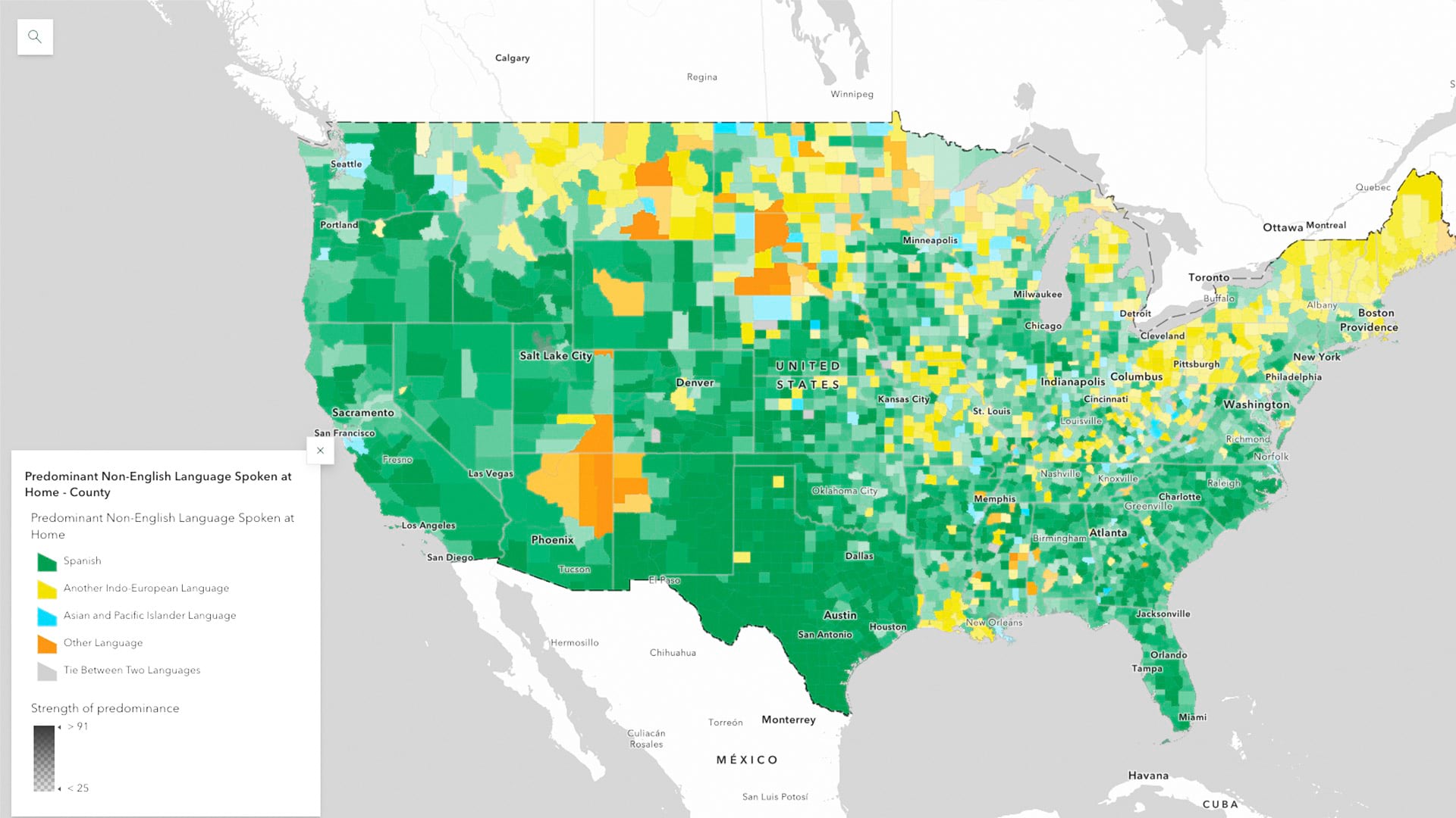
ArcGIS Living Atlas of the World now has the latest five-year estimates from the US Census Bureau’s American Community Survey

An experienced data analyst provides tips and best practices for managing GIS workflows.

The US Food and Drug Administration is using GIS to collect data on foodborne illness risk factors in US retail food service facilities.

Effective maps often blend art and cartography to evoke emotions and reactions.
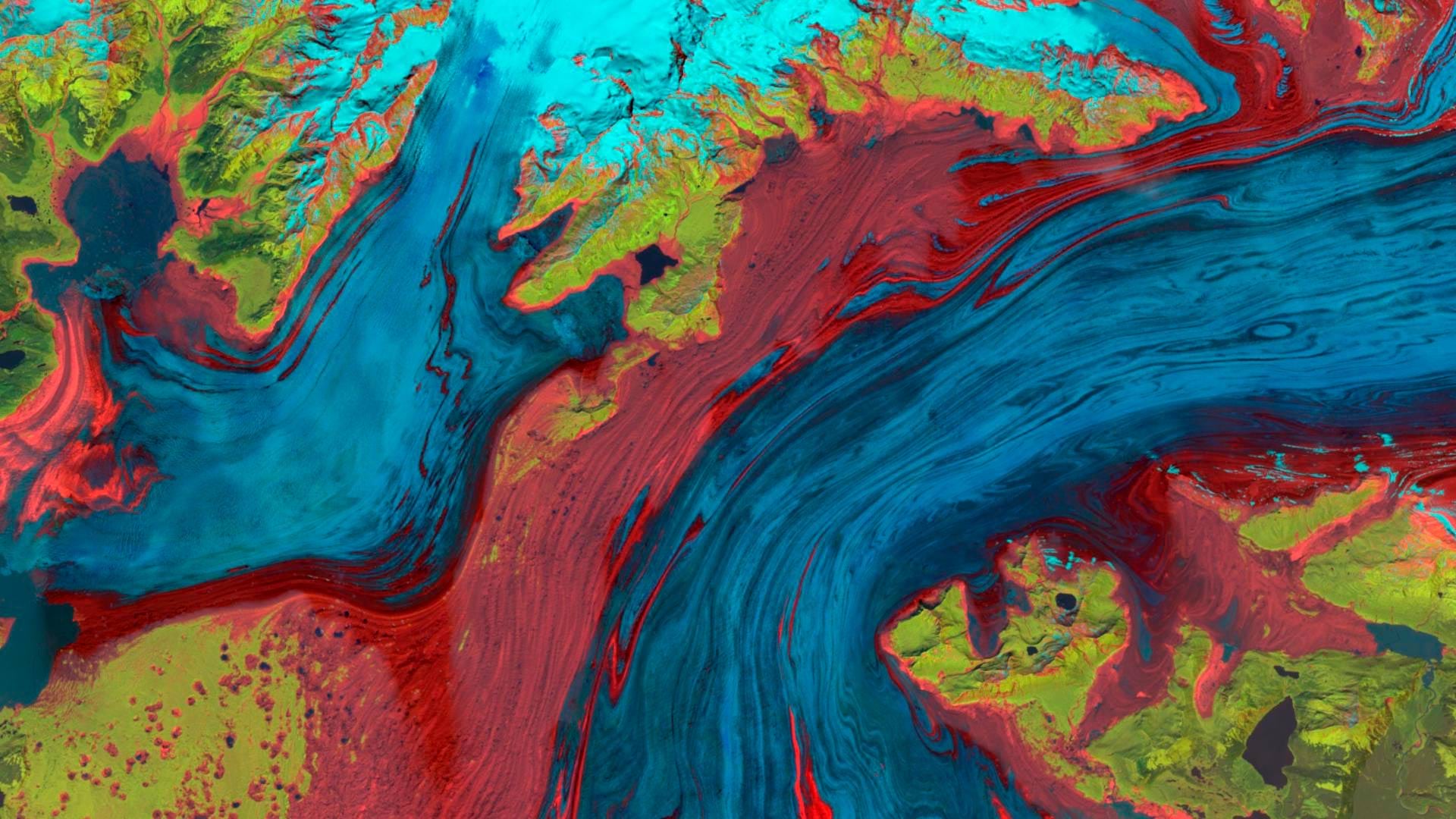
The Landsat Explorer app in ArcGIS Living Atlas of the World provides an easy way for users to access and interpret Landsat satellite data.
Visualize quotes, stories, sentiments, and experiences using labels, pop-ups, dashboards, and word clouds.

Jack Dangermond and National Geographic Society CEO Jill Tiefenthaler discuss technology and the power of storytelling.