displaying 28 results
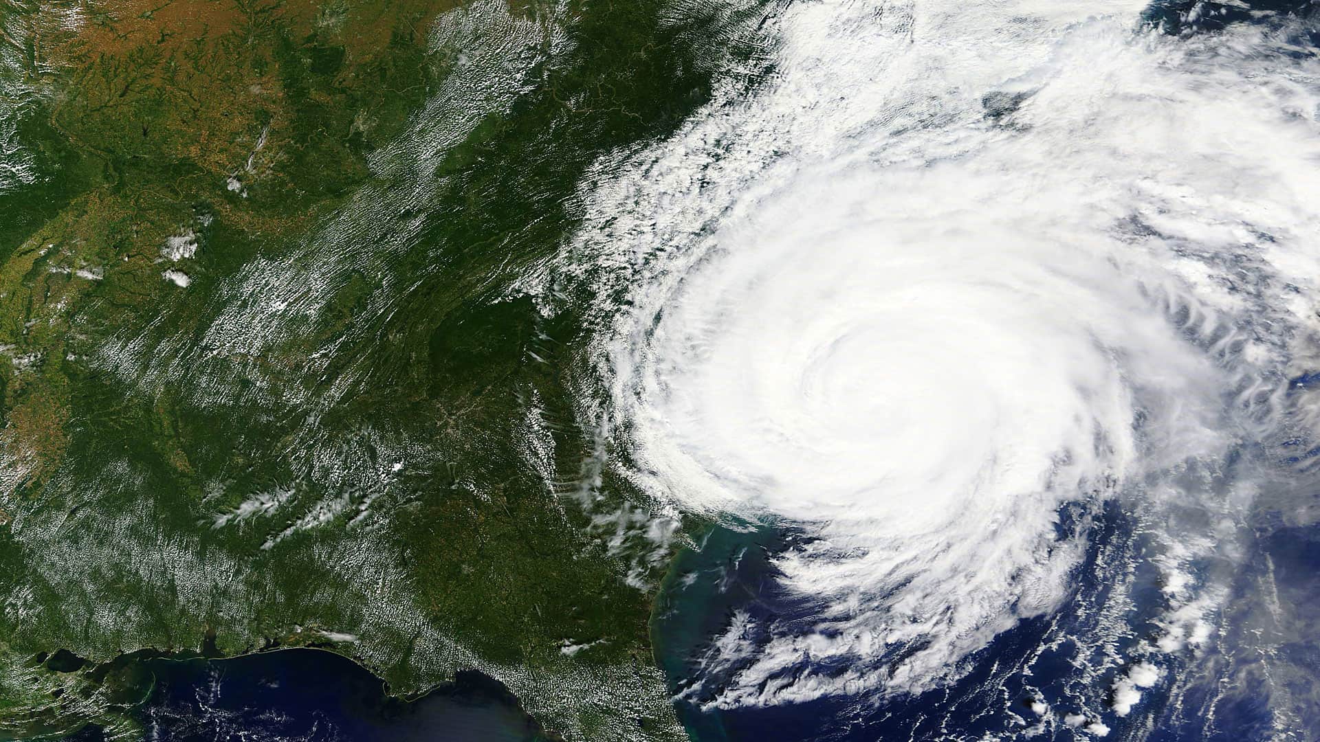
Web GIS is changing disaster response, allowing organizations to continually unite their daily operations with emergency needs.

Esri named a leader in location intelligence, launches new Ocean Health Hubs with OHI, and expands IoT developer opportunities.
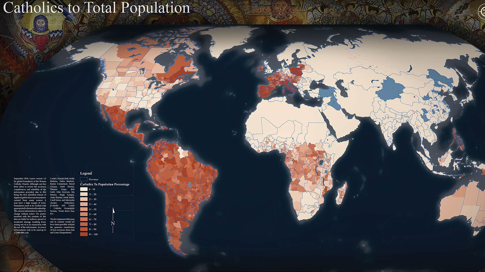
Land use has a moral dimension to it. That’s why Molly Burhans wants to help the Catholic Church better manage its land—first by mapping it.

ArcGIS Online now has five new User Types, which match user characteristics with GIS capabilities and apps. Which User Type are you?
With ArcGIS Enterprise Sites, users of all experience levels can design and build web pages that highlight an organization’s GIS content.


With advanced geospatial technology, Colorado agencies can identify snowslides before they happen.

The Kuwait Oil Company relied heavily on the ArcGIS platform to reduce congestion in its oil fields and better plan for future prospects.
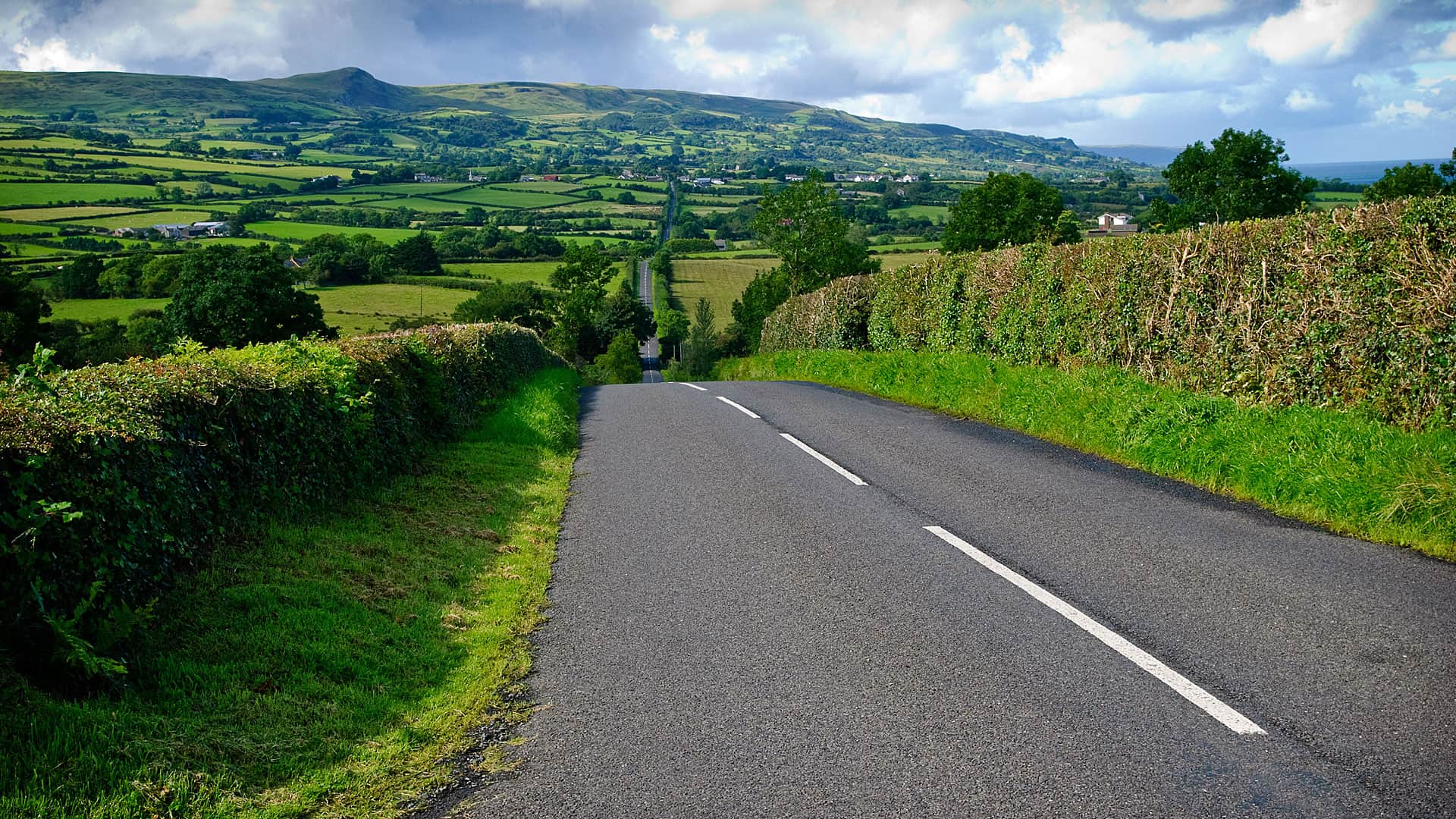
In Fermanagh, Northern Ireland, the district council is using ArcGIS technology to put up more than 4,000 road and townland signs.

A university professor used a decrease in local bus ridership to show his strategic supply chain management class the value of GIS.

To keep 24-hour-a-day airport operations running smoothly during a $15 billion development project, LAX is leveraging GIS strategically.

Together with Explorer for ArcGIS, new trail markers make it easier to find hikers.