displaying 27 results

The Esri Geospatial Cloud, which describes the entirely web-services based architecture of ArcGIS, gives users great reach and flexibility.

Esri platform selected to chart Danish waters, ArcGIS Hub meets new federal open data requirements, and ArcGIS for Developers is relaunched.
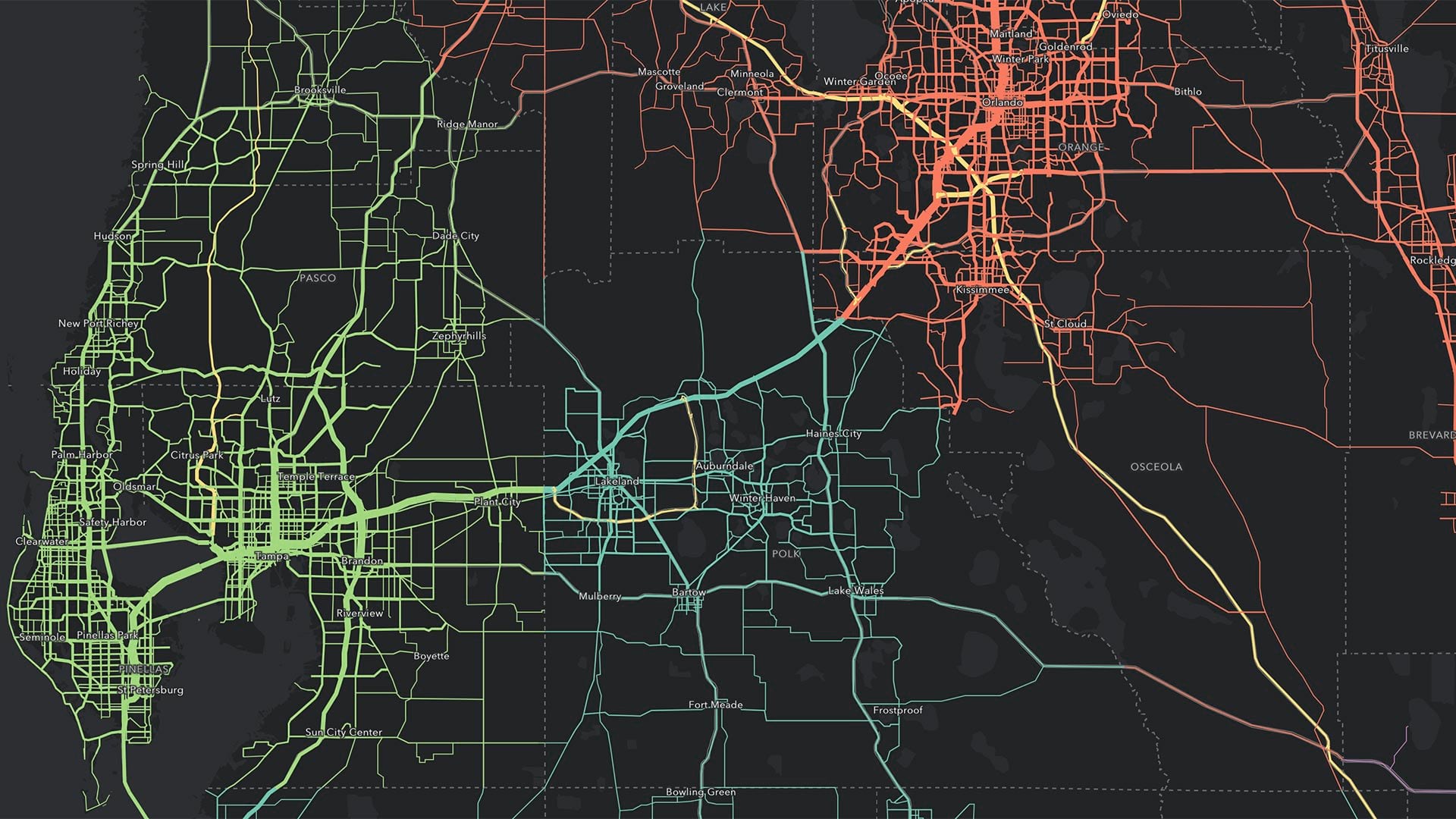
Most Esri users—from leading businesses to governments—incorporate Esri’s Geospatial Cloud into their on-premises systems and workflows.

Using radio occultation, nanosatellites can collect extremely accurate atmospheric data. This is about to transform weather forecasting.

Esri’s DRP has helped users respond to disasters for 25 years. Its new solution gets users to start preparing for the next incident today.
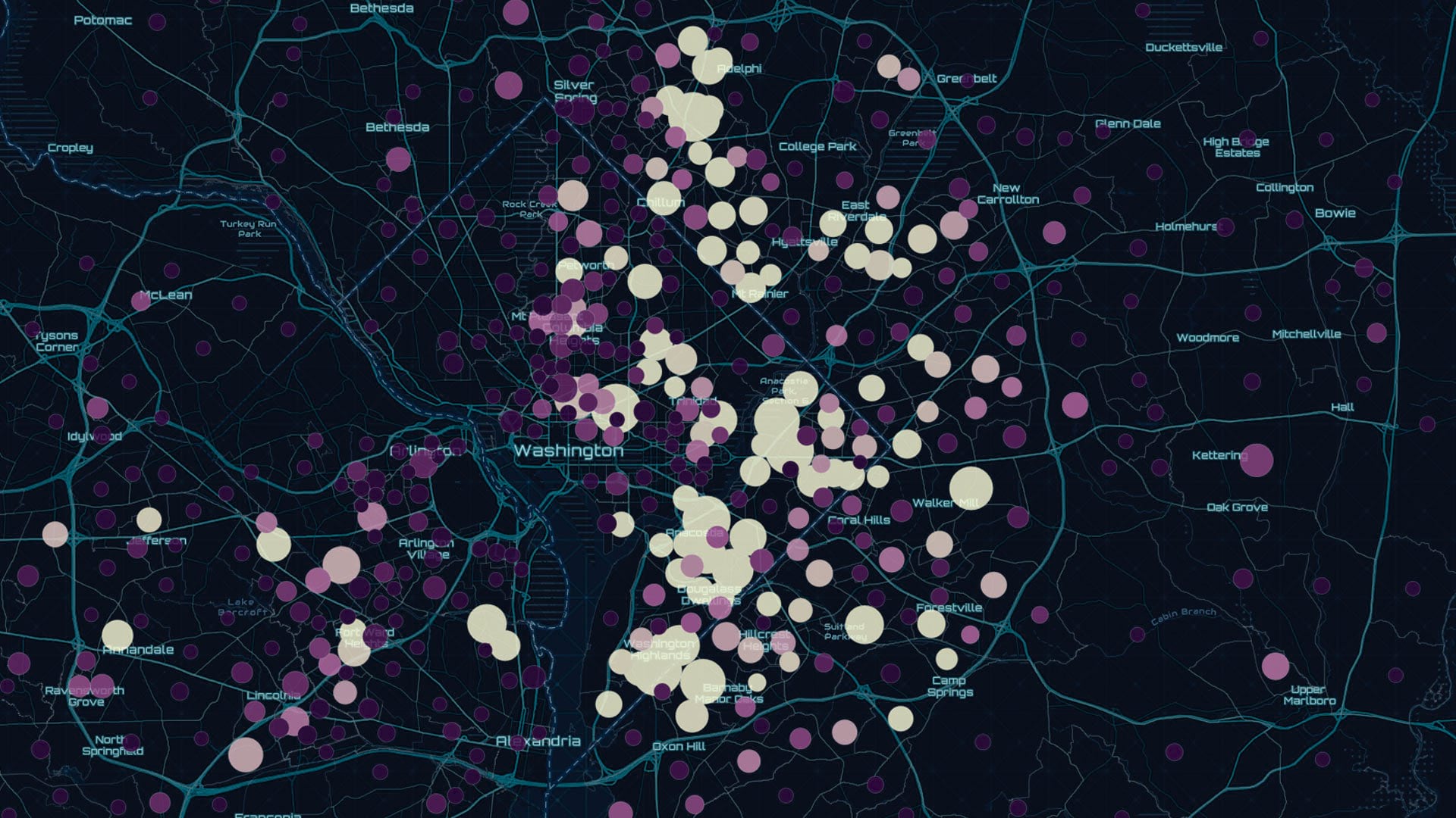
The preauthored maps in the new Esri Maps for Public Policy app foster collaboration and drive fact-based decision-making.
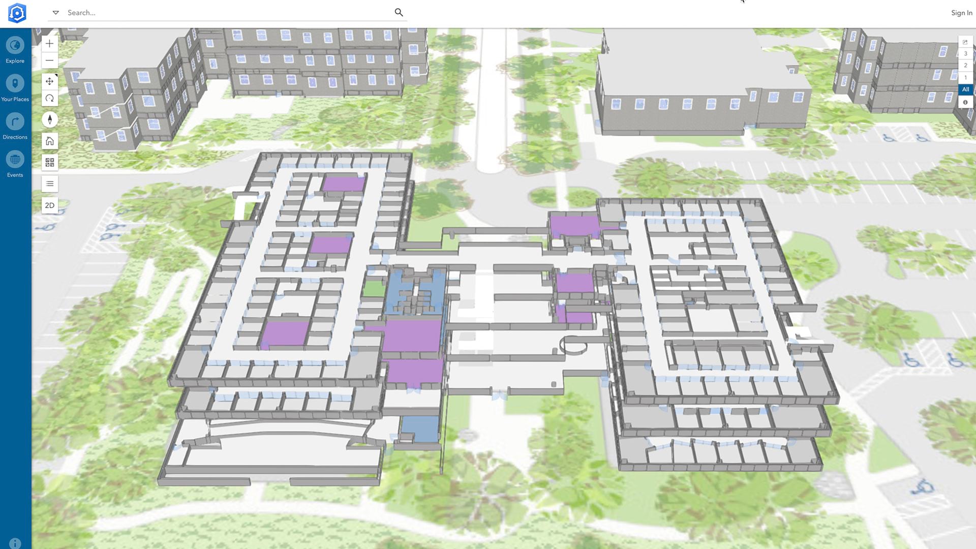
ArcGIS Indoors gives business owners, executives, building administrators, and employees a common understanding of their interior spaces.
The latest release of ArcGIS is big. Get to know what’s new.

Check out some of the latest updates to ArcGIS Online, including new filters, configurable apps, and security features.

Esri will require TLS 1.2 connections for ArcGIS Online services as of April 16, 2019. Immediate action may be needed.
The beta version of ArcGIS StoryMaps delivers a more elegant and streamlined experience for making and sharing story maps.

LA County is beta testing ArcGIS Indoors to give county employees and visitors complete mobility across familiar and unfamiliar spaces.