displaying 27 results

The Census Bureau collaborated with Esri, weaving geospatial capabilities into every operational component of its 2020 Census.
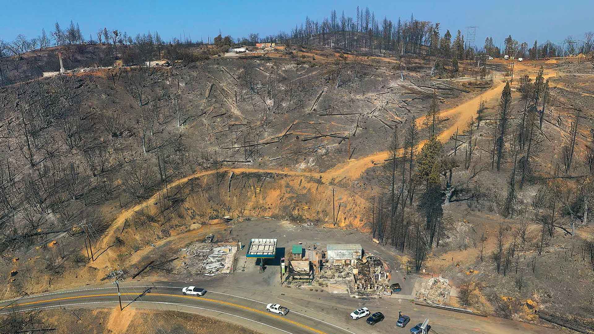
Law enforcement working on California wildfires tasked Esri partner and geospatial consulting firm GeoAcuity with obtaining aerial images.

Zibumi will help advance 3D visualization and simulation in Esri software and expand the integration of game engine technologies into ArcGIS.

People from all over the world had extra special virtual celebrations for GIS Day on November 18, 2020, despite the COVID-19 pandemic.

Esri’s ArcGIS Indoors is suited to help businesses safely plan reopening, helping them efficiently visualize their real estate.

The December update of ArcGIS Online includes a series of reports to more effectively manage organizational accounts.

Users who have upgraded to ArcGIS Enterprise 10.8.1 have access to ArcGIS StoryMaps to create an immersive narrative experience.

The new Agri-GIS app is bridging the spatial analytics gap in Indian farming communities.

Tietorahti Oy, Finnish transport consulting company, created a mobile app to easily access critical data while on the road.

The Inner West Light Rail, located in Sydney, Australia, runs for 8 miles predominantly along the corridor of a former freight railway line.

AASD and engineering students used GIS to study water scarcity in one Peruvian community to help other societies in similar situations.

Miami Beach, Florida, is one of the most vulnerable areas for sea level rise in the United States.