displaying 20 results

The real-time data sharing, analysis, visualization, and planning capabilities will be key to equitable and speedy vaccine distribution.

A college developed a community-based service-learning project uses GIS to fight food waste.

Table of contents listing articles in this issue and the Editor's Letter.
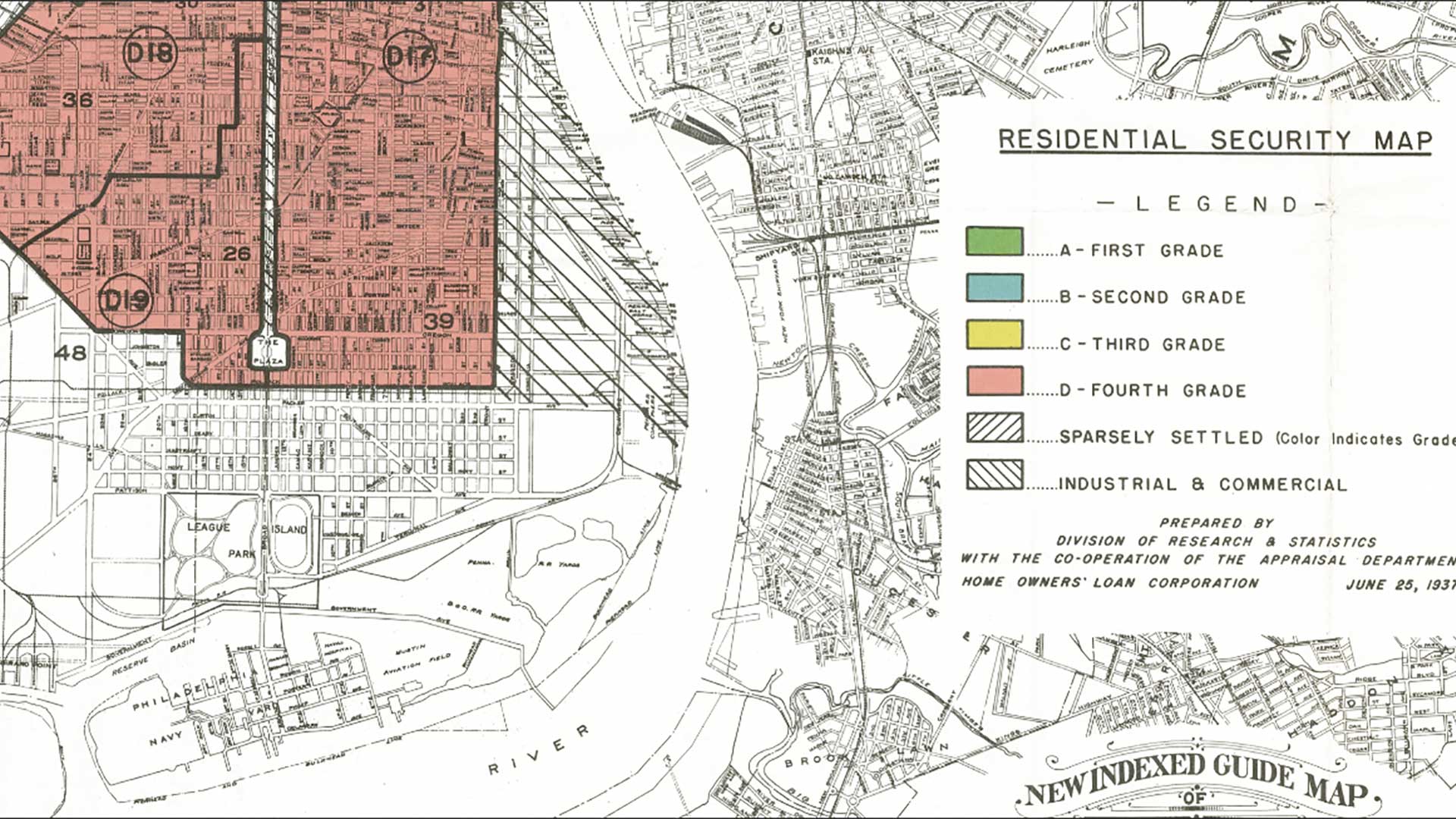
GIS can help governments and organizations discern and address systemic historical racial inequity.

Since 2001, Connected Nation, a nonprofit 501(c)(3) organization has been working to bridge the digital divide.
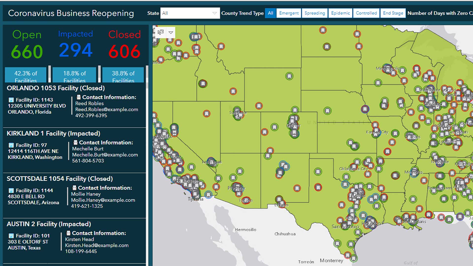
ArcGIS solutions provide maps, applications, templates, and widgets that support critical COVID-19 response.
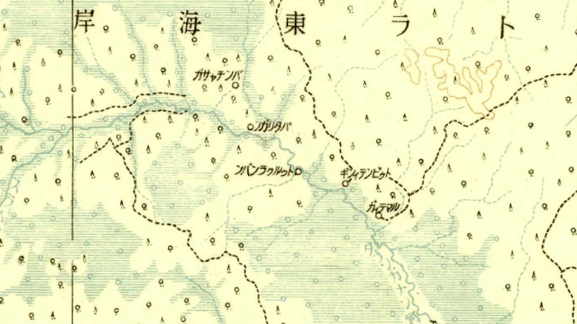
A web application developed by a Japanese university makes a priceless collection of historical maps available to the public.

The Greater Salt Lake Municipal Services District (MSD) used GIS to respond to an earthquake in Magna, Utah.

A Florida county appraiser’s office improve the assessment of commercial properties by incorporating traffic data.

Organizations need to think big but focus on the details to establish an effective GIS governance program.

Geospatial infrastructure empowers everyone to be an intrapreneur.
Software starts a map, but the decisions of mapmakers transform data and give a map its purpose.