displaying 21 results
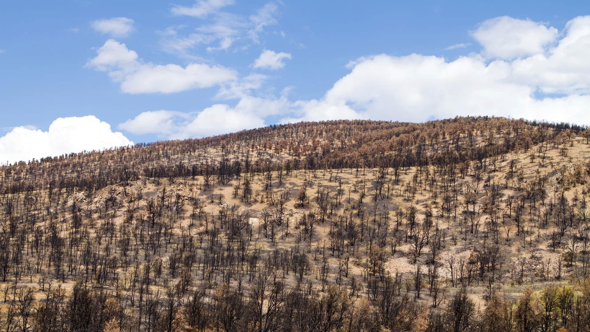
Rather replacing forest that burned in the 2018 Camp Fire, Bureau of Land Management (BLM) mapped a climate-informed restoration plan.

GIS is being used to help thousands who were left behind when United States forces left Afghanistan.

Loss of biodiversity is the other great and interrelated challenge of our era that is often overlooked.
Select the best way to share your imagery and raster data.

Esri introduced new capabilities for CAD and BIM integration that make more BIM content available for ArcGIS workflows.
To support the GIS needs of internal staff, the team leveraged ArcGIS Enterprise.
Video game developers are incorporating real-world geospatial data into their games more realistic.
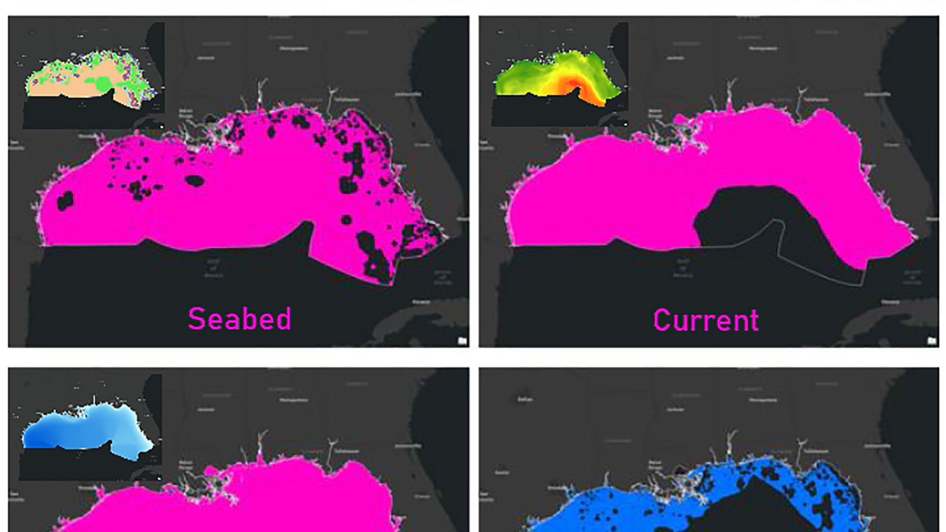
The author developed a suitability model that allows users to determine suitable anchorage locations for NOAA GNSS tide buoys.

Change management is essential for strategy development and it must be addressded to ensure change is managed effectively.

ArcGIS API for JavaScript can now use field values to control drawing order.
Knowing how your map will be shared before you start mapping helps with important design decisions.
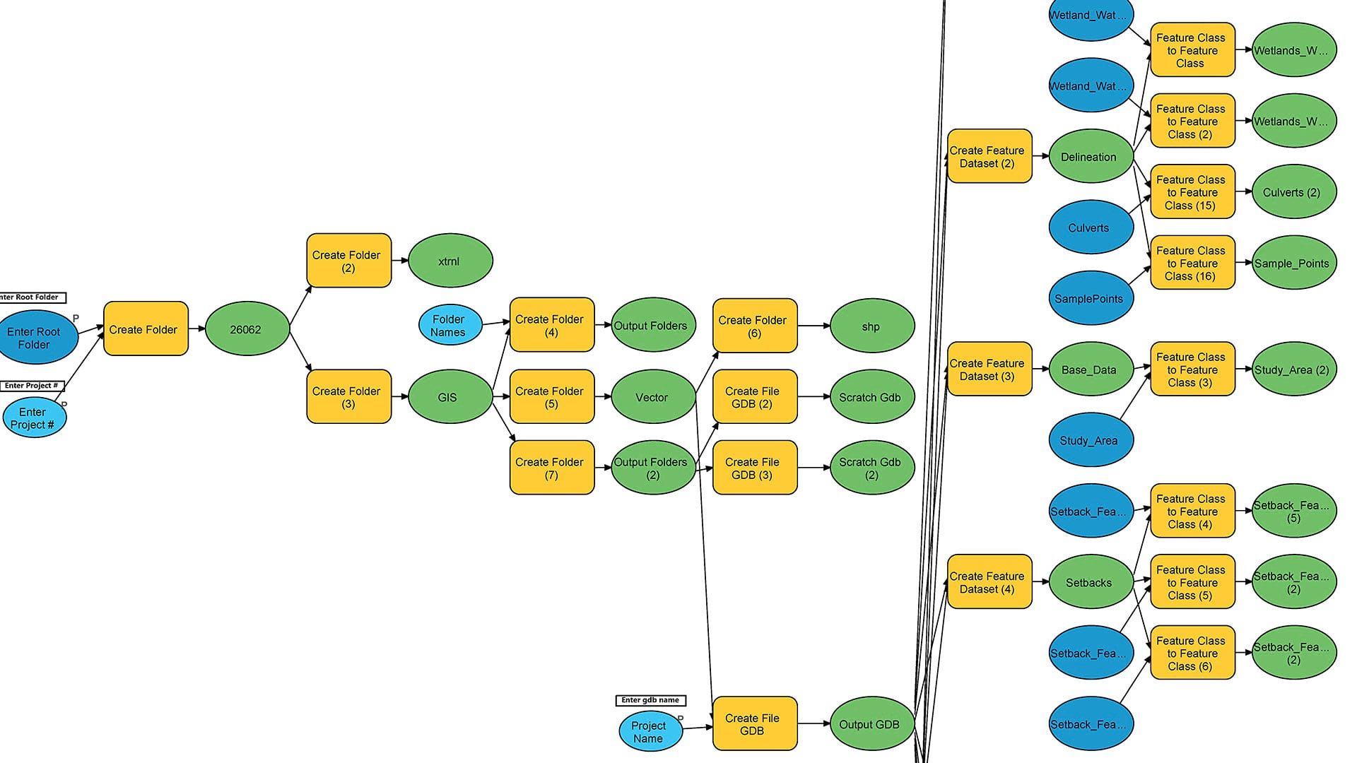
Automating routine GIS tasks using ModelBuilder save time, reduce error, and standardize workflows.