displaying 17 results
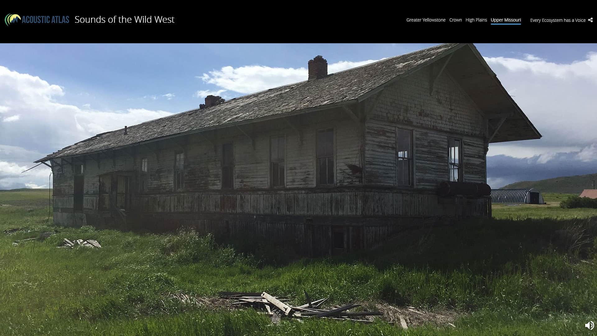
“Sounds of the Wild West,” created using an Esri Story Maps app, brings to life the sights and sounds of Montana's four major ecosystems.

Esri technology evangelist Bern Szukalski shows you how to enable social network logins for your ArcGIS Organization.

The new Maps for Public Policy web app from Esri provides free access to preauthored policy maps, allowing anyone to explore community issues.

Esri will require TLS 1.2 connections for ArcGIS Online services as of April 16, 2019 for security reasons. You may need to take action sooner.
A team from the US Census Bureau shows how geographic information and GIS mapping apps will be used to conduct the 2020 Census.
Pat Cummens of Esri explains the importance of three new laws passed by Congress and signed by the president, including the Geospatial Data Act.
Use the Community Maps Editor app, now in beta, to create and edit detailed features for special areas of interest within your communities.
Writer Charles Dickens once said, “Procrastination is the thief of time.” With that in mind, sign up for the Esri User Conference today.
Learn how to set up Operations Dashboard for ArcGIS to automatically focus on the latest event like an earthquake.
Do you have a publicly accessible ArcGIS organization? Here’s some sage advice how to make your organization easier for others to discover.
Watch this online workshop to find out what type of content ArcGIS Living Atlas of the World contains and how to organize and use it.
While the drought has eased in some parts of the western United States, other areas still suffer.