displaying 17 results

Frank Avila from NGA talks about the agency's interest in AI, the growth of the small satellite market, and advances in hyperspectral imagery

Learn how to create professional thumbnails for your maps, apps, and other geographic content in ArcGIS Online.
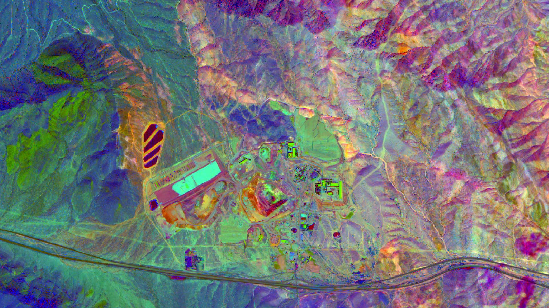
High quality imagery helps in finding mineral and petroleum deposits and Esri ArcGIS can be used to process, enhance, and analyze those images.
Understanding data comes down to mapping it. Get answers about the wheres, whys, and whens of your business and much more insightful information.
Get a taste of the more than 1,500 GIS Day events around the world by reading these inspiring stories.
Protected area managers in Africa are taking storytelling and photography training, including lessons in how to use ArcGIS StoryMaps apps.
Magdy Mikhail from Agile Assets joins Terry Bills from Esri for an informative webinar on how to incorporate GIS into pavement management.
Get tips and tricks on how to use Survey123 for ArcGIS to conduct damage assessments after hurricanes, earthquakes, and other natural disasters.

When creating thumbnails for items in ArcGIS Online, you can go beyond the basics and establish a unique style or brand. Here's how.
Map Viewer beta includes a new layout for authoring maps and more pop-up configuration capabilities, printing layouts, and smart mapping tools.
Want to spotlight a specific geographic area of interest in your map? Create a vignette with the Overlay Fade style for ArcGIS Pro.
Color ramps were updated for the Map Viewer beta. You will find more than 300 color ramps in the Map Viewer, most being colorblind friendly.