displaying 17 results

New trail markers and an Esri app speeds the response to emergency calls from hikers on a state park trail in Long Island, New York.

Esri technology evangelist Bern Szukalski shows you how to add audio files to Story Map Tour apps.

Want to hone your GIS skills and knowledge? Read these six books from Esri.
Celebrate GIS Day this November by hosting or attending a program that showcases GIS technology.
Esri's Rajinder Nagi gives you a tour of the tool collection available in the ArcGIS Living Atlas of the World.
Organizations can use ArcGIS Enterprise Sites to create a tailored web GIS experience with their ArcGIS Enterprise portal.
You can create market opportunity maps using demographic data available in ArcGIS Living Atlas of the World and ArcGIS Online capabilities.
Traffic information from Waze is now available as a data layer in ArcGIS Marketplace.
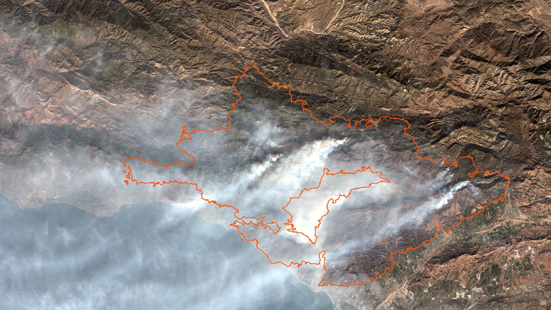
Study several aspects of the Thomas Fire by using ArcGIS Online analysis tools and data from ArcGIS Living Atlas of the World.
You can use ArcGIS API for JavaScript to render the edges of buildings to improve the perception of a building's actual shape,
Esri cartographic product engineers Jennifer Bell and Diana Lavery demonstrate the smart mapping capabilities in ArcGIS Online.
Mike Goggin from Patrick Engineering, explains the critical role that location intelligence plays in the utilities industry.