displaying 17 results
William Shuart uses drones and the latest Esri technology to help students at VCU bolster their skills for their future careers.
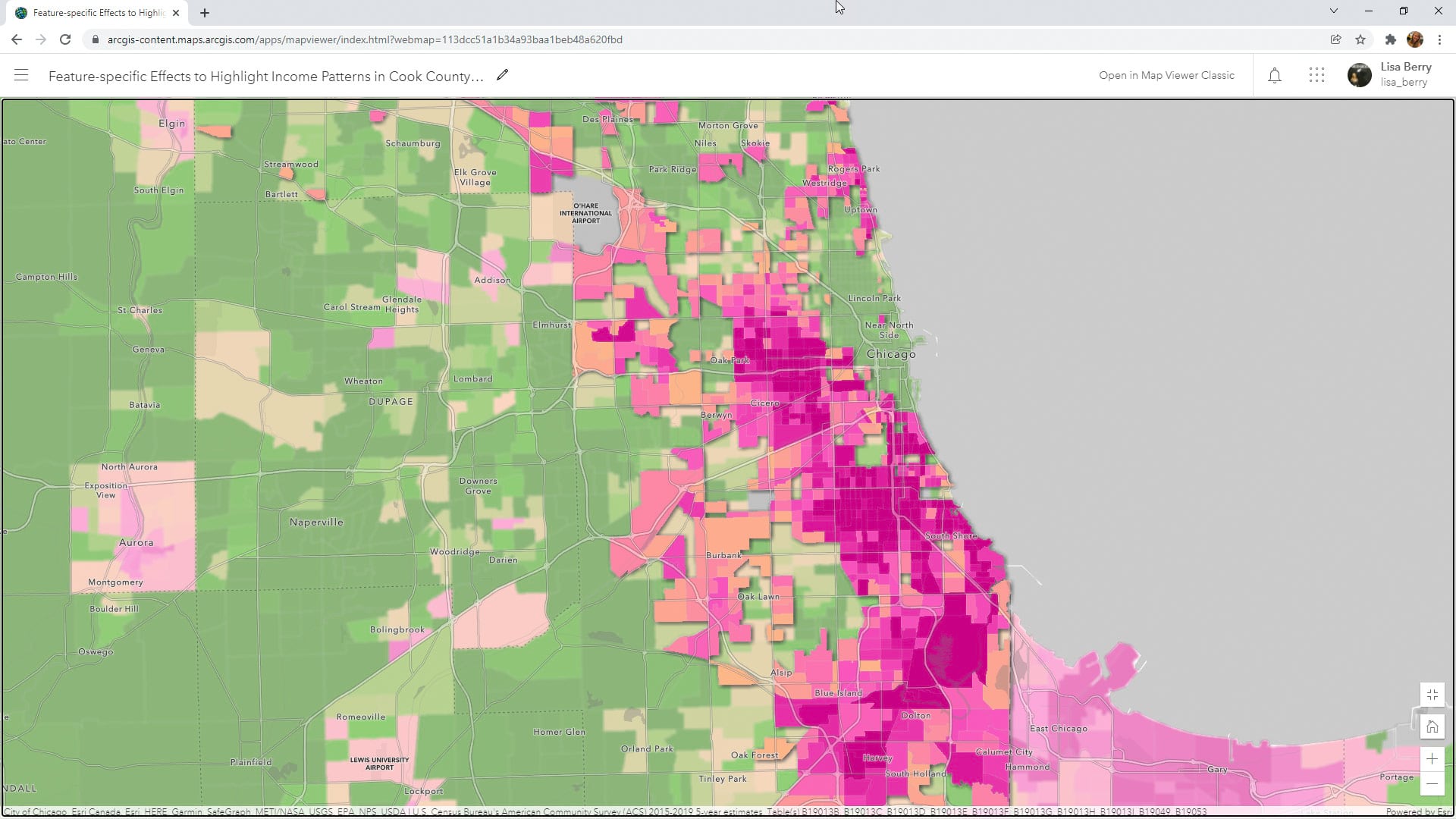
Learn to how to use a Map Viewer capability called feature-specific effects to emphasize a particular part of your map data.

Cartographer Kenneth Field's book Thematic Mapping is just one of three new Esri Press books worth picking up soon.
Kenneth Field, author of Thematic Mapping, writes about the importance of ethics in mapping as well as the core set of values to follow.

ArcGIS Online has a new home page, so it's time to reconfigure it using the home page editor. Lynnae Terpstra from Esri shows you how.
Find out how GIS is being used in the geodesign sphere during the Geodesign Summit, which will be held online April 11–12, 2022.
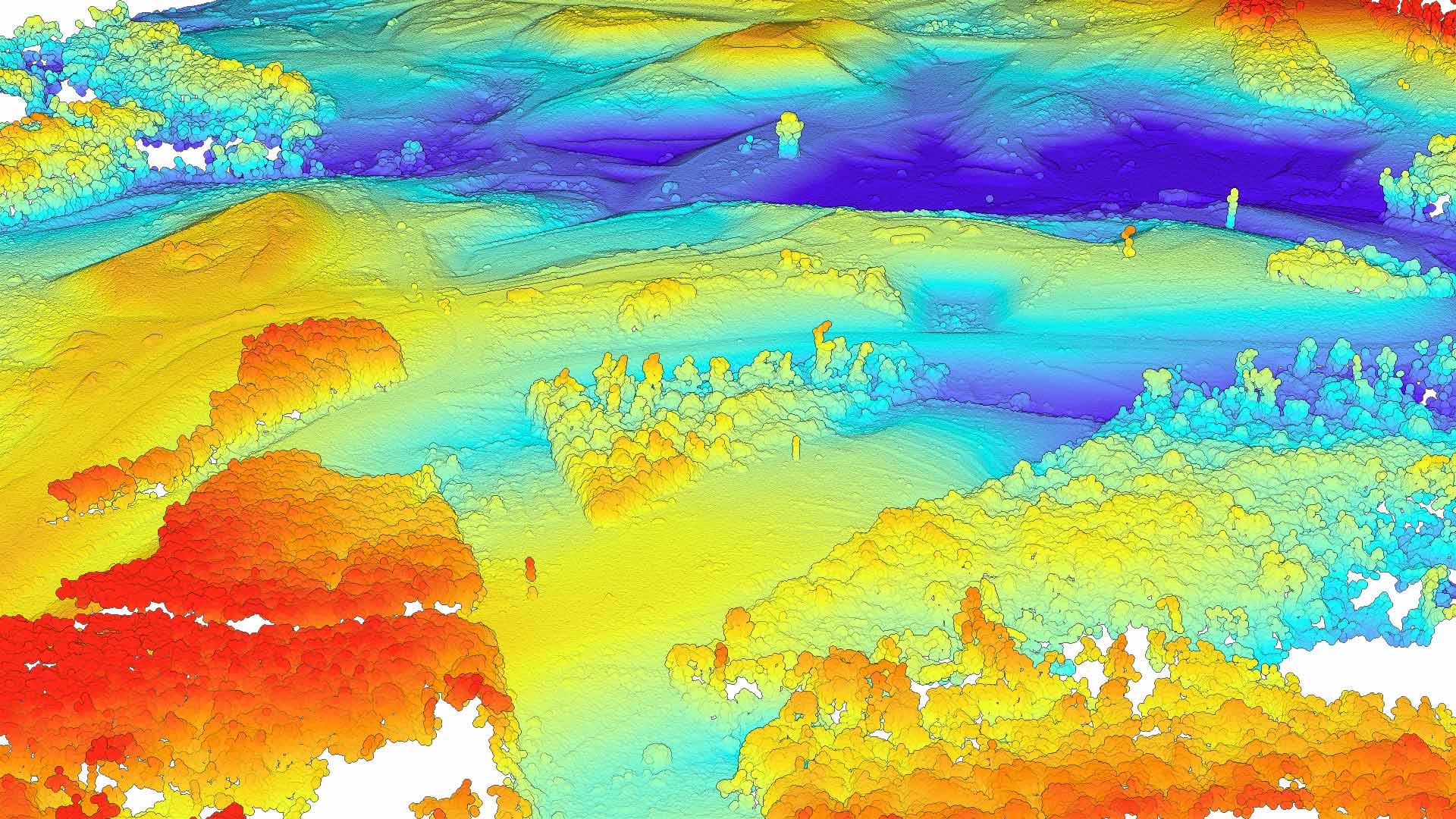
Find out how to use tools in ArcGIS Pro to automatically generate bathymetric features for use in navigational charts.
You can locate your current position inside a building by using the new ArcGIS IPS, an indoor positioning system from Esri.
Esri technology evangelist Bern Szukalski walks you through how to use ArcGIS Dashboards to create a dashboard that lets you visualize your data.
In the Configuring an ArcGIS Online Organization web course, you will learn to navigate and manage settings for your ArcGIS Online organization.
Explore imagery applications and advanced tools used to extract information from imagery during a six-week course that starts April 27, 2022.
Learn why using ArcGIS StoryMaps is a great way to showcase your work.