displaying 17 results

What happens when a huge earthquake hits California? Joseph Toland of the USGS breaks down his GIS-based response model to prepare for disaster.
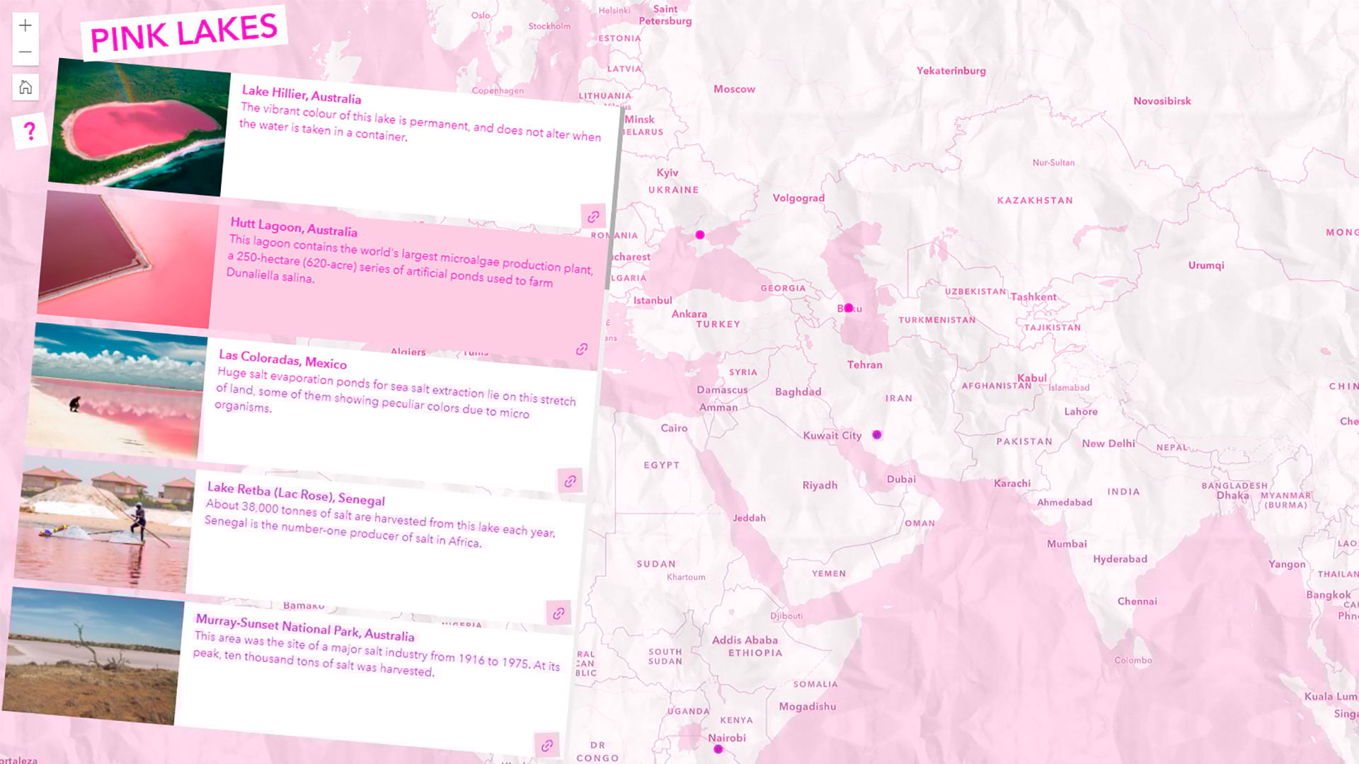
Learn to map pink lakes around the world and make the map pink to match its colorful theme.

In the age of remote work, the state of Ohio is turning to GIS to address inequalities in reliable broadband access.

The premier gathering of cartographers and GIScience professionals is coming to Redlands. Learn about the event's history and this year's agenda.
Esri’s new storytelling tool makes everyone a storyteller. Share ideas and experiences as interactive content featuring maps, media, and more.
With apps like ArcGIS Survey123, communities are better equipped to keep track of and assist those affected by homelessness.
In this video, Esri’s Clinton Johnson and Diana Lavery dive into the data and workflows to help you operationalize your equity impact assessment.
Listen as Claudia Blagu, digital project leader at Ingka Investments, talks smart maps, location intelligence, and why sustainability is key.
Technology evangelist Bern Szukalski walks you through how to access and best use subscriber content on ArcGIS Living Atlas of the World.
You can do more than just link out Excel files in ArcGIS Pro – Esri product engineer Elaine Evans shows you how.
Esri’s new no-cost massive open online course explores how integrating GIS, CAD, and BIM data enhances every phase of the AEC project life cycle.
ArcGIS StoryMaps isn’t just for maps – you can use it to communicate your professional accomplishments to stand out to potential employers.