displaying 17 results

With ArcGIS Hub, the Nevada Department of Transportation has built a new, public-facing website to make its geospatial data accessible for all.

One of the many things you can customize in your ArcGIS organization is your basemap gallery. Here's how.

Monroe Community College’s new GIS microcredential aims to meet modern industry trends and prepare students for the workforce.
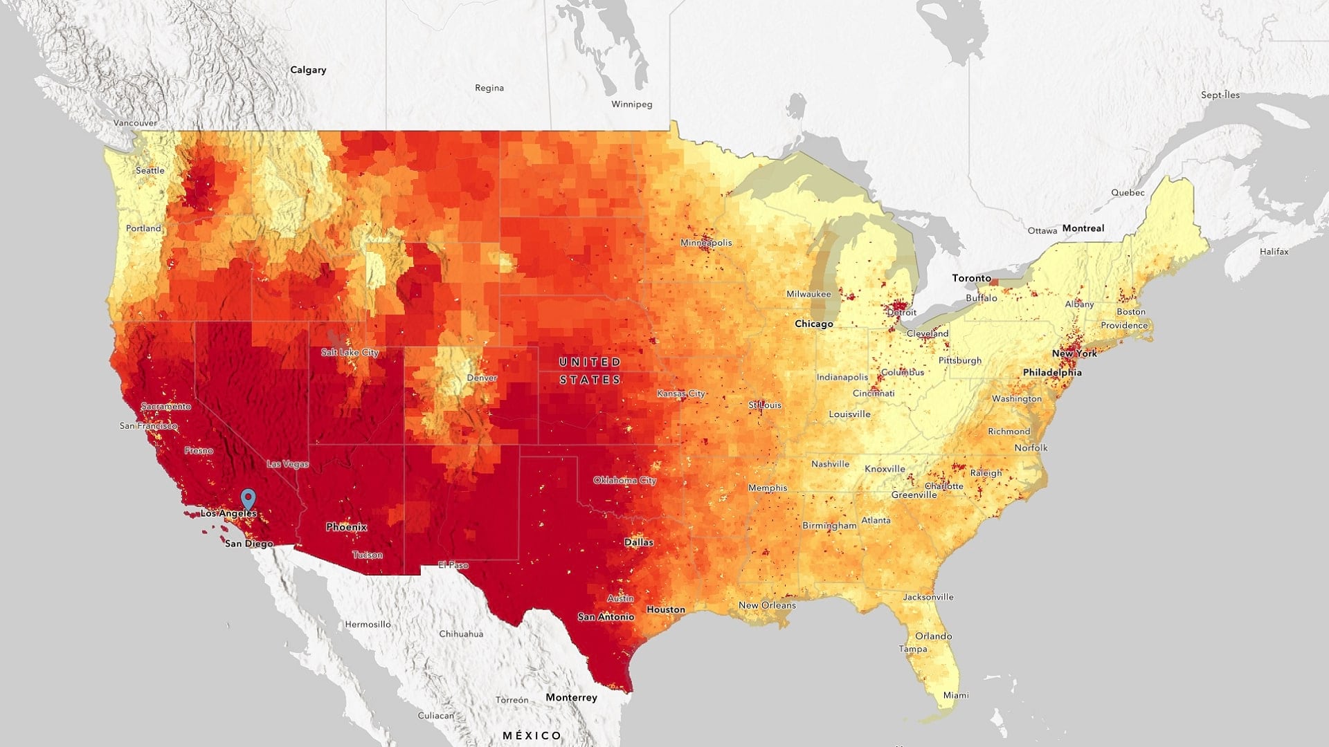
The White House's new Climate Mapping for Resilience and Adaptation portal brings together critical geospatial climate data in one place.
Listen as Anne Shaw, Executive Director at Transport for West Midlands, discusses geospatial technology's role in public transportation.
There's still time to register for the Esri Ocean, Weather, and Climate GIS Forum, held November 9-10 in Redlands.
Small nonprofit organizations based in the United States can apply for a grant from Esri that provides GIS software, data, and training.
Learn how architecture, engineering, and construction firms create more livable cities, workplaces, and campuses in the new book from Esri Press.
What does it mean to bring BIM data into GIS? Explore why it's important and how you can implement it practically in ArcGIS.
Developers can already customize ArcGIS apps with almost any language. Learn why Arcade matters, and what you can do to leverage it in your apps.
United States customers can configure or upgrade their GIS by packaging ArcGIS with a Dell EMC PowerEdge server.
Geographic information is the common denominator for any public health crisis. Explore how experts can use GIS to slow the spread of monkeypox.