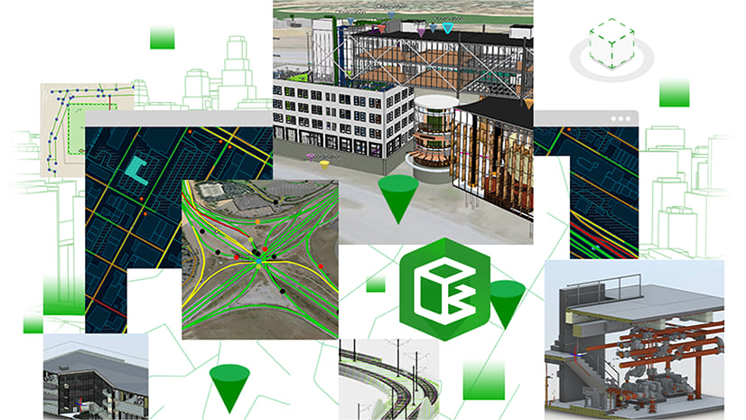
Overview
ArcGIS GeoBIM enables teams to connect geospatial data with design and construction information for seeing building information modeling (BIM) projects and assets in context. Architecture, engineering, construction (AEC), and operations teams can easily work with linked data and documentation using configurable web apps.
The June 2022 release applies performance enhancements, user experience improvements, and new support for the Industry Foundation Classes (IFC) open file format.
Release Highlights
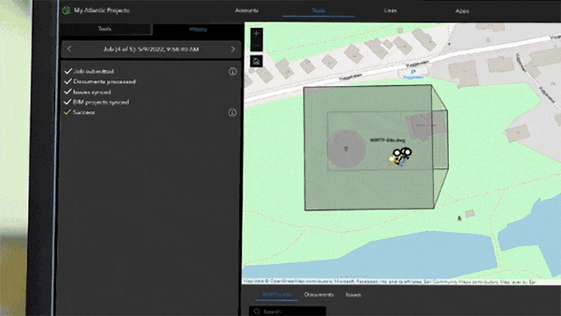
New History tab and performance reports in Tools
Within a new History tab under Tools, users can now easily view the step-by-step progress of running and completed jobs.
If there are any errors requiring attention, users can conveniently export error reports with the click of a button. These reports can optionally be sent to Esri for technical support.
Enhanced georeferencing tools
This release delivers enhancements to the way documents and BIM project boundaries are automatically georeferenced as polygons from stored BIM content. Applying refinements will continue to be a priority in future releases.
Support for reading IFC files has now been introduced for users looking to add the open file format to their projects.
New support for IFC files
Users of ArcGIS GeoBIM can now use the Locate Engineering Documents tool to search for IFC stored in the Autodesk Construction Cloud®. This expands on support beyond RVT (BIM) and DWG (CAD) file formats. When running the tool, ArcGIS GeoBIM will automatically map polygons for their location. For optimal results, ensure that you include projection (PRJ) files within the directory to help bring these datasets to their real-world location.
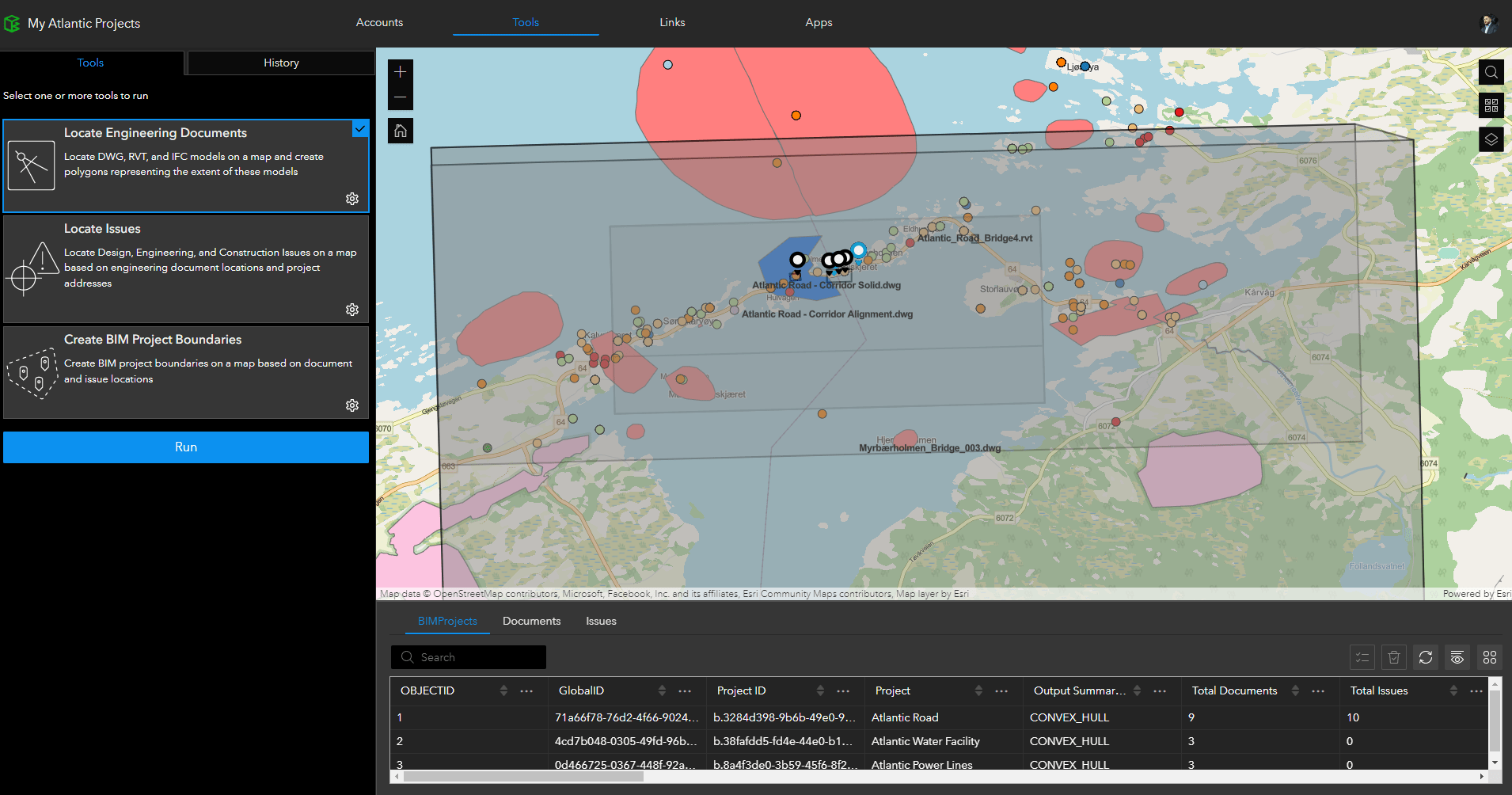
New support for WLD3 files
In addition to past support for PRJ files, ArcGIS GeoBIM now reads WLD3 files stored with your BIM and CAD files. If your digital model does not have any location information included natively, you can create a WLD3 file in ArcGIS Pro when georeferencing. This file can be stored with your models in the Autodesk Construction Cloud and supported by ArcGIS GeoBIM for accurately locating your documents and issues.
Additional enhancements to georeferencing
- Tightened boundaries in RVT (BIM) and DWG (CAD) files by ignoring specific non-model entity types that create large boundaries.
- Added a new geoprocessing back-end service that runs Tools faster and across larger document volumes
- Refined the logic for creating issue locations.
Enhanced schedule activity linking
Within the Links tab, users can now configure link rules between time-enabled schedule layers and related features. These can be used to build connections between your schedule activities, GIS data, and related BIM documents.
The Time Widget for end-users has also been enhanced to simplify how teams visualize the playback of schedule dates, based on values available within a map or scene. ArcGIS GeoBIM App users can visualize schedule data through this Time Widget. Alternatively, users can select the schedule layer from the Data Viewer and open each schedule activity for start, progress, and completion details.
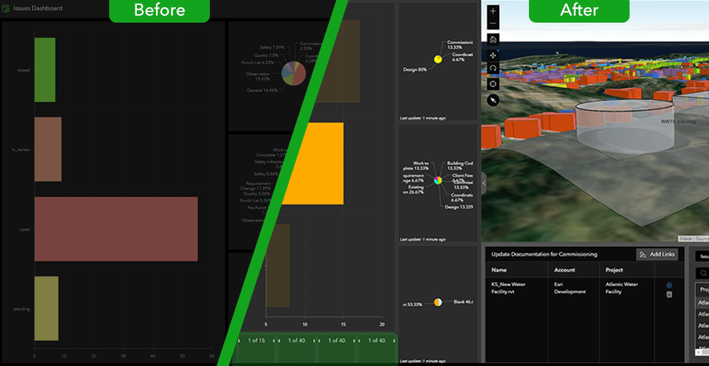
Changes to Dashboard App template
This release resolves a compatibility issue of dashboard components within ArcGIS GeoBIM Apps. All new apps created with this release and moving forward will contain updated components.
Users with existing dashboards in ArcGIS GeoBIM prior to this June 2022 release are advised to apply a minor edit to the layout based on this Known Issue.
Known Issue
Optimizing support for the Autodesk Construction Cloud® API
There are ongoing efforts being made to support API changes impacting ArcGIS GeoBIM Issues with Autodesk Construction Cloud projects. There is currently no impact on ArcGIS GeoBIM users working with Autodesk® BIM 360® projects.
This work is continuing, and changes will not be visible to users. The Locate Issues capability in the Autodesk Construction Cloud is currently unsupported at this time.
Additional Learning Resources
- A new Learn Path on bringing schedule information into your ArcGIS GeoBIM Apps is now available. Designed for intermediate users, this resource aims to help take your project engagement maps to the next level for improved team insights and planning.
- Webinar recording: Top 10 GIS and BIM Integration Tips for AEC
Driven by ISO 19650 principles, learn best practices for setting projects up for success, improving collaboration, and driving better outcomes through project delivery and operations. Our AEC team covers best practices for bringing GIS and BIM or CAD together in ArcGIS Pro, ArcGIS Online, and ArcGIS GeoBIM.
Join the Esri Community
Post questions and share your feedback on this release in the Esri Community for ArcGIS GeoBIM. Get solutions and advice from Esri experts, as well as others using ArcGIS GeoBIM on projects and workflows.


Article Discussion: